MyTopo
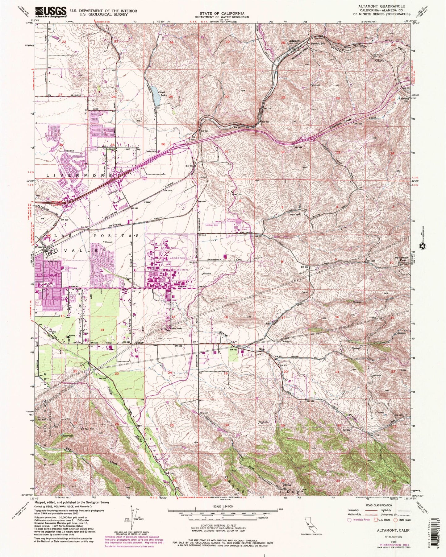
Classic USGS Altamont California 7.5'x7.5' Topo Map
Couldn't load pickup availability
Historical USGS topographic quad map of Altamont in the state of California. Map scale may vary for some years, but is generally around 1:24,000. Print size is approximately 24" x 27"
This quadrangle is in the following counties: Alameda.
The map contains contour lines, roads, rivers, towns, and lakes. Printed on high-quality waterproof paper with UV fade-resistant inks, and shipped rolled.
Contains the following named places: Alameda County Fire Department Station 20, Almond Park, Altamont, Altamont Creek Elementary School, Altamont Pass, Andrew N Christensen Middle School, Arroyo Seco Elementary School, Big Trees Park, Bill Clark Park, Cedar Mountain Winery, Christensen Park, Concannon Winery, Dry Creek, Frick Lake, Green School, Greenville, Jackson Avenue Elementary School, Lawrence Livermore National Laboratory, Leo R Croce Elementary School, Lincoln Shopping Center, Livermore - Pleasanton Fire Department Station 6, Livermore - Pleasanton Fire Department Station 8, Livermore Adult Education Center, Livermore Naval Air Station, Livermore-Pleasanton Division, Lone Hill, Meadowlark Field, Muriettas Well Winery, North Livermore Neighborhood Park, Northfront Park, Patterson 1-062 Dam, Patterson Pass, Patterson Reservoir, Plaza 580 Shopping Center, Robert Livermore Park, Sandia National Laboratories, Springtown Golf Course, Stony Ridge Winery, Summit School, Tex Spruiell Park, Townsend School, Trevarno, Ulmar, Vine and Branches Christian School, Wattenburger Park, Wente Brothers Winery, William Payne Sports Park