
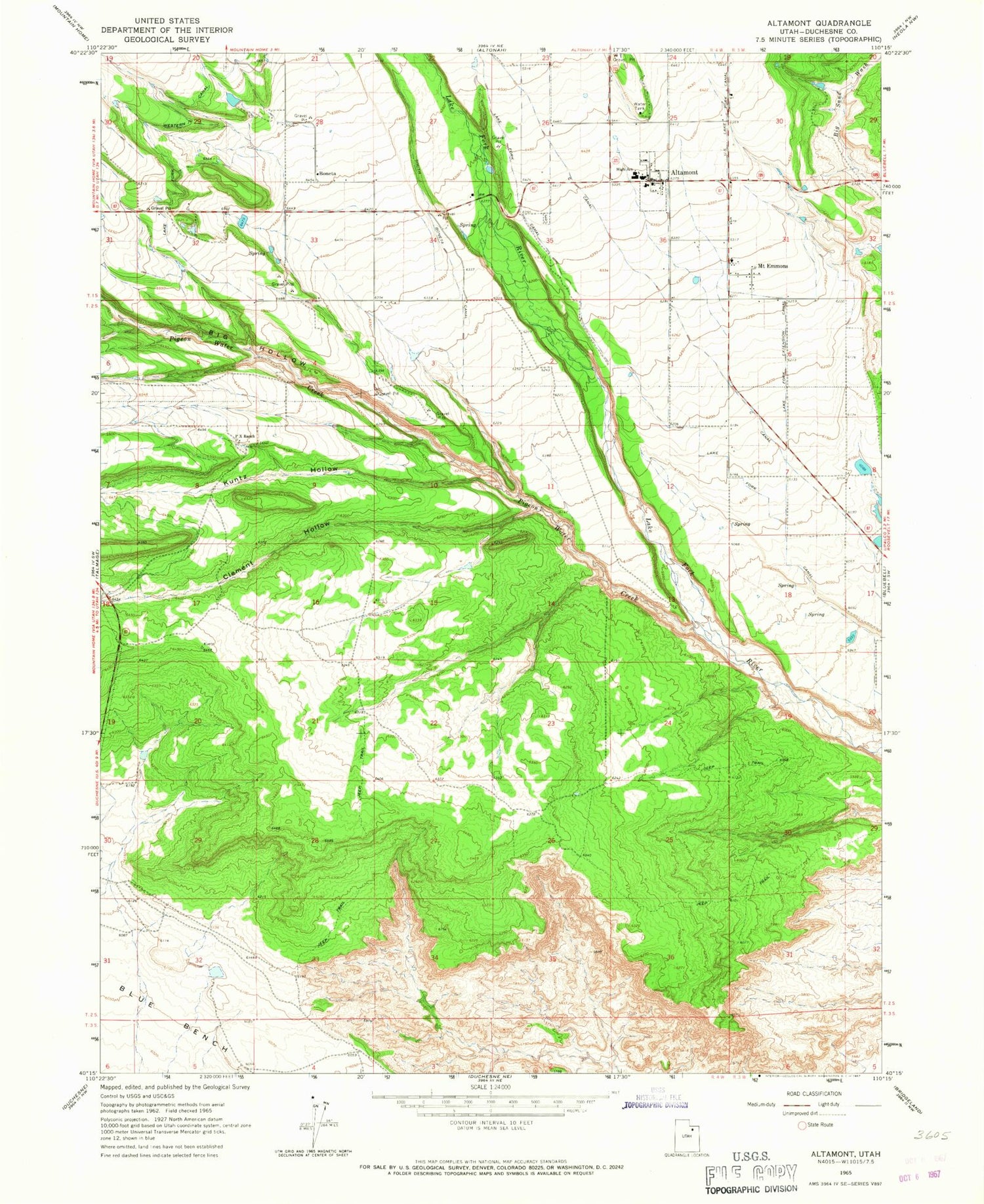
MyTopo
Classic USGS Altamont Utah 7.5'x7.5' Topo Map
Couldn't load pickup availability
Historical USGS topographic quad map of Altamont in the state of Utah. Map scale may vary for some years, but is generally around 1:24,000. Print size is approximately 24" x 27"
This quadrangle is in the following counties: Duchesne.
The map contains contour lines, roads, rivers, towns, and lakes. Printed on high-quality waterproof paper with UV fade-resistant inks, and shipped rolled.
Contains the following named places: Altamont, Altamont - Mount Emmons Cemetery, Altamont Elementary School, Altamont Fire Department, Altamont High School, Altamont Post Office, Big Hollow, Boneta, Boneta - Mountain Home Cemetery, C Canal, Clement Hollow, Kuntz Hollow, Lake Fork Canal, Lake Fork Extension Canal, Mount Emmons, P X Ranch, Pigeon Water Creek, South Boneta Canal, The Church of Jesus Christ of Latter Day Saints, Town of Altamont, ZIP Code: 84001


