MyTopo
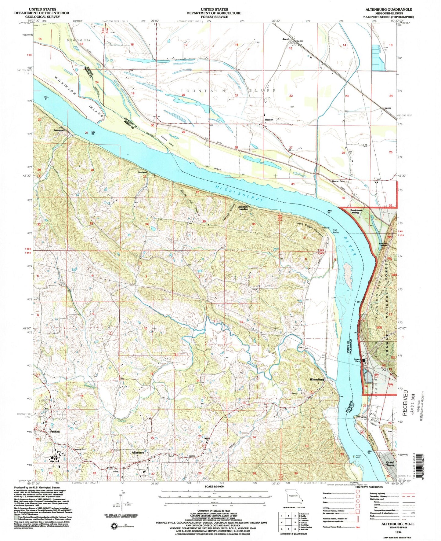
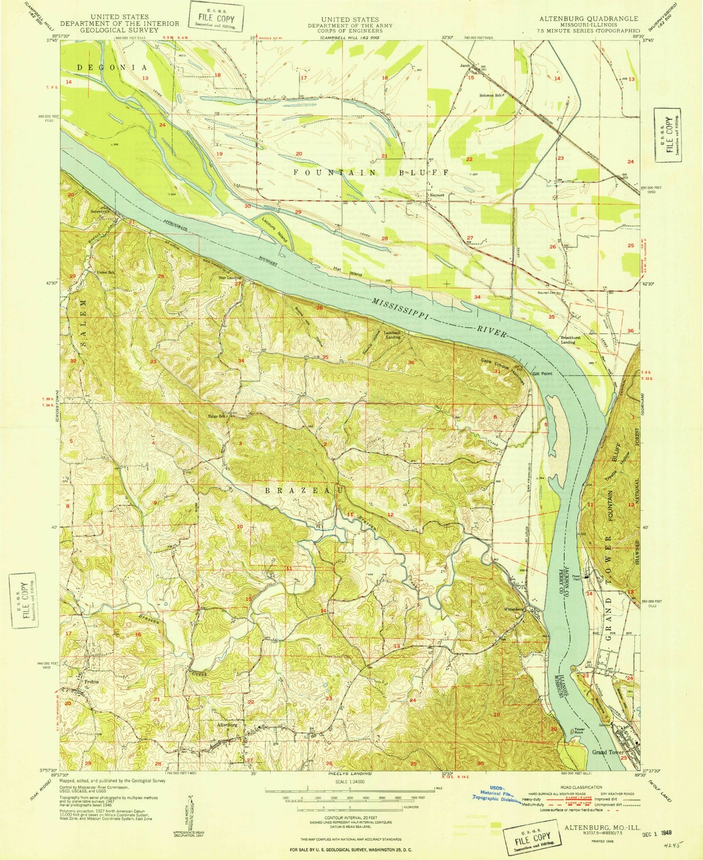
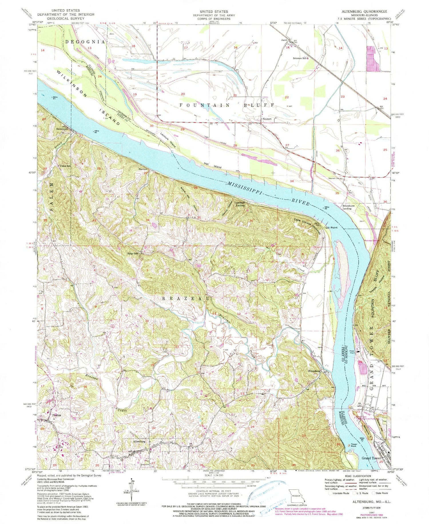
Classic USGS Altenburg Missouri 7.5'x7.5' Topo Map
Couldn't load pickup availability
Historical USGS topographic quad map of Altenburg in the states of Missouri, Illinois. Map scale may vary for some years, but is generally around 1:24,000. Print size is approximately 24" x 27"
This quadrangle is in the following counties: Jackson, Perry.
The map contains contour lines, roads, rivers, towns, and lakes. Printed on high-quality waterproof paper with UV fade-resistant inks, and shipped rolled.
Contains the following named places: Altenburg, Altenburg Post Office, Backbone Ridge, Boone Hill Hollow, Brazeau Bottoms, Brazeau Creek, Brunkhorst Landing, Cape Antoine, Cape Cinque Hommes, Christ Lutheran Cemetery, City of Altenburg, City of Frohna, City of Grand Tower, Clines Branch, Concordia Lutheran Cemetery, Devils Bake Oven, East Perry County Rural Fire Protection Association Station 1, Forked Lake, Fountain Bluff, Fountain Bluff Fire Protection Association, Frohna, Frohna - Altenburg Fire Department, Frohna Post Office, Gill Point, Grand Tower Campground and Picnic Area, Grand Tower Police Department, Grand Tower Post Office, Grand Tower Power Station, Halein School, Hat Island, Jacob, Jacob Post Office, Lacours Island, Loimbach Landing, Lower Wilkinson Landing, Mill Ditch, Neunert, Owl Creek, Reeds Creek, Ridge School, Saint Pauls Lutheran Cemetery, Sawmill Hollow, School Number 122, Seventysix, Shawnee Elementary School-North, Solomon School, Starland, Tower Rock, Tower Rock Fire Protection District, Township of Brazeau, Township of Fountain Bluff, Trestle Hollow, Union School, Walker Hill, Walker Hill Cemetery, Wilkinson Island, Wittenberg, ZIP Code: 62950