

MyTopo
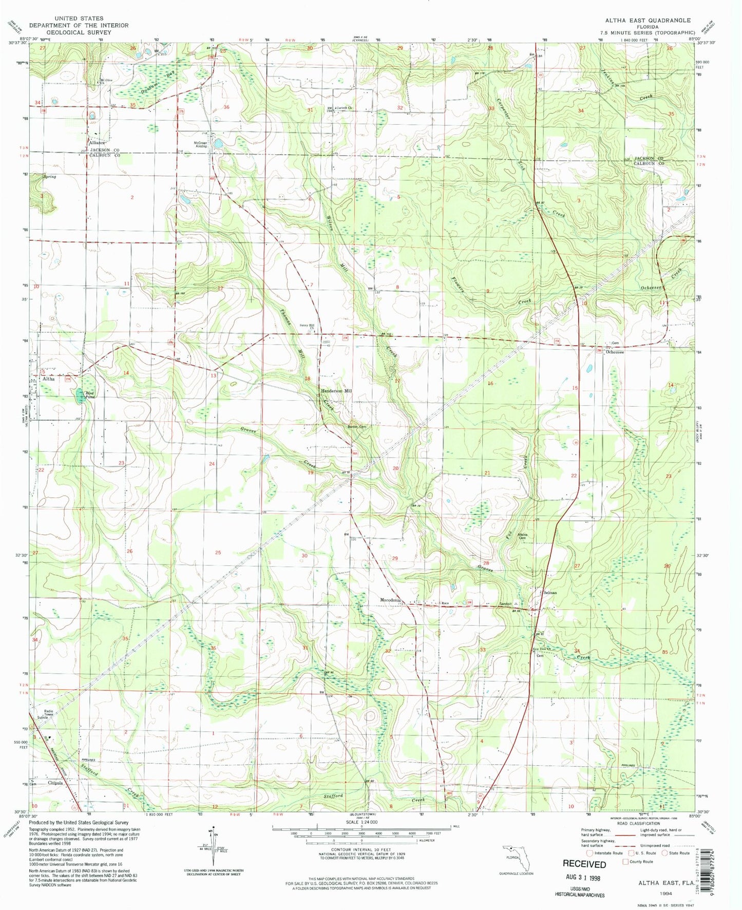
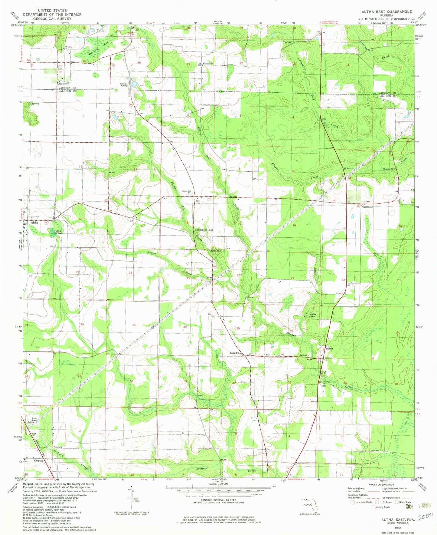
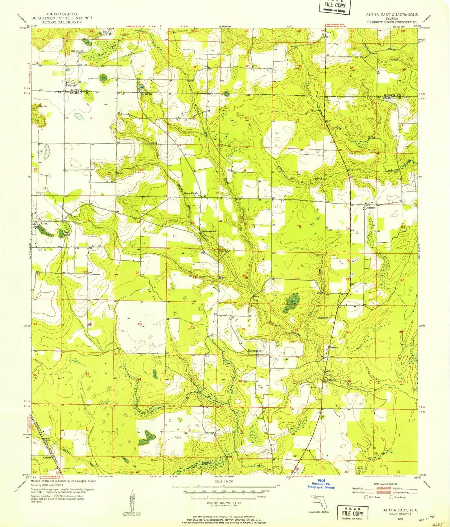
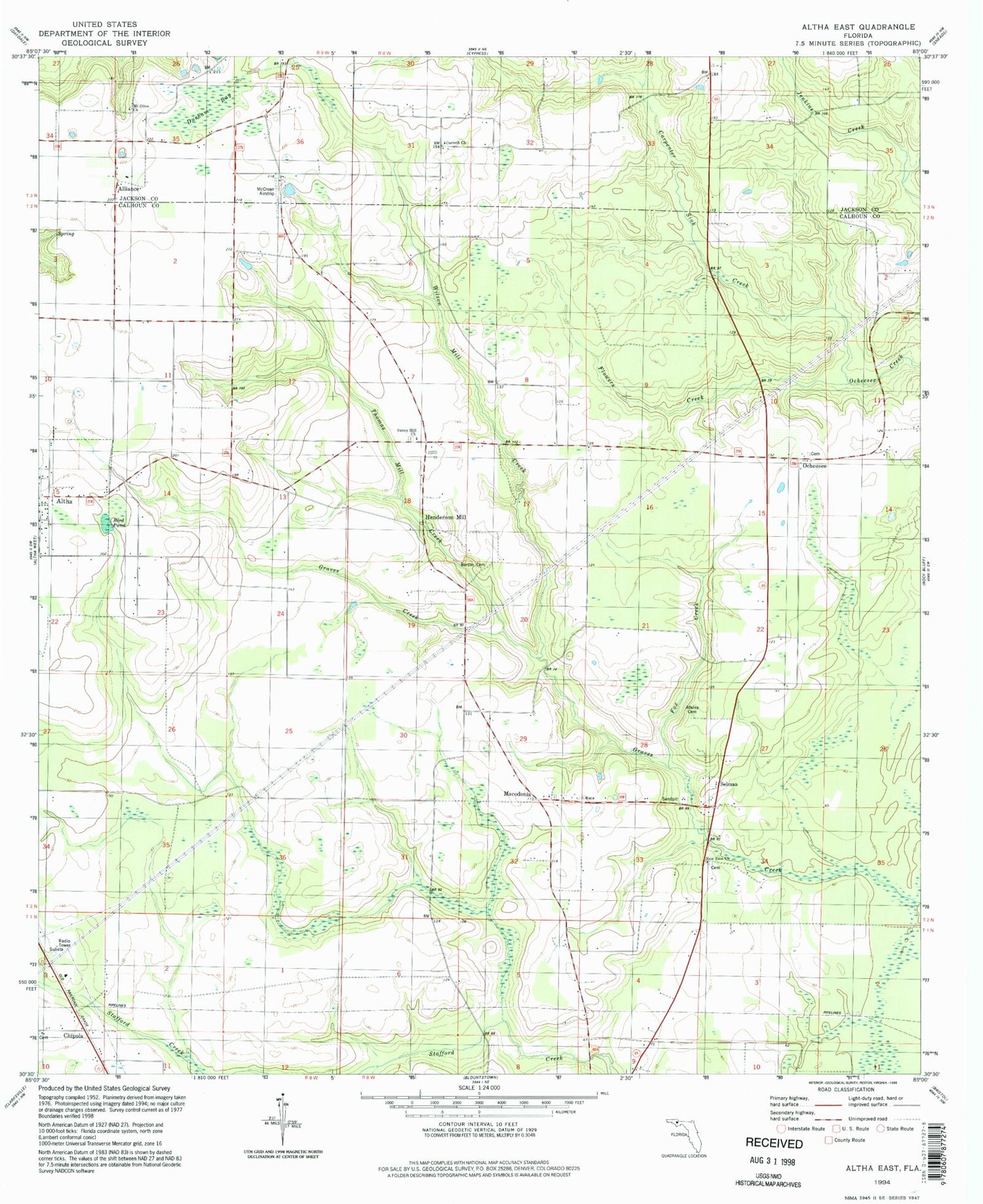
Classic USGS Altha East Florida 7.5'x7.5' Topo Map
Couldn't load pickup availability
Historical USGS topographic quad map of Altha East in the state of Florida. Map scale may vary for some years, but is generally around 1:24,000. Print size is approximately 24" x 27"
This quadrangle is in the following counties: Calhoun, Jackson.
The map contains contour lines, roads, rivers, towns, and lakes. Printed on high-quality waterproof paper with UV fade-resistant inks, and shipped rolled.
Contains the following named places: Alliance, Altha Division, Altha International Airport, Atkins Cemetery, Barton Cemetery, Bird Pond, Carpenter Sink Creek, Chipola, Chipola Cemetery, Corinth Church, County Line Airstrip, Durham Bay, Eufala, Flowers Creek, Fox Creek, Henderson Mill, Macedonia, Macedonia Church, Mount Olive Church, New Zion Church, Ocheesee, Selman, Smokehouse Creek, Sunny Hill Church, Thomas Mill Creek, Wilson Mill Creek