MyTopo
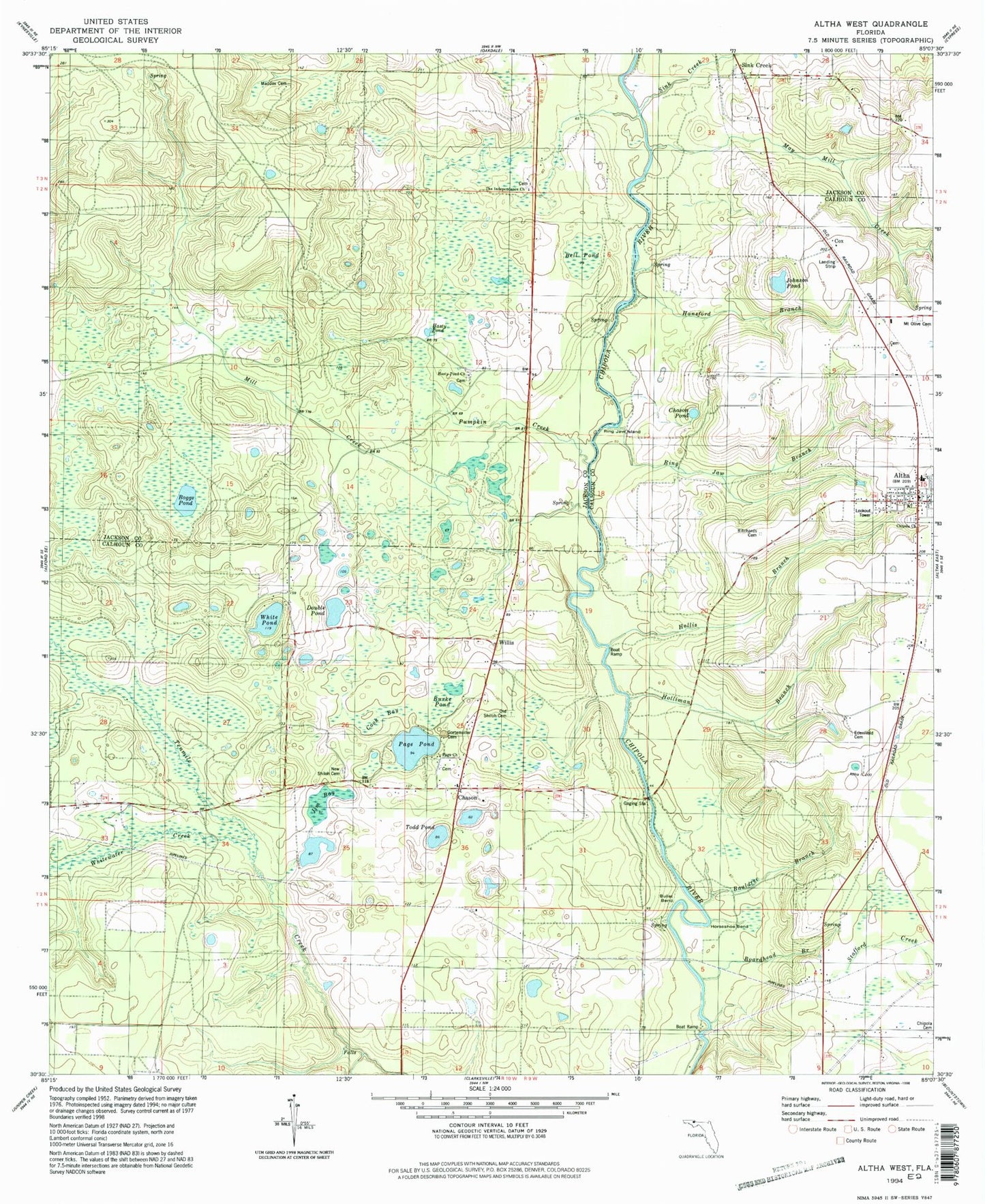
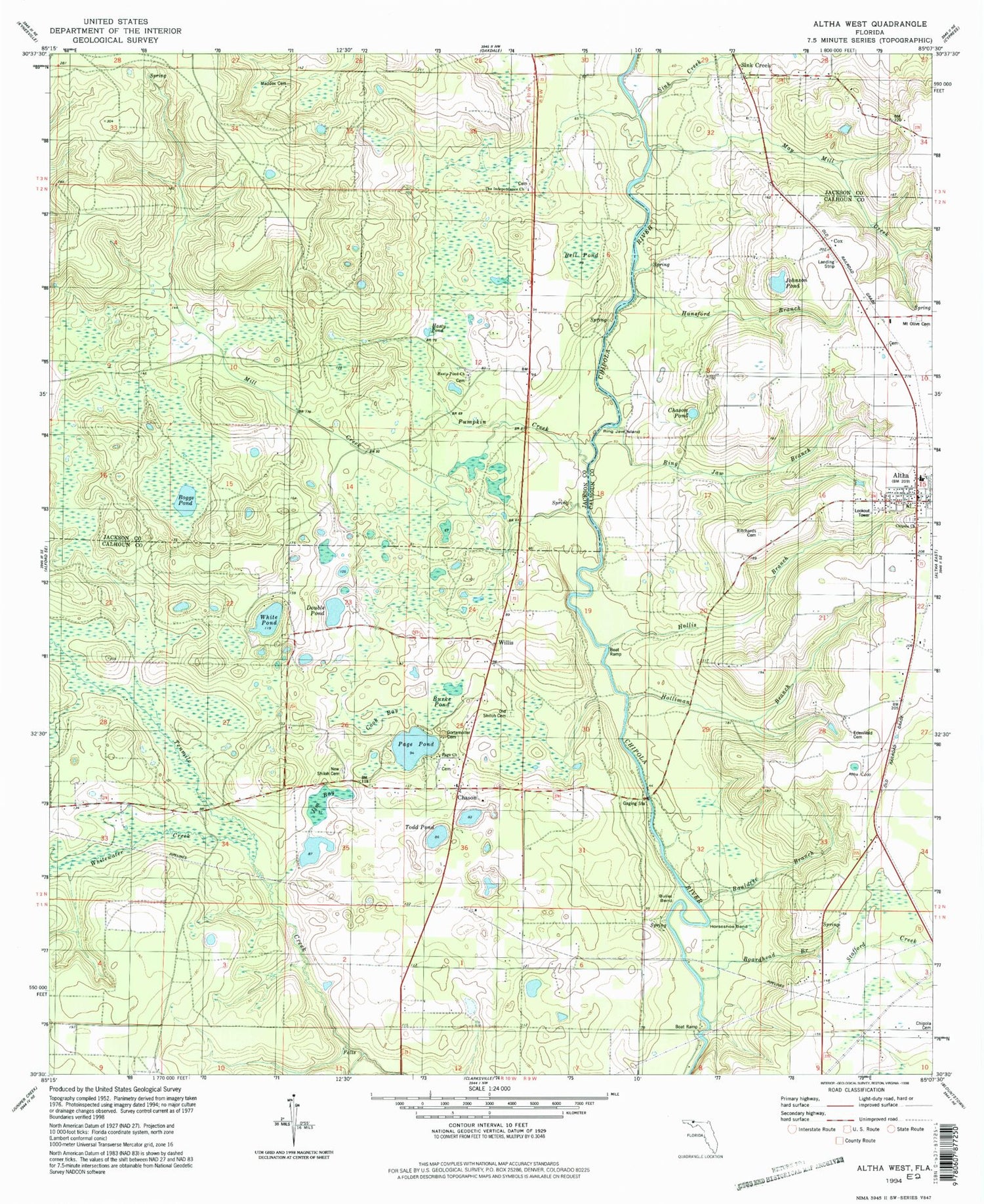
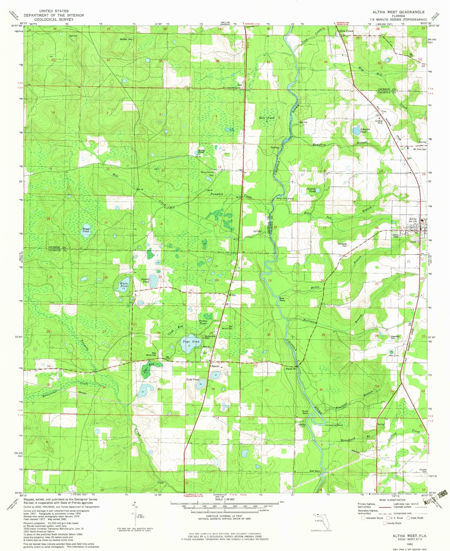
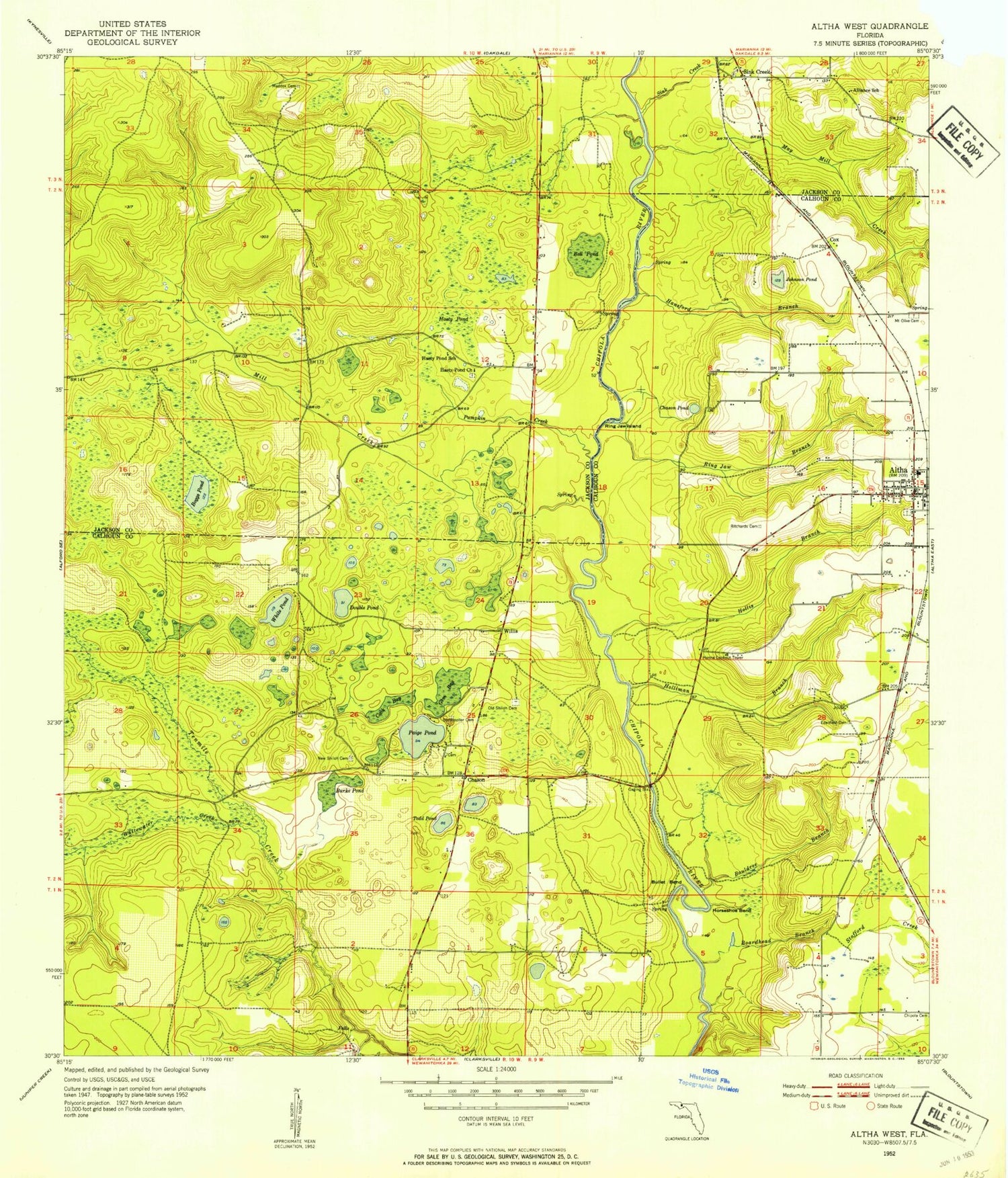
Classic USGS Altha West Florida 7.5'x7.5' Topo Map
Couldn't load pickup availability
Historical USGS topographic quad map of Altha West in the state of Florida. Map scale may vary for some years, but is generally around 1:24,000. Print size is approximately 24" x 27"
This quadrangle is in the following counties: Calhoun, Jackson.
The map contains contour lines, roads, rivers, towns, and lakes. Printed on high-quality waterproof paper with UV fade-resistant inks, and shipped rolled.
Contains the following named places: Alliance School, Alliance Station, Altha, Altha Police Department, Altha Post Office, Altha Volunteer Fire Department, Bauldree Branch, Bell Pond, Boardhead Branch, Boggs Pond, Bullet Bend, Burke Pond, Cattle Creek Ranch Airport, Chason, Chason Pond, Cook Bay, Cox, Double Pond, Edenfield Cemetery, Farm Air Service Airport, Gem Bay, Gortemoller Cemetery, Hanna Lookout Tower, Hansford Branch, Hasty Pond, Hasty Pond Church, Hasty Pond School, Holliman Branch, Hollis Branch, Horseshoe Bend, Jim Bay, Johnson Pond, Maddox Cemetery, May Mill Creek, Mayo Mill Branch, Mill Creek, Mount Olive Cemetery, New Shiloh Cemetery, Old Shiloh Cemetery, Page Pond, Pumpkin Creek, Ring Jaw Branch, Ring Jaw Island, Ritchards Cemetery, Sink Creek, Todd Pond, Town of Altha, White Pond, Whitewater Creek, Willis, ZIP Code: 32421