MyTopo
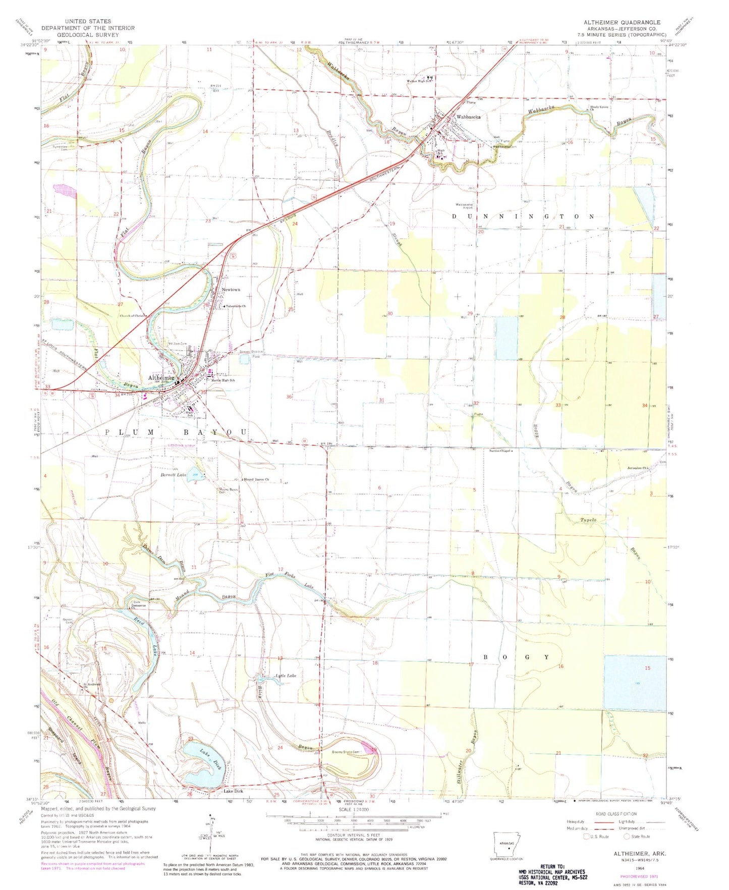
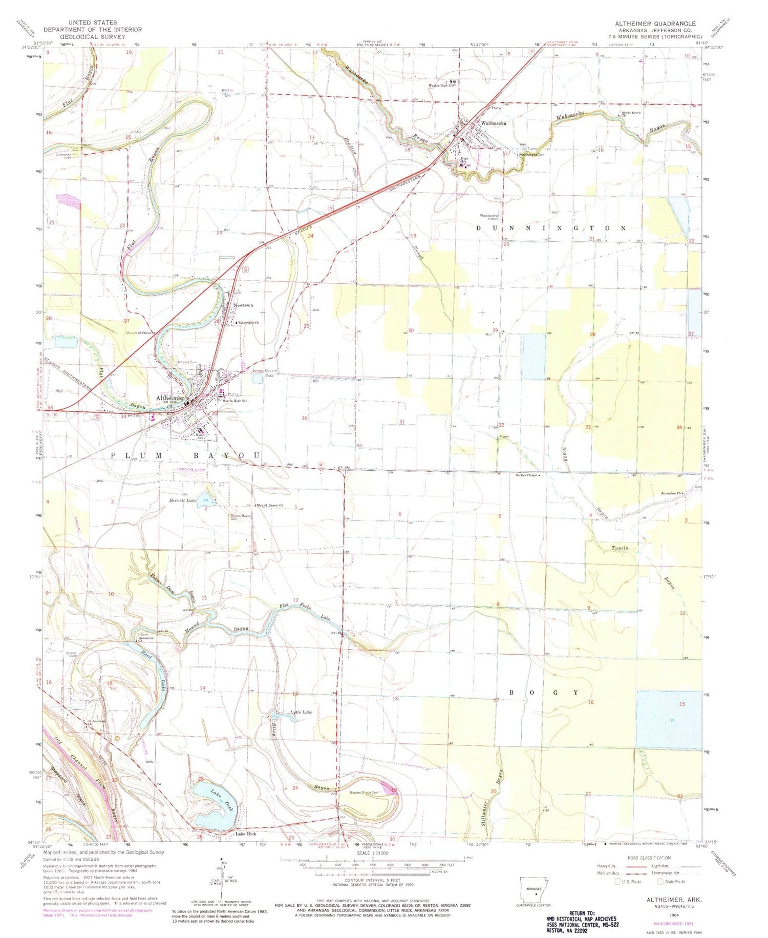
Classic USGS Altheimer Arkansas 7.5'x7.5' Topo Map
Couldn't load pickup availability
Historical USGS topographic quad map of Altheimer in the state of Arkansas. Map scale may vary for some years, but is generally around 1:24,000. Print size is approximately 24" x 27"
This quadrangle is in the following counties: Jefferson.
The map contains contour lines, roads, rivers, towns, and lakes. Printed on high-quality waterproof paper with UV fade-resistant inks, and shipped rolled.
Contains the following named places: Altheimer, Altheimer Middle School, Altheimer Police Department, Altheimer Post Office, Altheimer Volunteer Fire Department, Altheimer-Sherrill High School, Barnett Lake, Barraque Lateral, Bass Chapel Number 2, Battles Chapel, Beaver Dam Bayou, Bloomy Shade Cemetery, Bloomy Shade Church, Bradley Slough, Browns Chapel, Bryson Cemetery, Church of Christ, City of Altheimer, Damascus Cemetery, Damascus Church, Five Forks Lake, Five Forks School, Five Points School, Jerusalem Church, King Bayou, Lake Dick, Lake Dick Church, Lateral A-2, Lateral B, Lateral Number 1, Lateral Number 2, Main Canal, Martin Elementary School, Martin High School, Mound Bayou, Mound Bayou Cemetery, Mound Bayou Church, Mound Bayou School, Mount Moriah Church, Mount Zion Cemetery, Newtown, Philips Cemetery, Reed Lake, Reed Lake Spur, Riley Bayou, Saint Andrews Church, Stillhouse Bayou, Tabernacle Church, Tabernacle School, Town of Wabbaseka, Township of Dunnington, Tupelo Brake, Turner Church, Turrentine Cemetery, Turrentine Church, Turrentine School, Wabbaseka, Wabbaseka Cemetery, Wabbaseka Elementary School, Wabbaseka Flying Service Airport, Wabbaseka High School, Wabbaseka Police Department, Wabbaseka Post Office, Wabbaseka Volunteer Fire Department, Walker High School, Walnut Grove School, Watkins School, ZIP Codes: 72004, 72175