MyTopo
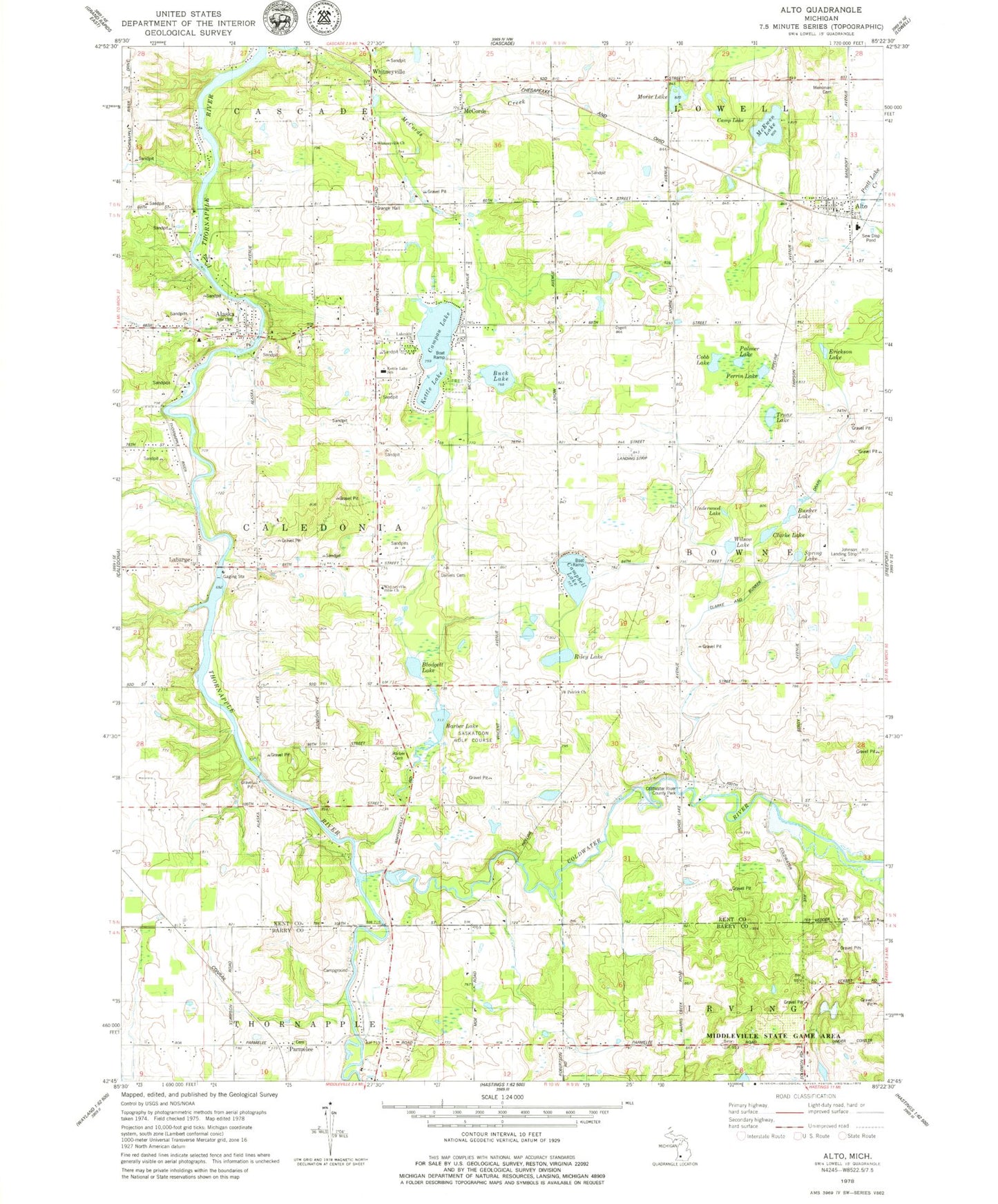
Classic USGS Alto Michigan 7.5'x7.5' Topo Map
Couldn't load pickup availability
Historical USGS topographic quad map of Alto in the state of Michigan. Typical map scale is 1:24,000, but may vary for certain years, if available. Print size: 24" x 27"
This quadrangle is in the following counties: Barry, Kent.
The map contains contour lines, roads, rivers, towns, and lakes. Printed on high-quality waterproof paper with UV fade-resistant inks, and shipped rolled.
Contains the following named places: Alaska, Alto, Barber Cemetery, Barber Lake, Blodgett Lake, Buck Lake, Bunker Lake, Camp Lake, Campau Lake, Campbell Lake, Clarke and Bunker Drain, Clarke Lake, Cobb Lake, Coldwater River, Coldwater River County Park, Daniels Cemetery, Erickson Lake, Kettle Lake, Kettle Lake School, Labarge, Lakeside Church, McCords, McEwen Lake, Merriman Cemetery, Morse Lake, Palmer Lake, Parmelee, Perrin Lake, Riley Lake, Saint Patrick Church, Spring Lake, Truax Lake, Underwood Lake, Whitneyville, Whitneyville Bible Church, Whitneyville Church, Wilson Lake, Saskatoon Golf Course, GRH Heliport, Township of Caledonia, Parmelee United Methodist Church Historical Marker, Alaska Baptist Church, Alto Station, Grace United Reformed Church, Alto Library, Alto Post Office, First Baptist Church of Alto, Alto Elementary School, Community of Christ Church, Whitneyville Cemetery, Saint Patrick's Cemetery, Alaska Memorial Cemetery, Whitneyville Post Office (historical), McCords Post Office (historical), Labarge Post Office (historical), Harris Creek Post Office (historical), Alaska Post Office (historical), Whitneyville Station, McCords Station, Parmalee Cemetery, Parmelee Post Office (historical), Parmelee Station (historical), Indian Valley Campground, Bowne Township Fire Department, Vincent Lake


