
MyTopo
Classic USGS Alto Texas 7.5'x7.5' Topo Map
Couldn't load pickup availability
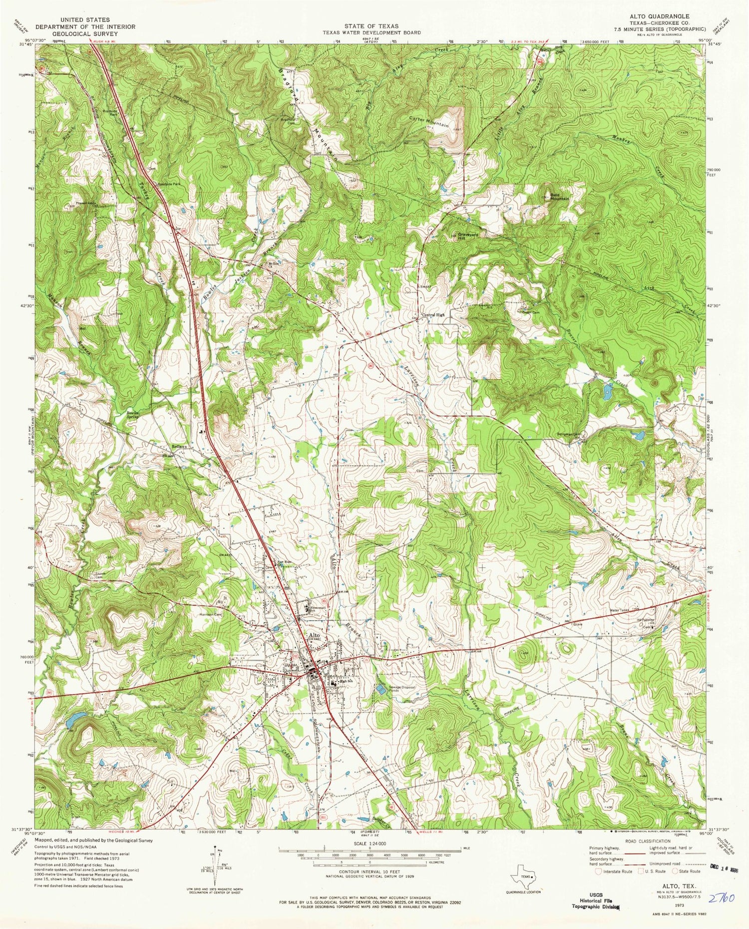
Historical USGS topographic quad map of Alto in the state of Texas. Map scale may vary for some years, but is generally around 1:24,000. Print size is approximately 24" x 27"
This quadrangle is in the following counties: Cherokee.
The map contains contour lines, roads, rivers, towns, and lakes. Printed on high-quality waterproof paper with UV fade-resistant inks, and shipped rolled.
Contains the following named places: Alto, Alto Branch, Alto City Hall, Alto Division, Alto Fire Department, Alto Police Department, Alto Post Office, Bald Mountain, Berryman Cemetery, Big Atoy Creek, Bowles Spring, Bradford Cemetery, Carter Mountain, Central High, Genevieve Miller Hitchcock Public Library, Graveyard Hill, Green Cemetery, Harrison Cemetery, Helen Hall Library, Jackson Branch, Little Atoy Creek, Mares Memorial Library, Mount Zion Church, New Hope Church, Old Palestine Church, Pleasant Grove Church, Redlawn, Shiloh Cemetery, Town of Alto, Turkey Creek


