MyTopo
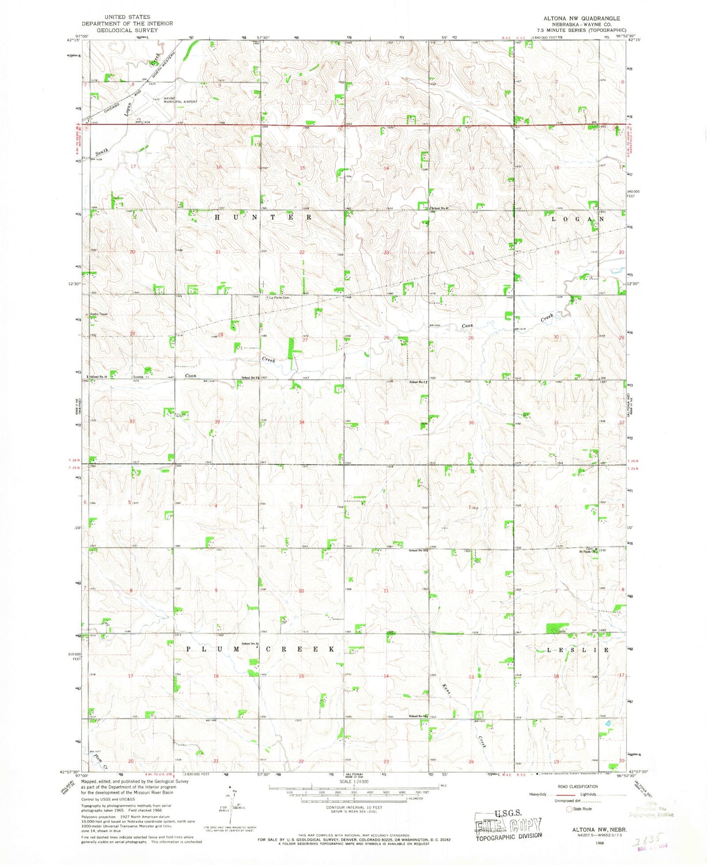
Classic USGS Altona NW Nebraska 7.5'x7.5' Topo Map
Couldn't load pickup availability
Historical USGS topographic quad map of Altona NW in the state of Nebraska. Map scale may vary for some years, but is generally around 1:24,000. Print size is approximately 24" x 27"
This quadrangle is in the following counties: Wayne.
The map contains contour lines, roads, rivers, towns, and lakes. Printed on high-quality waterproof paper with UV fade-resistant inks, and shipped rolled.
Contains the following named places: Hunter Election Precinct, La Porte Post Office, LaPorte Cemetery, Lions Club Camper Park, Lions Club Park, Plum Creek Election Precinct, Saint Pauls Church, School Number 10, School Number 2, School Number 33, School Number 34, School Number 47, School Number 64, School Number 8, Township of Hunter, Township of Plum Creek, Wayne Historical Marker, Wayne Municipal Airport/ Stan Morris Field