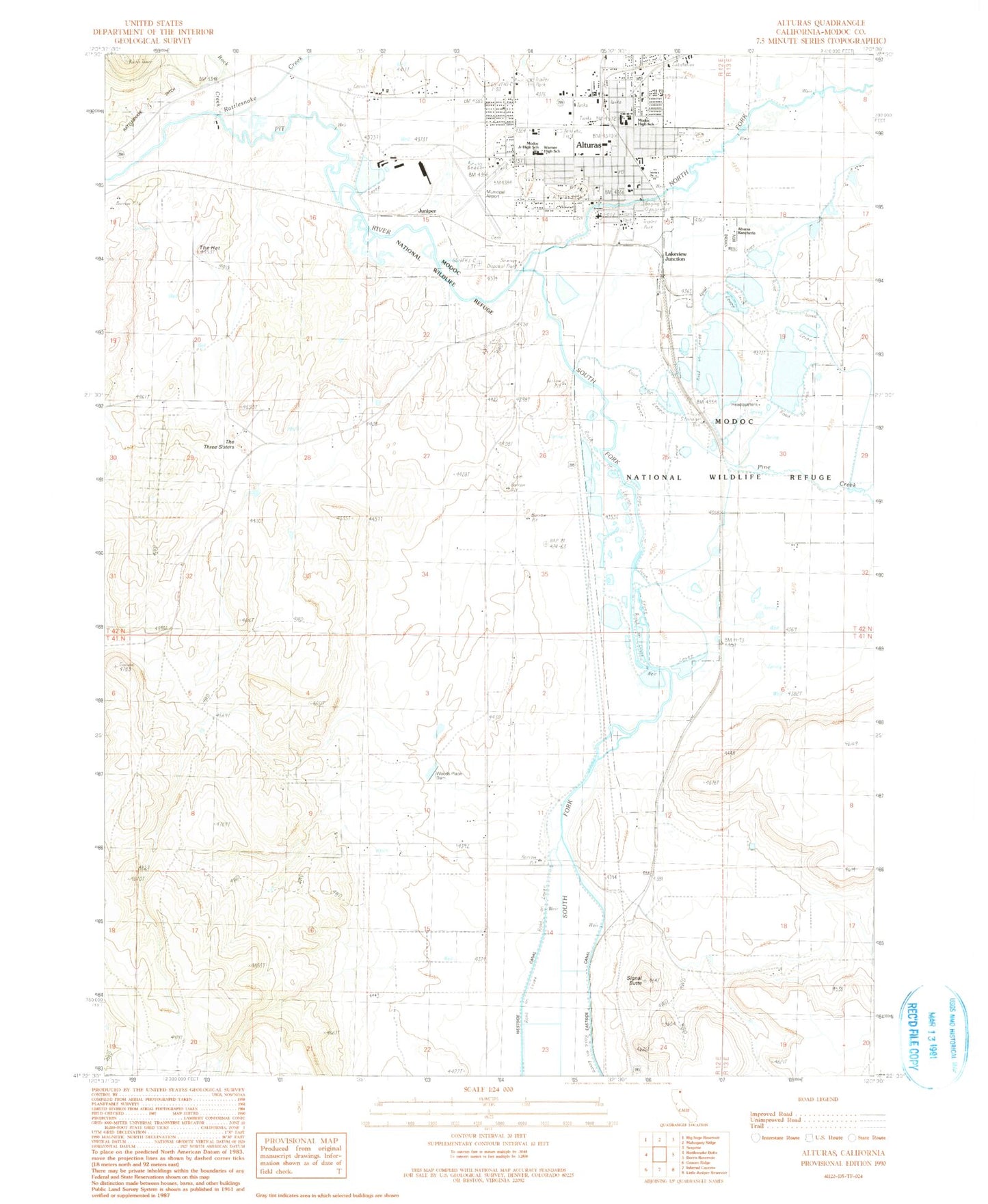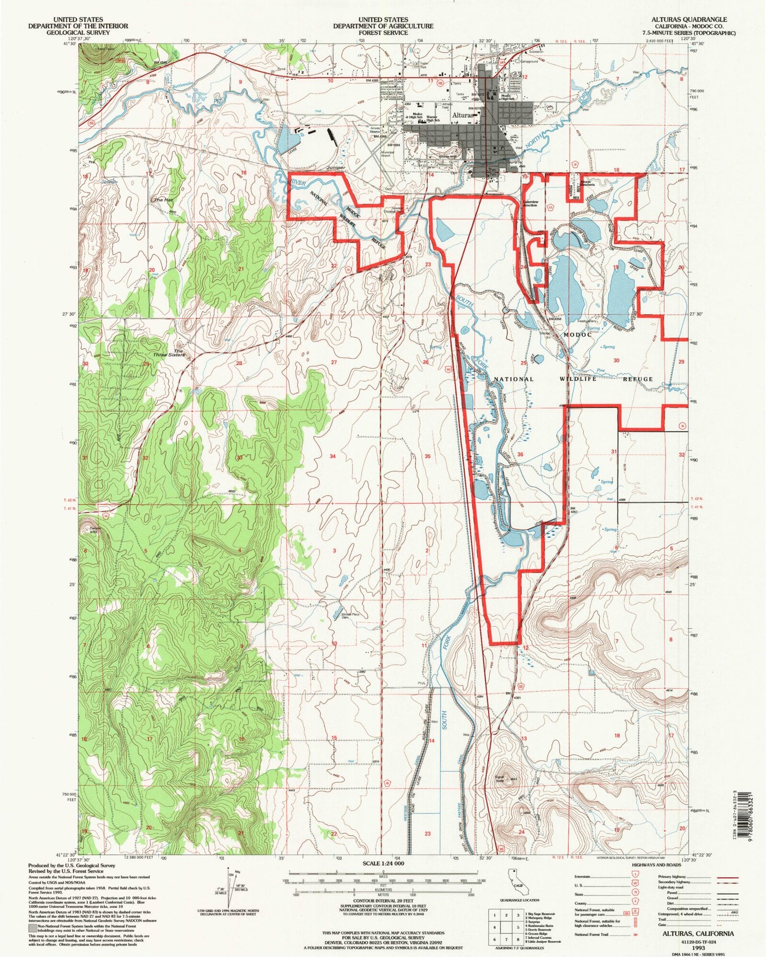
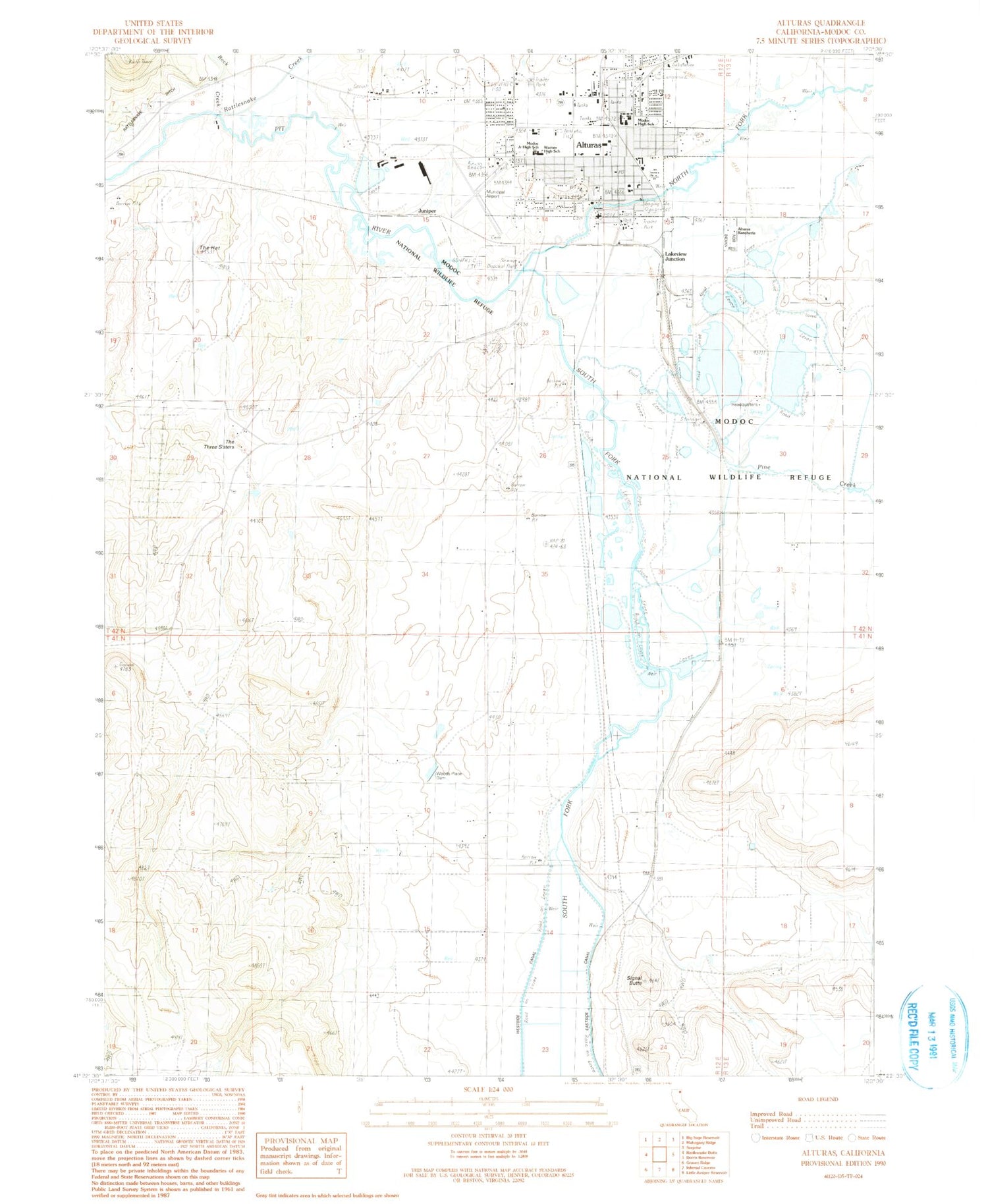

MyTopo
Classic USGS Alturas California 7.5'x7.5' Topo Map
Couldn't load pickup availability
Historical USGS topographic quad map of Alturas in the state of California. Map scale may vary for some years, but is generally around 1:24,000. Print size is approximately 24" x 27"
This quadrangle is in the following counties: Modoc.
The map contains contour lines, roads, rivers, towns, and lakes. Printed on high-quality waterproof paper with UV fade-resistant inks, and shipped rolled.
Contains the following named places: Alturas, Alturas Baptist Church, Alturas Cemetery, Alturas Elementary School, Alturas Fire Department, Alturas Gospel Mission, Alturas Indian Rancheria, Alturas Municipal Airport, Alturas Police Department, Alturas Post Office, Alturas Rural Fire Department, Alturas Seventh Day Adventist Church, Alturas Yard, Bahai Faith Church, Barnes Grade, Bates Field, California Department of Forestry and Fire Protection Lassen Modoc Unit Alturas - Fire Station, California Highway Patrol Alturas, California Highway Patrol Northern Division - Alturas, Christian Life Assembly Church, Church of Christ, Church of the Nazarene, City of Alturas, Coop, Copco, Duck Pond, Faith Baptist Church, Goose Pond, Jim Creek, Juniper, Kingdom Hall of Jehovahs Witnesses, Lakeview Junction, Modoc County Courthouse, Modoc High School, Modoc Medical Center, Modoc Middle School, Modoc National Wildlife Refuge, North Fork Pit River, Paola, Pickering Lumber 111 Dam, Pine Creek, Rattlesnake Creek, Rock Creek, Sacred Heart Catholic Church, Saint Michaels Episcopal Church, Signal Butte, South Fork Pit River, Teal Pond, The Hat, The Three Sisters, Warner High School, Wesinger Ranch Airport, Woods Place Dam, ZIP Code: 96101