MyTopo
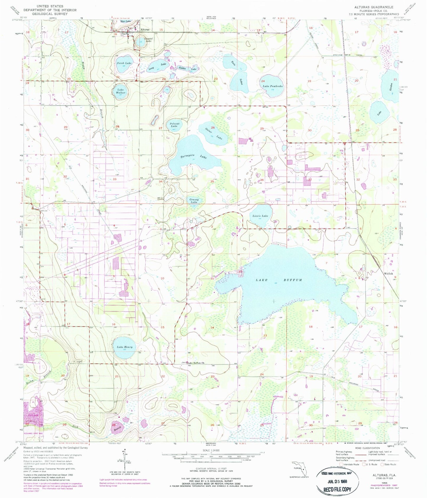
Classic USGS Alturas Florida 7.5'x7.5' Topo Map
Couldn't load pickup availability
Historical USGS topographic quad map of Alturas in the state of Florida. Map scale may vary for some years, but is generally around 1:24,000. Print size is approximately 24" x 27"
This quadrangle is in the following counties: Polk.
The map contains contour lines, roads, rivers, towns, and lakes. Printed on high-quality waterproof paper with UV fade-resistant inks, and shipped rolled.
Contains the following named places: Alturas, Alturas Census Designated Place, Alturas Elementary School, Alturas Post Office, Crystal Lake, Gadau Lake, Gator Lake, Grassy Lake, Green Acres Mobile Home Park, Jubilee Acres Airport, Lake Buffum, Lake Buffum Church, Lake Gordon, Lake Henry, Lake Millbite, Lake Pembroke, Lake Wales Mobile Home Park, Lake Walker, Lizzie Lake, Long Lake, Perch Lake, Polecat Lake, Polk County Fire Department Station 2 Alturas, Round Lake, Southwest Lake Gordon, Surveyors Lake, Twin Lakes, Villa Char Mar Airport, Wolfolk, ZIP Code: 33859