MyTopo
Classic USGS Alum Texas 7.5'x7.5' Topo Map
Regular price
$16.95
Regular price
Sale price
$16.95
Unit price
per
Couldn't load pickup availability
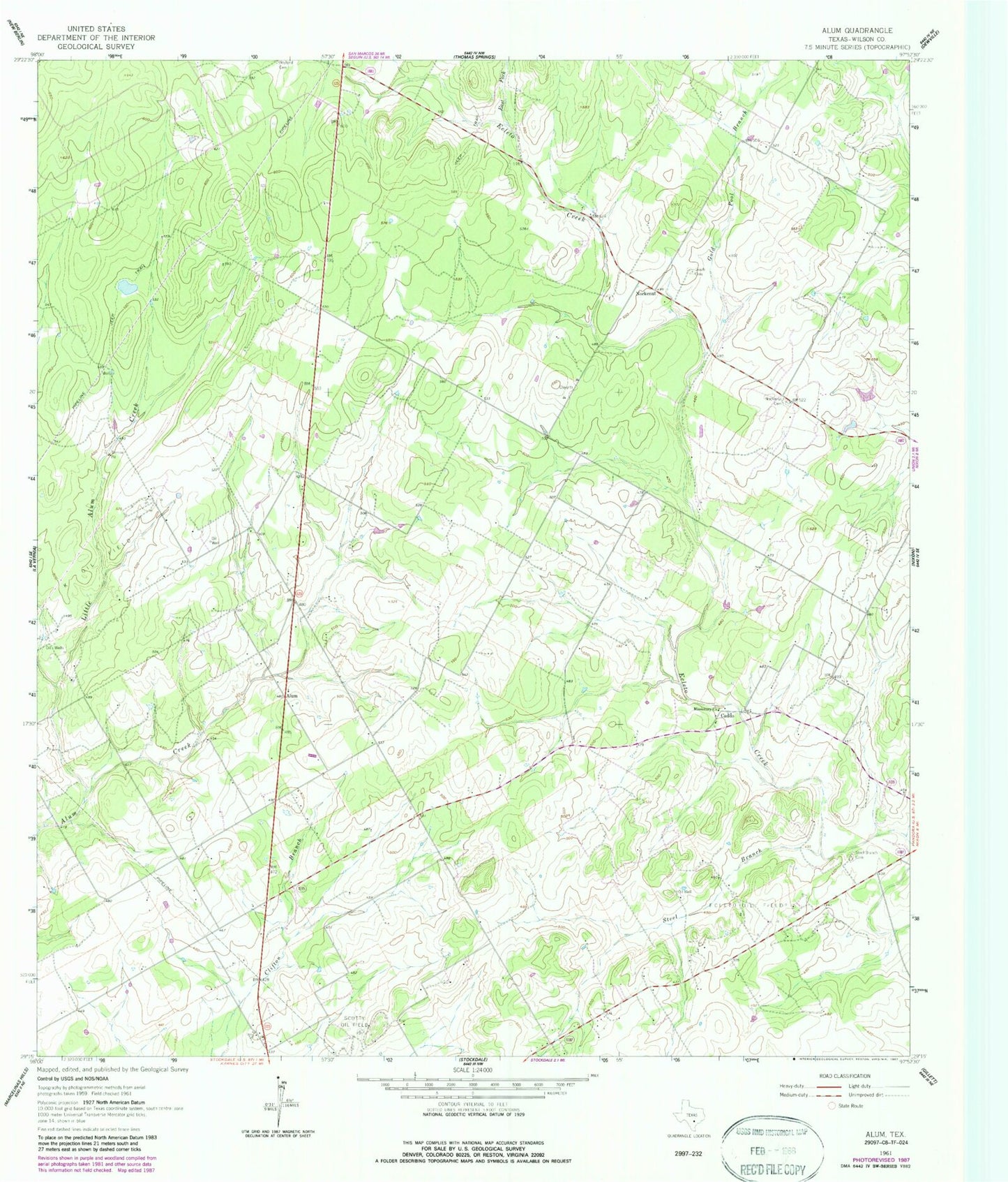
Historical USGS topographic quad map of Alum in the state of Texas. Map scale may vary for some years, but is generally around 1:24,000. Print size is approximately 24" x 27"
This quadrangle is in the following counties: Wilson.
The map contains contour lines, roads, rivers, towns, and lakes. Printed on high-quality waterproof paper with UV fade-resistant inks, and shipped rolled.
Contains the following named places: Alum, Caddo, East Fork Ecleto Creek, Ecleto Oil Field, Gold Pool Branch, Leach Cemetery, Little Alum Creek, Longhorn Volunteer Fire Department, Missionary Church, Nockenut, Nockenut Cemetery, Scotty Oil Field, Steel Branch, Steel Branch Cemetery, ZIP Code: 78160