MyTopo
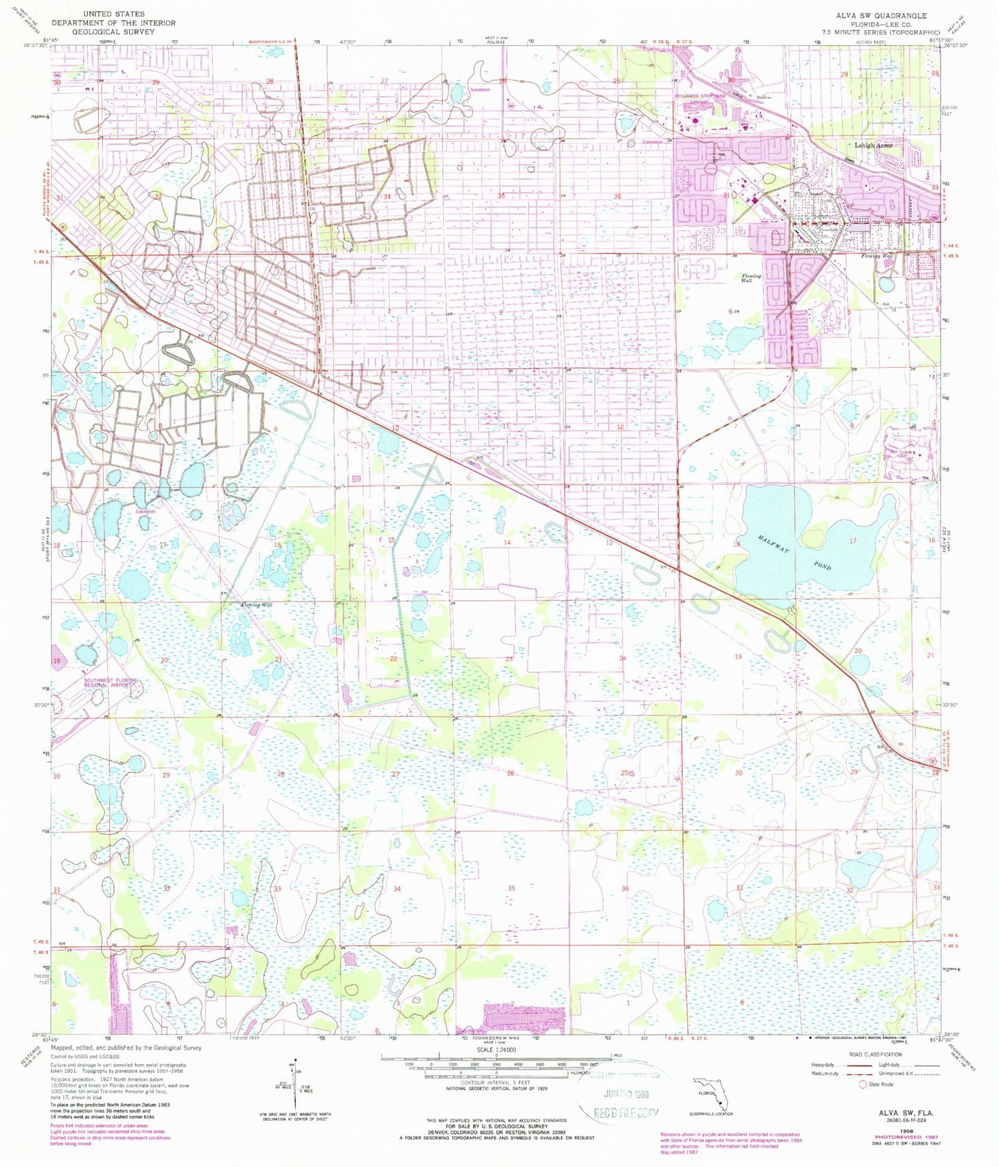
Classic USGS Alva SW Florida 7.5'x7.5' Topo Map
Couldn't load pickup availability
Historical USGS topographic quad map of Alva SW in the state of Florida. Map scale may vary for some years, but is generally around 1:24,000. Print size is approximately 24" x 27"
This quadrangle is in the following counties: Lee.
The map contains contour lines, roads, rivers, towns, and lakes. Printed on high-quality waterproof paper with UV fade-resistant inks, and shipped rolled.
Contains the following named places: Able Canal, Caloosahatchee Forestry Center, Christ United Methodist Church of Lehigh Acres, First Church of Christ Scientist, Gateway Census Designated Place, Halfway Pond, Homestead Shopping Center, Korean Assembly of God Church of Fort Myers, Lake Camille Shopping Center, Las Colinas Golf Course, Lauderhills Golf Course, Lee Boulevard Baptist Church, Lee Boulevard Shopping Center, Lee County Port Authority Fire Rescue - Station 92, Lee County Sheriff's Office Bravo East District, Lee Memorial Garden Cemetery, Lehigh Acres Census Designated Place, Lehigh Acres Christian Academy, Lehigh Acres Church of the Nazarene, Lehigh Acres Division, Lehigh Acres Fire Control and Rescue District Station 103, Lehigh Acres Fire Control and Rescue Station 104, Lehigh Acres Fire Department Control and Rescue District Station 102, Lehigh Acres Middle School, Lehigh Acres Post Office, Lehigh Elementary School, Lehigh Memorial Park, Lehigh Regional Medical Center, Sunshine Plaza and Mall, Trinity Baptist Chapel, ZIP Codes: 33913, 33973, 33976