MyTopo
Classic USGS Alva Oklahoma 7.5'x7.5' Topo Map
Couldn't load pickup availability
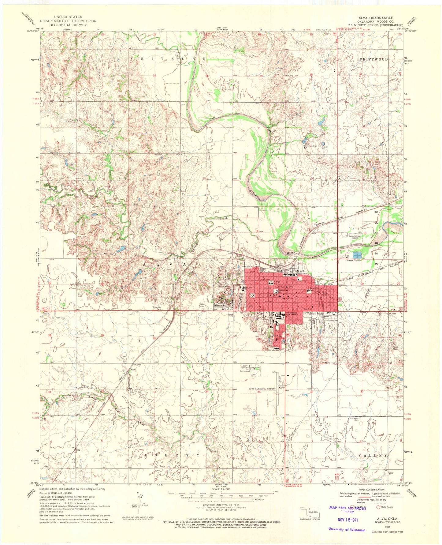
Historical USGS topographic quad map of Alva in the state of Oklahoma. Map scale may vary for some years, but is generally around 1:24,000. Print size is approximately 24" x 27"
This quadrangle is in the following counties: Woods.
The map contains contour lines, roads, rivers, towns, and lakes. Printed on high-quality waterproof paper with UV fade-resistant inks, and shipped rolled.
Contains the following named places: Alva, Alva Country Club, Alva Emergency Medical Service, Alva Fire Department, Alva High School, Alva Middle School, Alva Municipal Cemetery, Alva Police Department, Alva Post Office, Alva Regional Airport, Assembly of God Church, Baptist Church First, Bible Baptist Church, Boggy Creek, Bouziden Lake, Bouziden Lake Dam, Charles E "Bill" Johnson Correctional Center, Church of Christ, Church of Christ Bible Church, Church of God, Church of the Nazarene, City of Alva, Diacon Lake Dam, Discon Lake, First Christian Church, First Presbyterian Church, First United Methodist Church, Hatfield Park, KALV-AM (Alva), Lincoln Elementary School, Longfellow Elementary School, Lutheran Cemetery, Murray Plaza, Murray Plaza Shopping Center, Noel, Northwest Technology Center, Northwestern Oklahoma State University, Otterbein United Methodist Church, Reorganized Chuch of Jesus, Sacred Heart Catholic Church, Sacred Heart Cemetery, Seventh Day Adventist Church, Share Medical Center, The Church of Jesus Christ of Latter Day Saints, Town and Country Christian Church, Turkey Creek, Washington Early Childhood Center, Wood Lake Dam, Woodlake Airport, Woods County Sheriff's Office, Zion Lutheran Church, Zion School