MyTopo
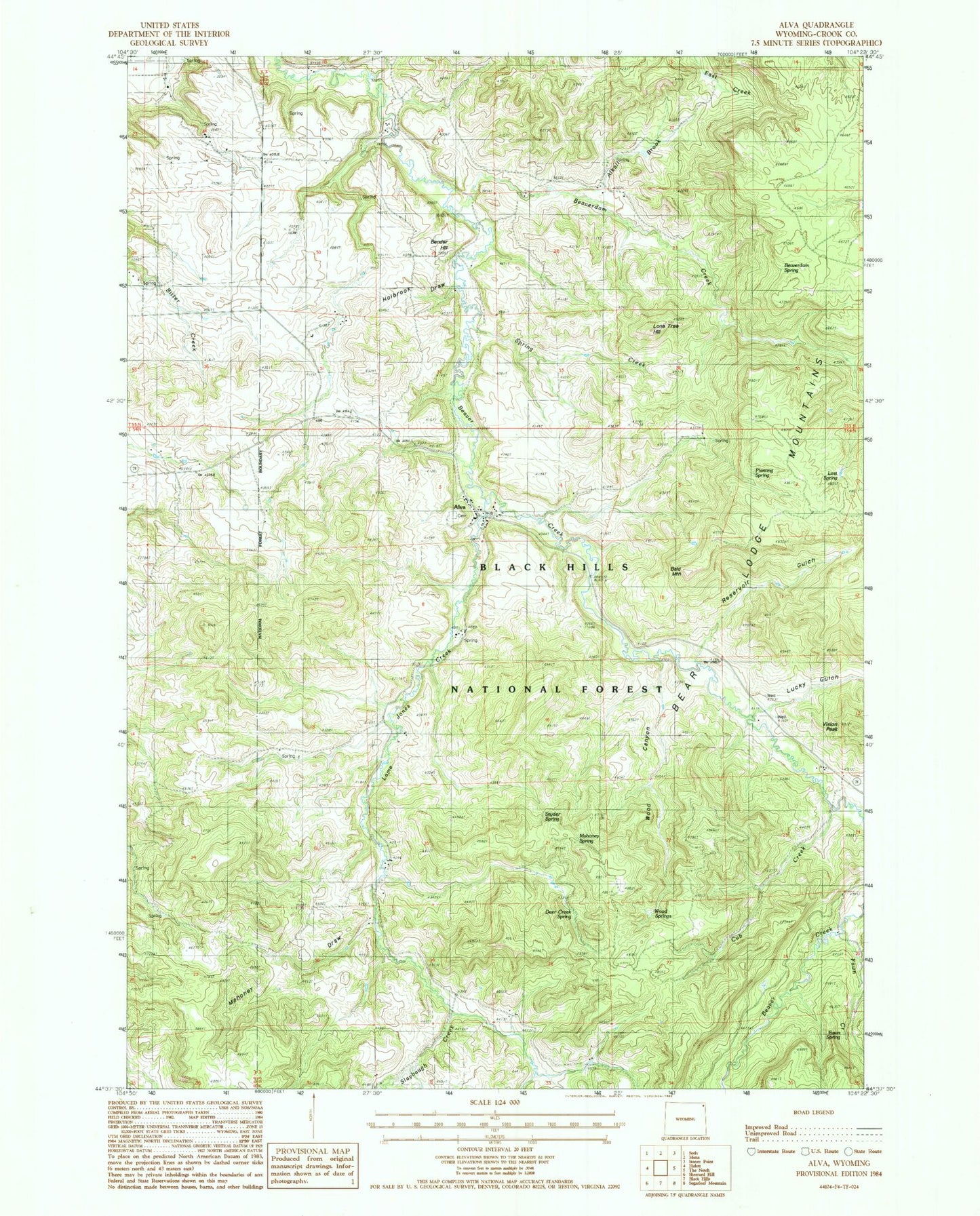
Classic USGS Alva Wyoming 7.5'x7.5' Topo Map
Couldn't load pickup availability
Historical USGS topographic quad map of Alva in the state of Wyoming. Map scale may vary for some years, but is generally around 1:24,000. Print size is approximately 24" x 27"
This quadrangle is in the following counties: Crook.
The map contains contour lines, roads, rivers, towns, and lakes. Printed on high-quality waterproof paper with UV fade-resistant inks, and shipped rolled.
Contains the following named places: Alkali Brook, Alva, Alva Cemetery, Alva Post Office, Bald Mountain, Beaverdam Creek, Beaverdam Spring, Bender Hill, Cub Creek, Deer Creek, Deer Creek Spring, Driskell Pit, Fawn Creek, Fawn Spring, French Dam, French Reservoir, Holbrook Draw, Lame Jones Creek, Lame Jones School, Lone Tree Hill, Lost Spring, Lucky Gulch, Mahoney Draw, Mahoney Spring, Planting Spring, Rauth Trail, Reservoir Gulch, Simmons Trail, Slaybaugh Creek, Snyder Spring, Spring Creek, Upper Beaver Creek School, Vision Peak, White Slide Claims One-three Mine, Wood Canyon, Wood Reservoir, Wood Spring, ZIP Code: 82711