MyTopo
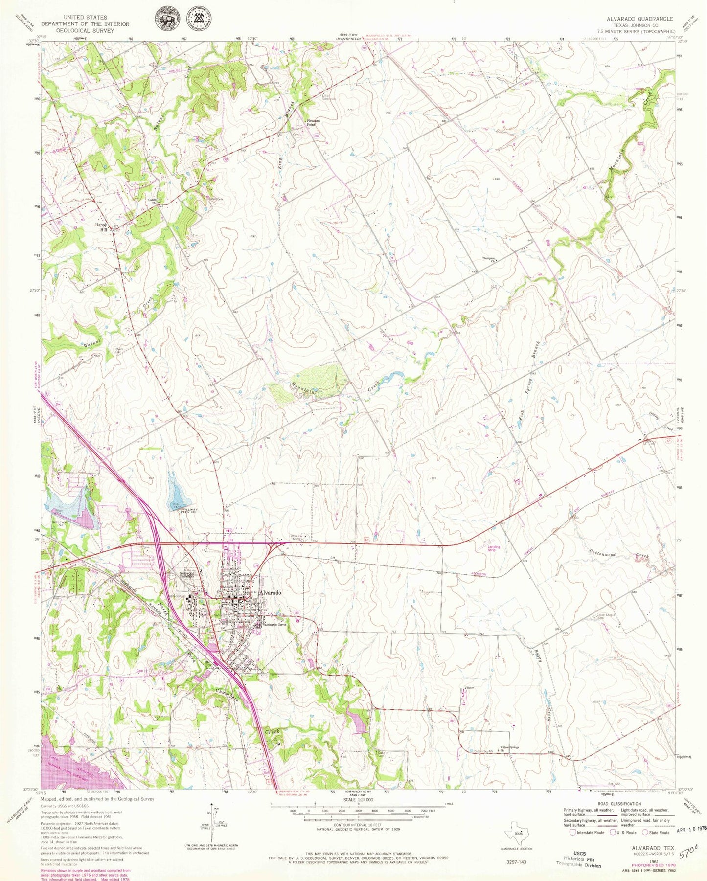
Classic USGS Alvarado Texas 7.5'x7.5' Topo Map
Couldn't load pickup availability
Historical USGS topographic quad map of Alvarado in the state of Texas. Map scale may vary for some years, but is generally around 1:24,000. Print size is approximately 24" x 27"
This quadrangle is in the following counties: Johnson.
The map contains contour lines, roads, rivers, towns, and lakes. Printed on high-quality waterproof paper with UV fade-resistant inks, and shipped rolled.
Contains the following named places: Alvarado, Alvarado City Hall, Alvarado Division, Alvarado Elementary School - North, Alvarado Fire Department and Emergency Medical Services, Alvarado Intermediate School, Alvarado Junior High School, Alvarado Police Department, Alvarado Post Office, Balch Cemetery, Cahill Cemetery, Cahill Church, Center League Cemetery, Charles Head Stadium, Church of Christ, City of Alvarado, Duke Cemetery, First Missionary Baptist Church, Fish Spring Branch, Fundamental Baptist Church, George Washington Carver School, Glenwood Cemetery, Goodlett Field, Happy Hill, Hillside Baptist Church, Johnson County Constable's Office Precinct 3, Pleasant Point, Savinegrace Baptist Church, Soil Conservation Service Site 31 Dam, Soil Conservation Service Site 31 Reservoir, Soil Conservation Service Site 32 Dam, Soil Conservation Service Site 32 Reservoir, Soil Conservation Service Site 43a Dam, Soil Conservation Service Site 43a Reservoir, The Homesteads, The Homesteads Census Designated Place, Thompson Church, Willow Springs Church, ZIP Code: 76009