MyTopo
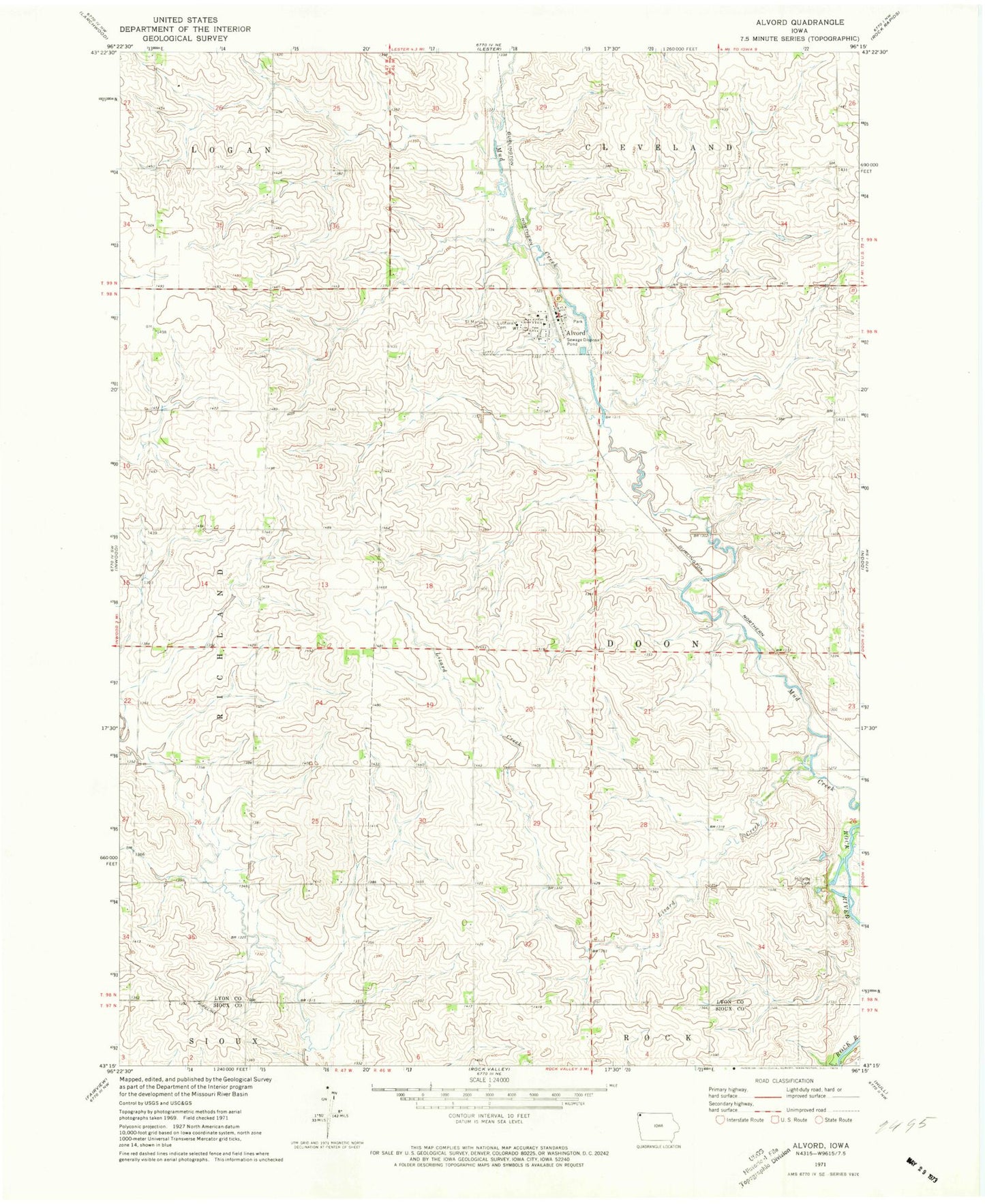
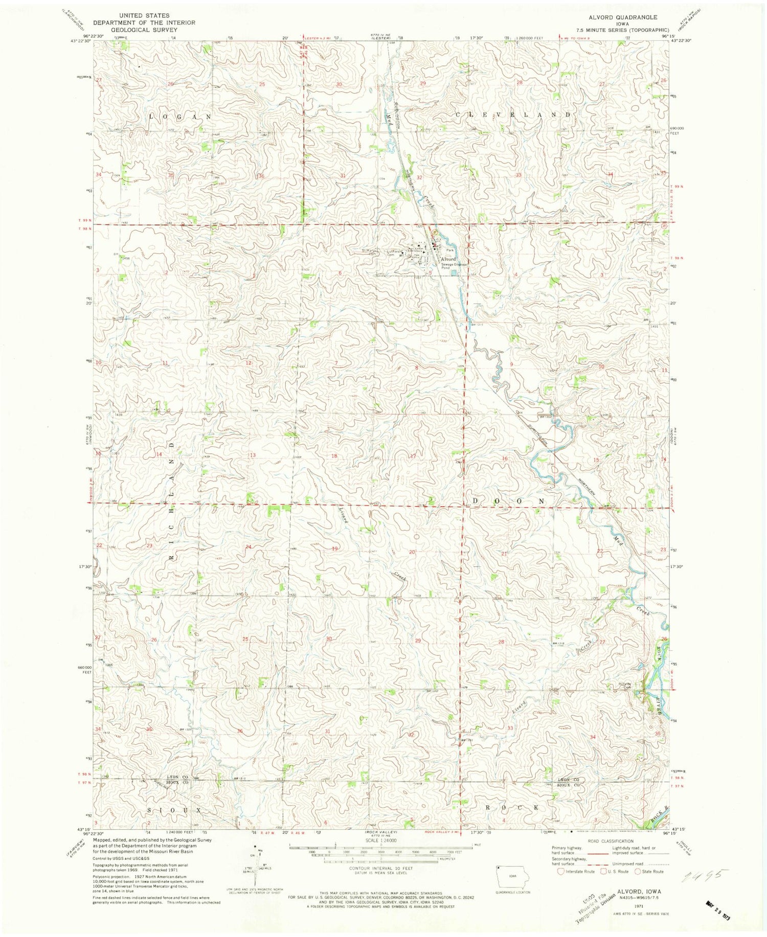
Classic USGS Alvord Iowa 7.5'x7.5' Topo Map
Couldn't load pickup availability
Historical USGS topographic quad map of Alvord in the state of Iowa. Map scale may vary for some years, but is generally around 1:24,000. Print size is approximately 24" x 27"
This quadrangle is in the following counties: Lyon, Sioux.
The map contains contour lines, roads, rivers, towns, and lakes. Printed on high-quality waterproof paper with UV fade-resistant inks, and shipped rolled.
Contains the following named places: Altena Farms, Alvord, Alvord Feed and Supply Incorporated Elevator, Alvord Fire Department, Alvord Post Office, Christ Lutheran Church, City of Alvord, Eagle Avenue Farm, Farmers Elevator Company Elevator, Helgerson Post Office, Hillside Cemetery, Kelly Stock Farms, L and M Farm, Lizard Creek, M D F Farms, Mogler Farms, Pine Groves Farm, Sacred Heart Catholic Church, Saint Marys Cemetery, Serck Farms, Teunissen Farms, Township of Doon, Triple T Farms, Winding Meadows Dairy, Y - Do - I Farm, ZIP Code: 51230