MyTopo
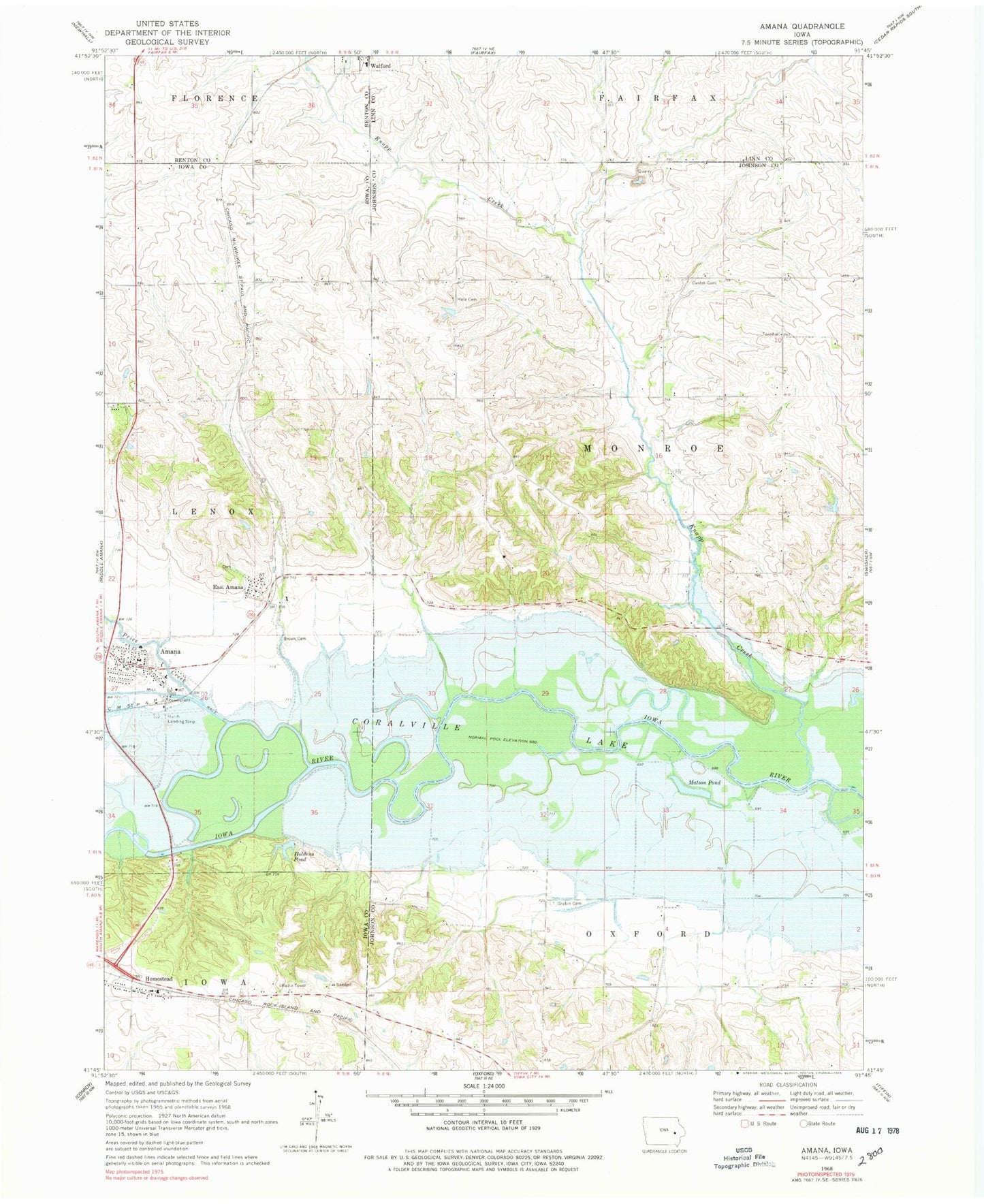
Classic USGS Amana Iowa 7.5'x7.5' Topo Map
Couldn't load pickup availability
Historical USGS topographic quad map of Amana in the state of Iowa. Map scale may vary for some years, but is generally around 1:24,000. Print size is approximately 24" x 27"
This quadrangle is in the following counties: Benton, Iowa, Johnson, Linn.
The map contains contour lines, roads, rivers, towns, and lakes. Printed on high-quality waterproof paper with UV fade-resistant inks, and shipped rolled.
Contains the following named places: Amana, Amana Airport, Amana Community Church Museum, Brown Cemetery, Castek Cemetery, Danforth Post Office, East Amana, East Amana Census Designated Place, Four County Quarry, Grabin Cemetery, Hala Cemetery, Holdens Pond, Homestead, Homestead Census Designated Place, Homestead Post Office, Iowa City Bible Fellowship, Knapp Creek, KRNA-FM (Iowa City), Matson Pond, Monroe Townhall, Museum of Amana History, Rich Field, Spicer Spooner Cemetery, Township of Monroe, Williams Prairie State Preserve, Wool Will Machine Shop Museum