MyTopo
Classic USGS Amargosa Valley Nevada 7.5'x7.5' Topo Map
Regular price
$16.95
Regular price
Sale price
$16.95
Unit price
per
Couldn't load pickup availability
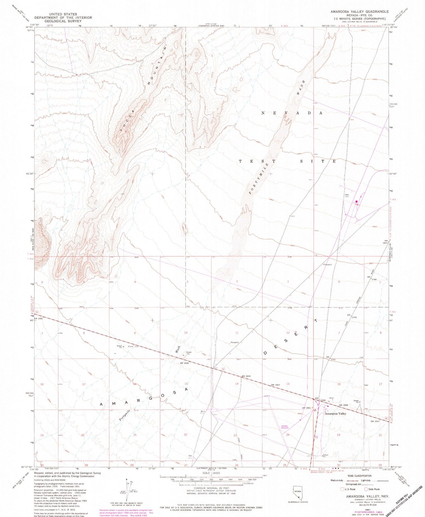
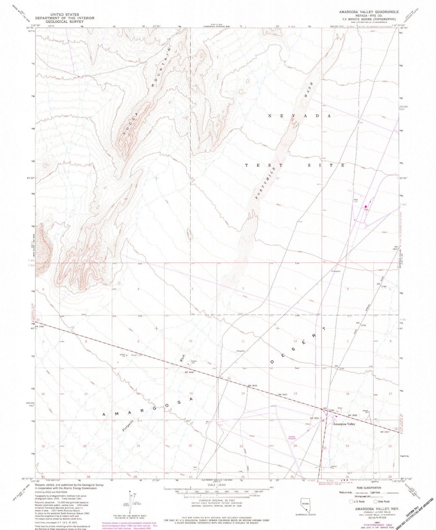
Historical USGS topographic quad map of Amargosa Valley in the state of Nevada. Map scale may vary for some years, but is generally around 1:24,000. Print size is approximately 24" x 27"
This quadrangle is in the following counties: Nye.
The map contains contour lines, roads, rivers, towns, and lakes. Printed on high-quality waterproof paper with UV fade-resistant inks, and shipped rolled.
Contains the following named places: Amargosa Valley, Amargosa Valley Elementary School, Amargosa Valley Middle School, Amargosa Valley Post Office, Azrael Ridge, Black Ridge, Desolation Point, Horizon Academy, Jackass Aeropark, Topopah Wash