
MyTopo
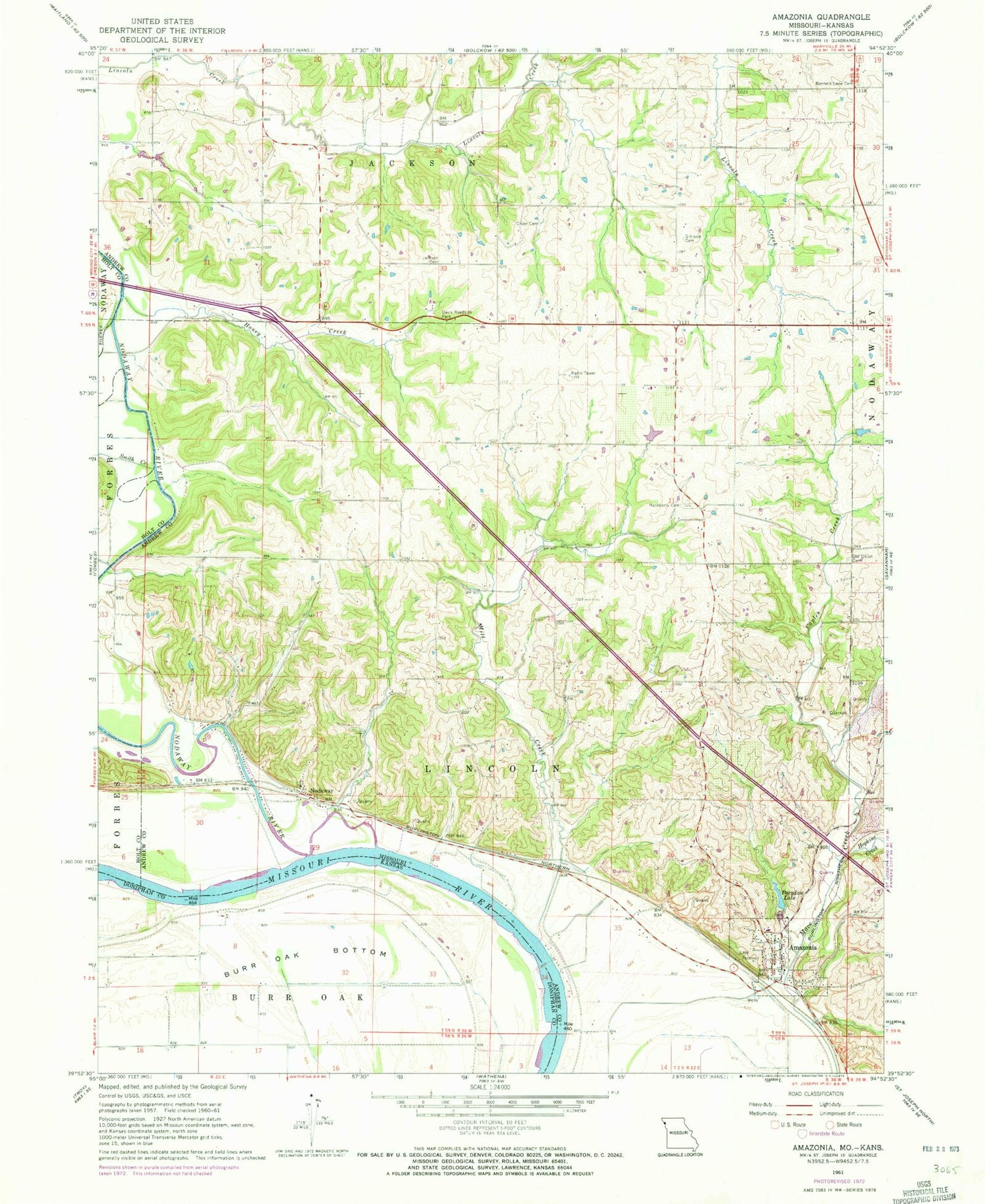
Classic USGS Amazonia Missouri 7.5'x7.5' Topo Map
Couldn't load pickup availability
Historical USGS topographic quad map of Amazonia in the states of Missouri, Kansas. Typical map scale is 1:24,000, but may vary for certain years, if available. Print size: 24" x 27"
This quadrangle is in the following counties: Andrew, Doniphan, Holt.
The map contains contour lines, roads, rivers, towns, and lakes. Printed on high-quality waterproof paper with UV fade-resistant inks, and shipped rolled.
Contains the following named places: Nodaway River, Bennett Lane Cemetery, Caples Creek, Clizer Cemetery, Davis Roadside Park, Gillispie Cemetery, Hackberry Cemetery, Honey Creek, Hopkins Creek, Jackson Cemetery, Mill Creek, Nodaway, Mount Carmel Cemetery, Paradise Lake, Smith Creek, Amazonia, Sollars Lake (historical), Garlich Lake (historical), Hummon School (historical), Gee School, Goodloe School, Whiteoak School, Bennett Lane School (historical), Brand School (historical), Liggett School, Nodaway Island School (historical), Gee School (historical), Callen School (historical), Amazonia Elementary School, Paradise Lake Dam, Thompson Lake Dam, Thompson Lake, Schweizer Lake Dam, Schweizer Lake, Township of Lincoln, Village of Amazonia, Nodaway Census Designated Place, Amazonia Post Office, Burr Oak Bottom


