MyTopo
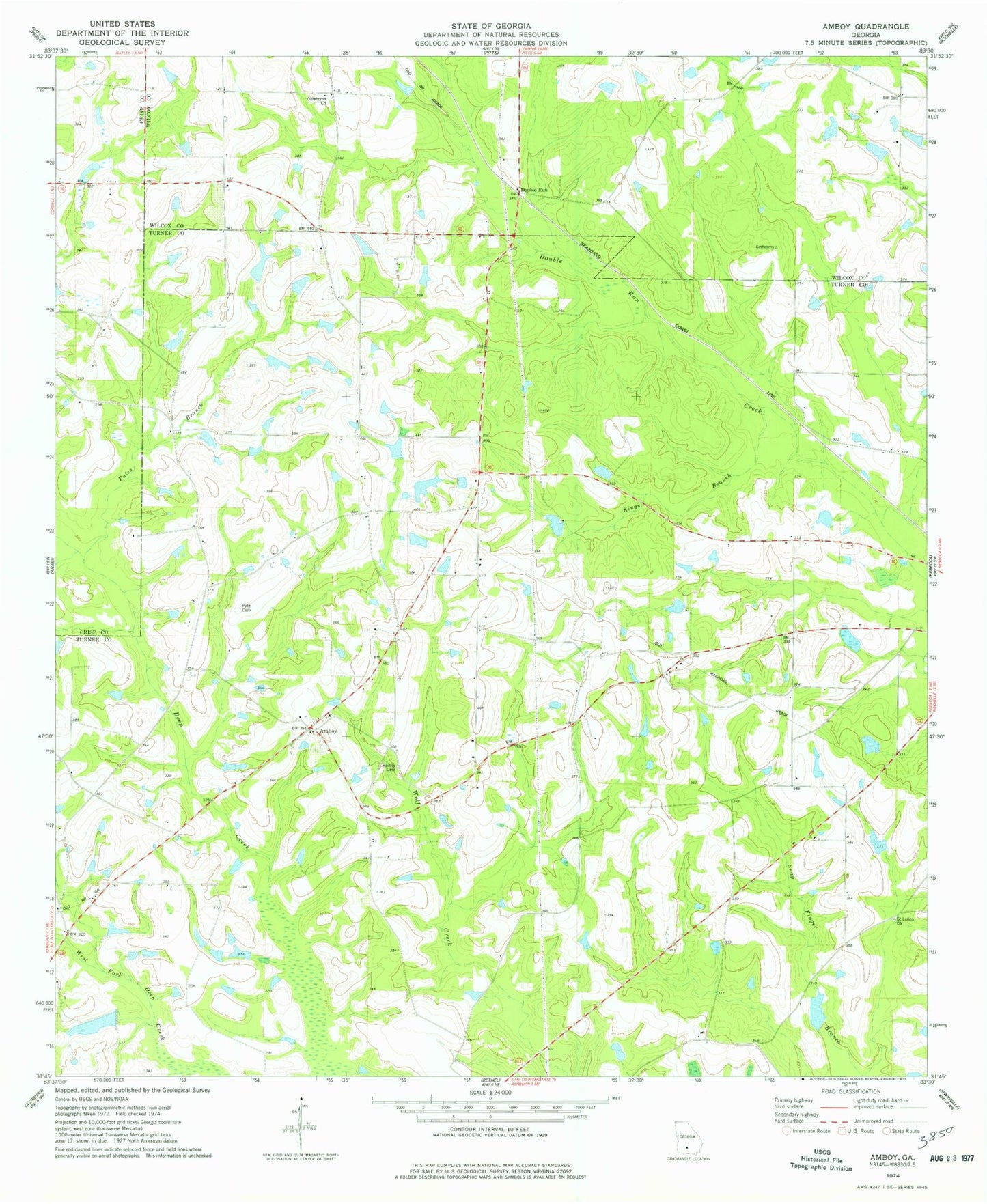
Classic USGS Amboy Georgia 7.5'x7.5' Topo Map
Couldn't load pickup availability
Historical USGS topographic quad map of Amboy in the state of Georgia. Map scale may vary for some years, but is generally around 1:24,000. Print size is approximately 24" x 27"
This quadrangle is in the following counties: Crisp, Turner, Wilcox.
The map contains contour lines, roads, rivers, towns, and lakes. Printed on high-quality waterproof paper with UV fade-resistant inks, and shipped rolled.
Contains the following named places: Amboy Baptist Church, Armboy, Burges School, Date Lake Dam, Deep Creek School, Double Run, Double Run Missionary Baptist Church, Durham School, Felder, Gibbs Lake, Gibbs Lake Dam, Gilmore School, Hobby Lake, Hobby Lake Dam, Kings Branch, Oak Hill Church, Oklahoma Cemetery, Oklahoma Church, Pate Cemetery, Pate Lake, Pates Branch, Pleasant Grove Church, Rainey Cemetery, Rebecca Division, Saint Lukes Church, Shinglers, Tom Halls Pond, Turner County Fire and Rescue Amboy Station, Webbs Chapel, Whelchel Lake, Whelchel Lake Dam