
MyTopo
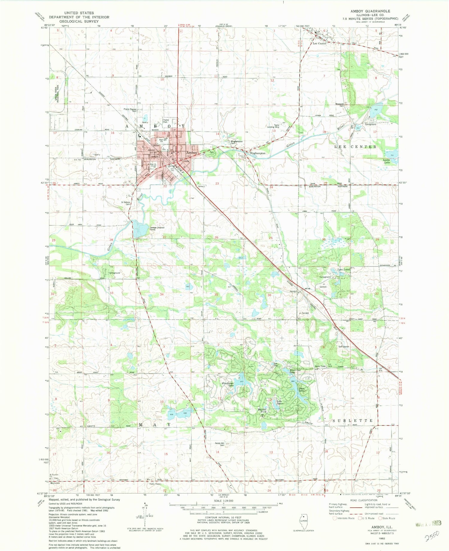
Classic USGS Amboy Illinois 7.5'x7.5' Topo Map
Couldn't load pickup availability
Historical USGS topographic quad map of Amboy in the state of Illinois. Map scale may vary for some years, but is generally around 1:24,000. Print size is approximately 24" x 27"
This quadrangle is in the following counties: Lee.
The map contains contour lines, roads, rivers, towns, and lakes. Printed on high-quality waterproof paper with UV fade-resistant inks, and shipped rolled.
Contains the following named places: Amboy, Amboy Central Elementary School, Amboy City Hall, Amboy Fire Protection District, Amboy High School, Amboy Junior High School, Amboy Marsh Sanctuary, Amboy Police Department, Amboy Post Office, Amboy Quarry, Bass Lake, Bass Lake Dam, Big Marsh, Binghampton, Binghampton Cemetery, Bird Song, Black Oak Lake, Earth Star Flats, Fifty Turtlehead Pond, First Baptist Church, High Ridge, Immanuel Lutheran Church, Indian Ridge, Indigo Wetland, Inlet Grove, Kessel Farms, Lake Sunset, Leake Lake, Lee Center, Lee Center Post Office, Lee County, Leffelman Airport, Lily Pad Pond, Lyon Lakes, Mallard Pond, Maytown, Meusel Farms, Mormon Cemetery, Oak Glen Savanna, Orchid Wetland, Pankhurst Memorial Library, Prairie Repose Cemetery, Saint Patrick Cemetery, Saint Patrick's Cemetery, Saint Patricks Church, Sandy Hill Cemetery, Schaver Farms, Setchell Farms, Shelburn, Snapping Turtle Pond, Spears Meadow, Taylor Airport, Township of Amboy, Township of May, United First Church, Wet Pond, Woodhaven Lake, Woodhaven Lake Dam, Woodpecker Woods, Woodside Cemetery, ZIP Codes: 61310, 61331


