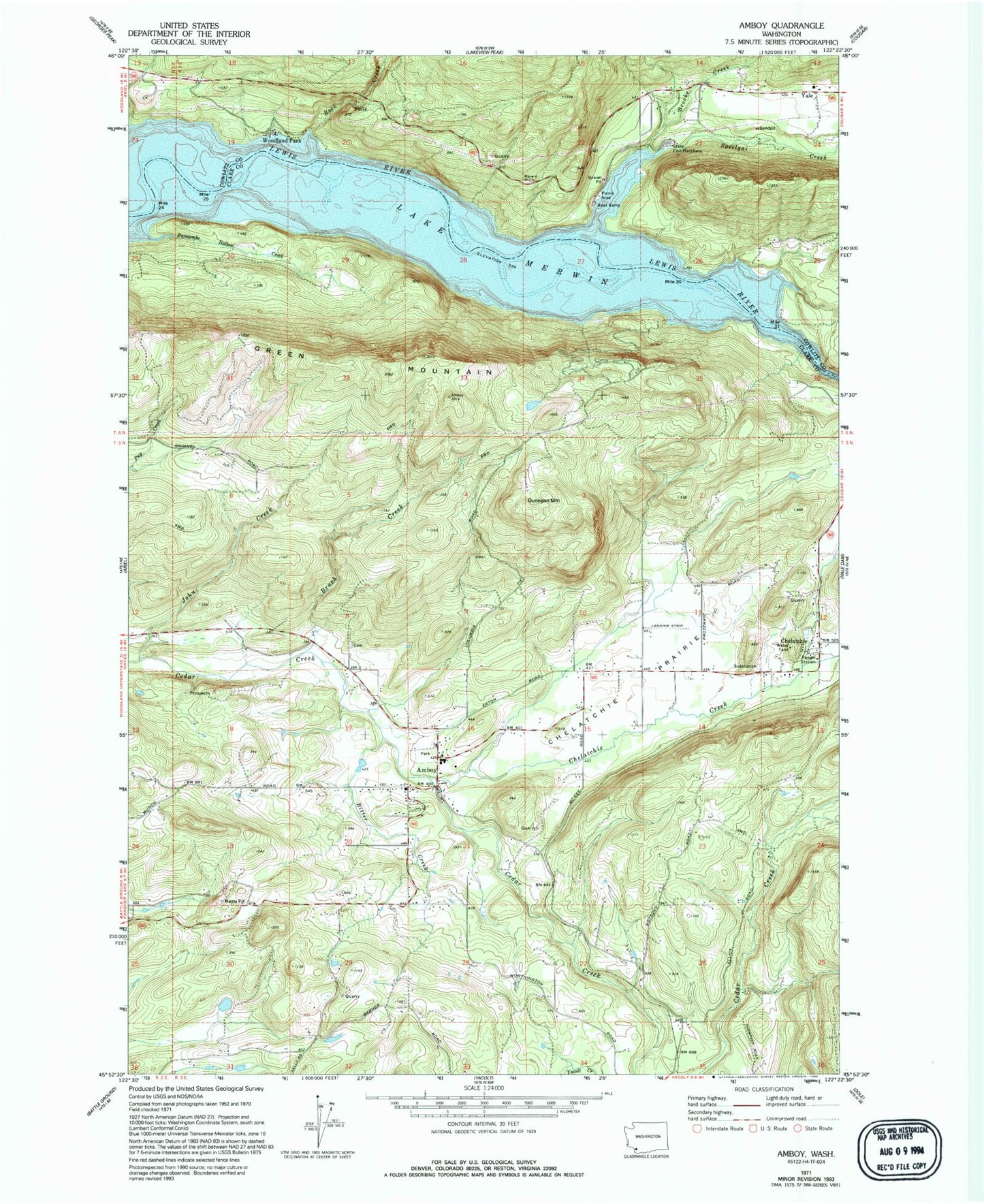
MyTopo
Classic USGS Amboy Washington 7.5'x7.5' Topo Map
Couldn't load pickup availability
Historical USGS topographic quad map of Amboy in the state of Washington. Typical map scale is 1:24,000, but may vary for certain years, if available. Print size: 24" x 27"
This quadrangle is in the following counties: Clark, Cowlitz.
The map contains contour lines, roads, rivers, towns, and lakes. Printed on high-quality waterproof paper with UV fade-resistant inks, and shipped rolled.
Contains the following named places: Yale Elementary School, Amboy, Bitter Creek, Brooks Creek, Brush Creek, Buncombe Hollow Creek, Chelatchie, Chelatchie Creek, Chelatchie Prairie, Dunegan Mountain, Green Mountain, John Creek, Maple Pit, Lake Merwin, Rock Creek, Speelyai Creek, Woodland Park, Yale, Saint Helens Ranger Station, Mount Saint Helens National Volcanic Monument Headquarters, Speelyai Picnic Area, Schmidt Creek, Amboy Park, Amboy Middle School, Seely Dam, Warren Seely Reservoir, Leroy Anderson Dam, Leroy Anderson Reservoir, Fassett Reservoir Dam, Fassett Reservoir, Columbia Tie Mill Pond, Walter Sutton's Private Strip, Mount St Helen's Aero Ranch, Amboy Census Designated Place, Clark County Fire District 10 Station 1, Clark County Fire District 10 Station 106, Cowlitz - Skamania Fire District 7 Station 71, Clark County Fire District 10 Station 2, Amboy Post Office