
MyTopo
Classic USGS Ambrose California 7.5'x7.5' Topo Map
Regular price
$16.95
Regular price
Sale price
$16.95
Unit price
per
Couldn't load pickup availability
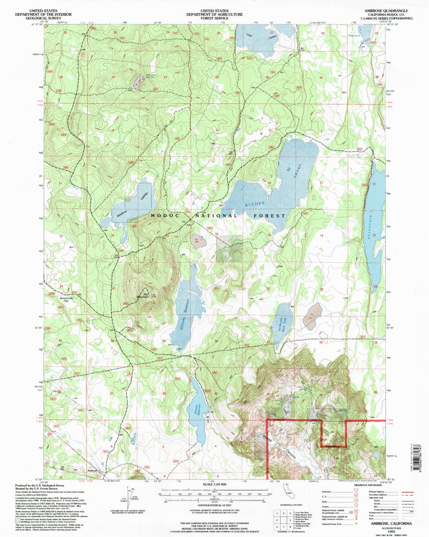
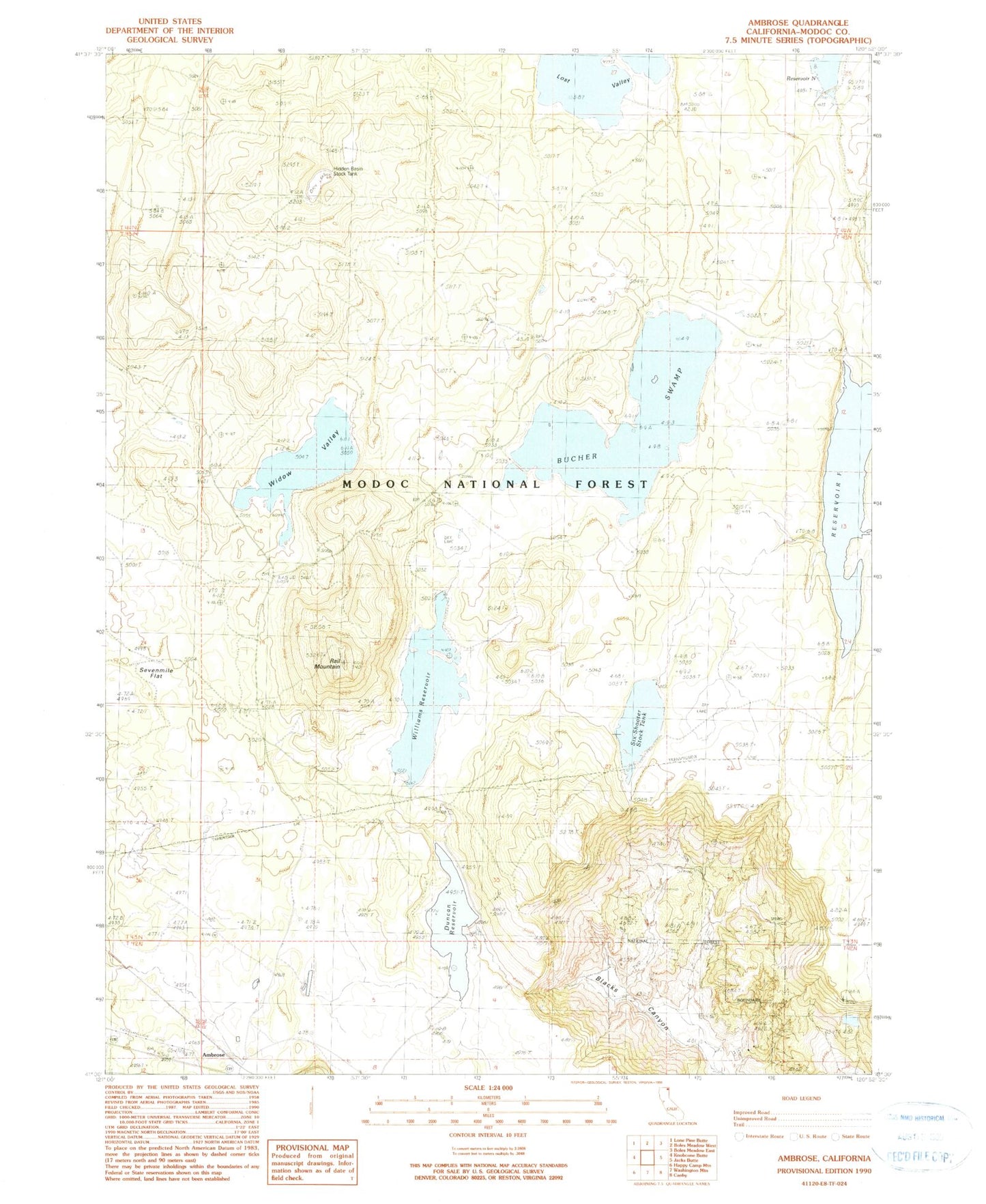
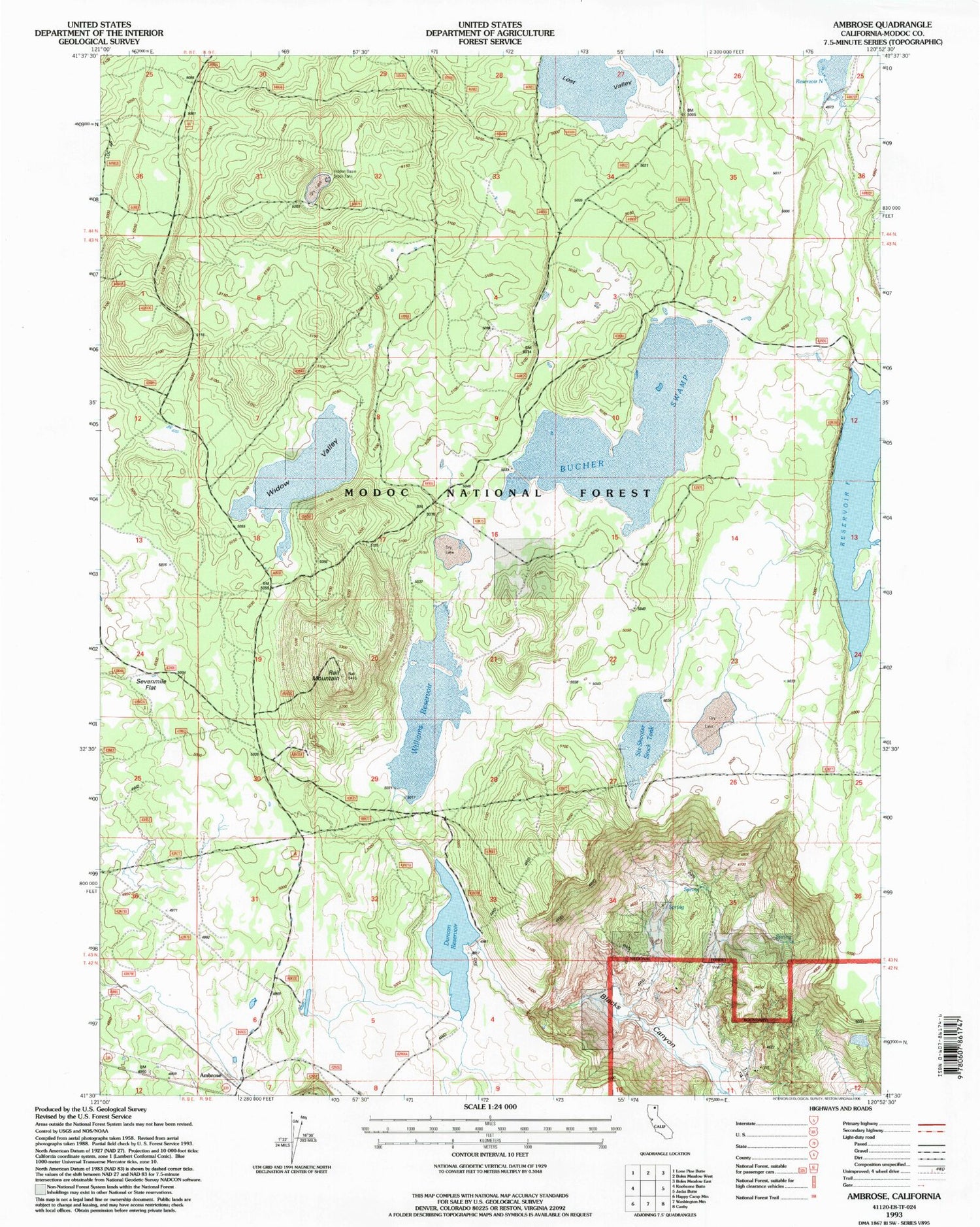
Historical USGS topographic quad map of Ambrose in the state of California. Map scale may vary for some years, but is generally around 1:24,000. Print size is approximately 24" x 27"
This quadrangle is in the following counties: Modoc.
The map contains contour lines, roads, rivers, towns, and lakes. Printed on high-quality waterproof paper with UV fade-resistant inks, and shipped rolled.
Contains the following named places: Ambrose, Bacon Ranch, Bucher Swamp, Duncan 149-002 Dam, Duncan Reservoir, Hidden Basin Stock Tank, Modoc National Forest, Rail Mountain, Reservoir F, Sevenmile Flat, Six-Shooter Stock Tank, Widow Valley, Williams Reservoir