MyTopo
Classic USGS Amelia Louisiana 7.5'x7.5' Topo Map
Couldn't load pickup availability
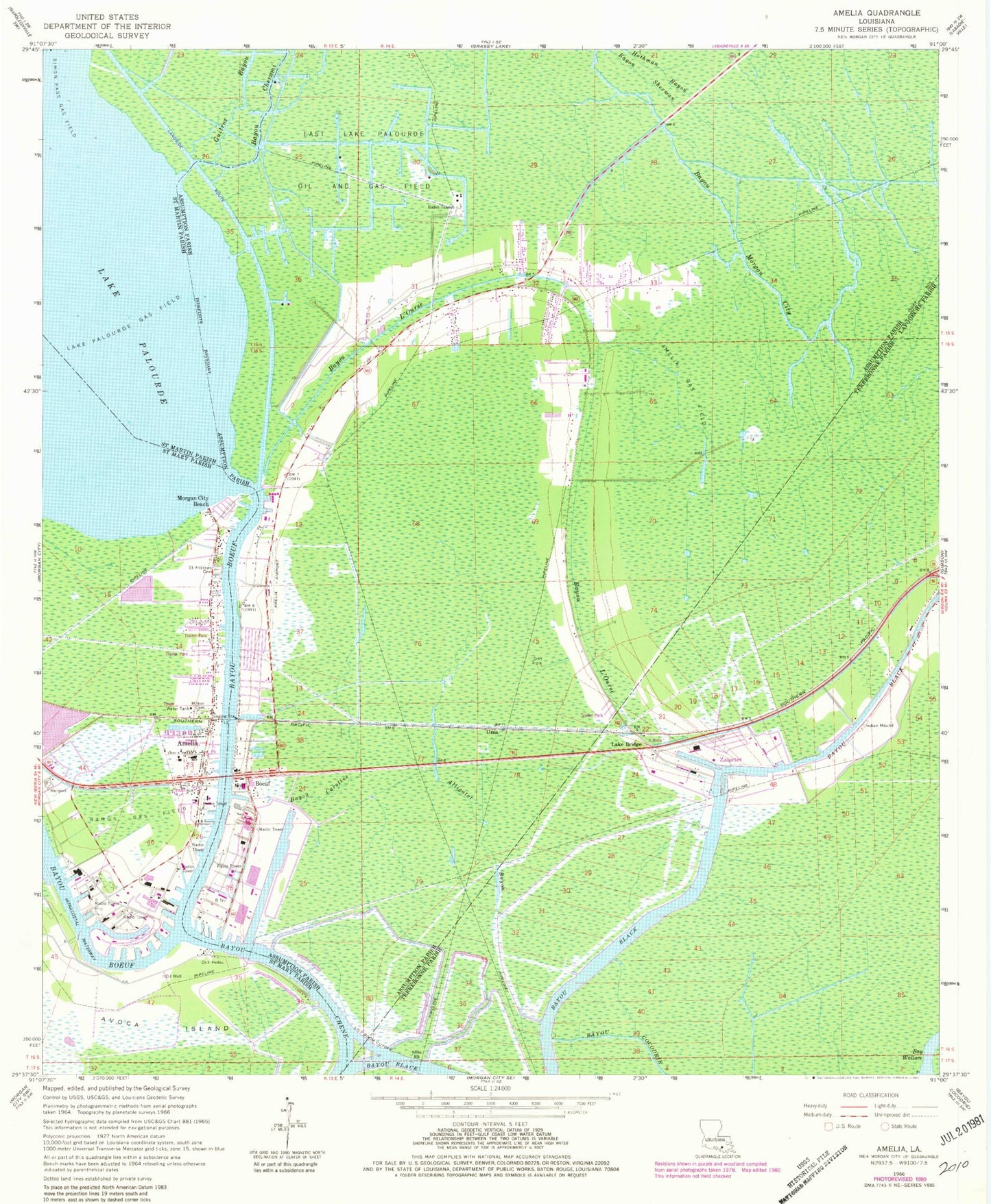
Historical USGS topographic quad map of Amelia in the state of Louisiana. Map scale may vary for some years, but is generally around 1:24,000. Print size is approximately 24" x 27"
This quadrangle is in the following counties: Assumption, Lafourche, St. Martin, St. Mary, Terrebonne.
The map contains contour lines, roads, rivers, towns, and lakes. Printed on high-quality waterproof paper with UV fade-resistant inks, and shipped rolled.
Contains the following named places: Alligator Bayou, Amelia, Amelia Airport, Amelia Base Heliport, Amelia Census Designated Place, Amelia Gas Field, Amelia Post Office, Amelia Volunteer Fire Department, Arco Morgan City Heliport, Assumption Parish Library Bayou L'Ourse Branch, Aucoin Elementary School, Bay Wallace, Bayou Black, Bayou Boeuf Seaplane Base, Bayou Caroline, Bayou Cherami, Bayou Cocodrie, Bayou L'Ourse, Bayou L'Ourse Baptist Church, Bayou L'Ourse Census Designated Place, Bayou L'Ourse Head Start School, Bayou L'Ourse Primary School, Bayou L'Ourse Volunteer Fire Department, Boeuf, East Lake Palourde Oil and Gas Field, Era-Morgan City Heliport, First Baptist Church of Amelia, Guitroz Bayou, Holy Family Church, Lake Bridge, Lake Palourde Base Heliport, Lake Palourde Gas Field, Lily Boom Cutoff, Milton Cemetery, Morgan City Beach, Parish Governing Authority District 3, Ramos Gas Field, Saint Andrew Church, Saint Andrews Cemetery, Saint Mary Parish Library Amelia Branch, Simon Pass Gas Field, Ursa, Ward Nine, Zacarter, ZIP Code: 70340