MyTopo
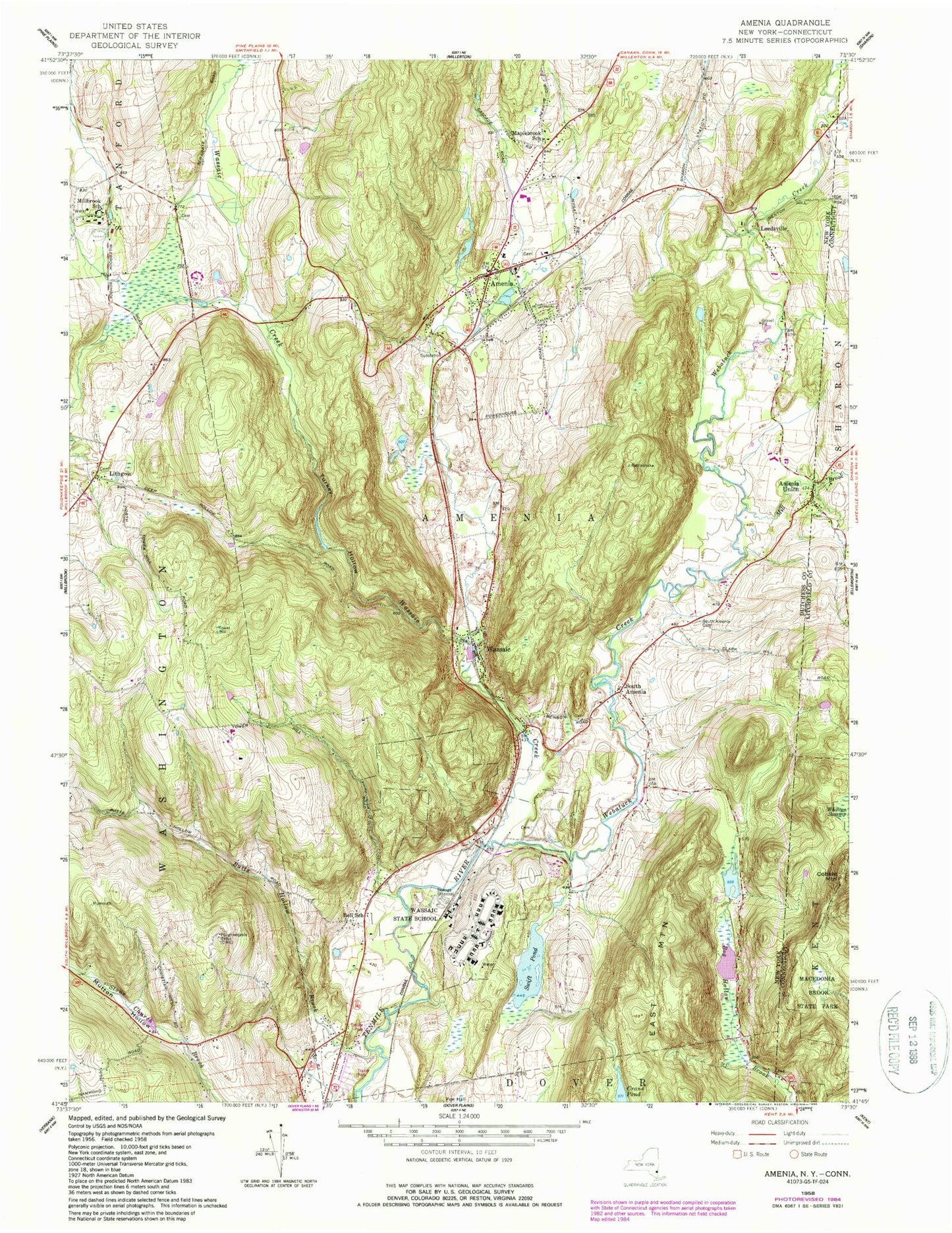
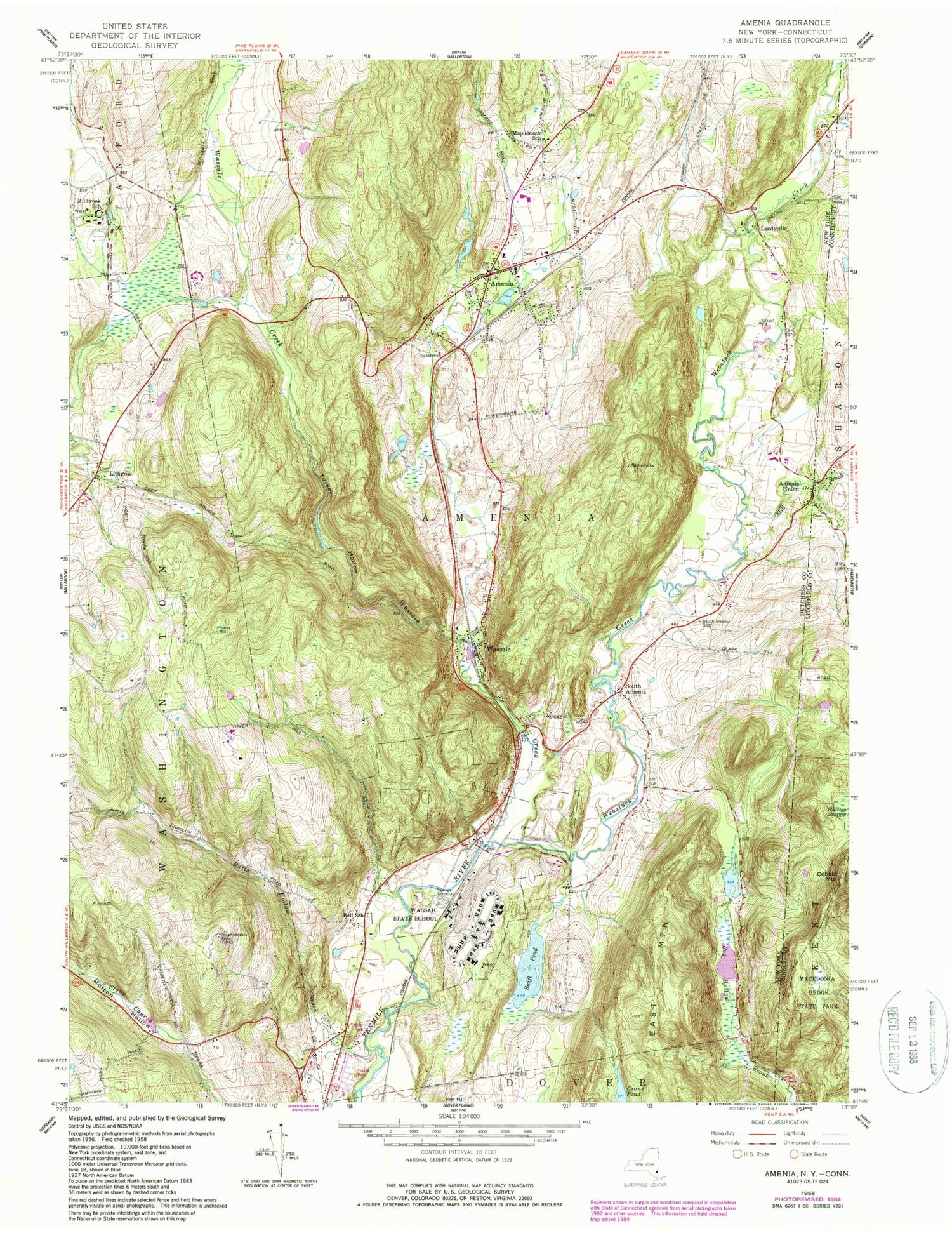
Classic USGS Amenia New York 7.5'x7.5' Topo Map
Couldn't load pickup availability
Historical USGS topographic quad map of Amenia in the states of New York, Connecticut. Map scale may vary for some years, but is generally around 1:24,000. Print size is approximately 24" x 27"
This quadrangle is in the following counties: Dutchess, Litchfield.
The map contains contour lines, roads, rivers, towns, and lakes. Printed on high-quality waterproof paper with UV fade-resistant inks, and shipped rolled.
Contains the following named places: Amenia, Amenia Burying Ground - Red Meeting House Cemetery, Amenia Census Designated Place, Amenia Drive-In, Amenia Elementary School, Amenia Fire Company, Amenia Free Library, Amenia Island Cemetery, Amenia Post Office, Amenia Town Hall, Amenia Union, Amenia Union Cemetery, Bell School, Butts Hollow Brook, Castle Gate Mobile Home Park, Cobble Mountain, Evergreen Farm, Immaculate Conception Church, Indian Lake Creek, Leedsville, Lithgow, Maplebrook School, Mill Brook, Millbrook School, Mutton Hollow, Northrup Burial Ground, Oak Leaf Hill Farm, Saint Peters Church, Saint Peters Episcopal Cemetery, Saint Thomas Episcopal Church, Separate Burying Ground, Silo Ridge Country Club, South Amenia, South Amenia Cemetery, Stone Church Brook, Swift Pond, Tenmile River Station, Town of Amenia, Turkey Hollow, United Presbyterian Church, Wassaic, Wassaic Census Designated Place, Wassaic Creek, Wassaic Post Office, Wassaic State Multiple Use Area, Wassaic State School, Wassaic Station, Wassaic Volunteer Fire Company, Webatuck Creek, ZIP Codes: 12501, 12592