MyTopo
Classic USGS Amicalola Georgia 7.5'x7.5' Topo Map
Couldn't load pickup availability
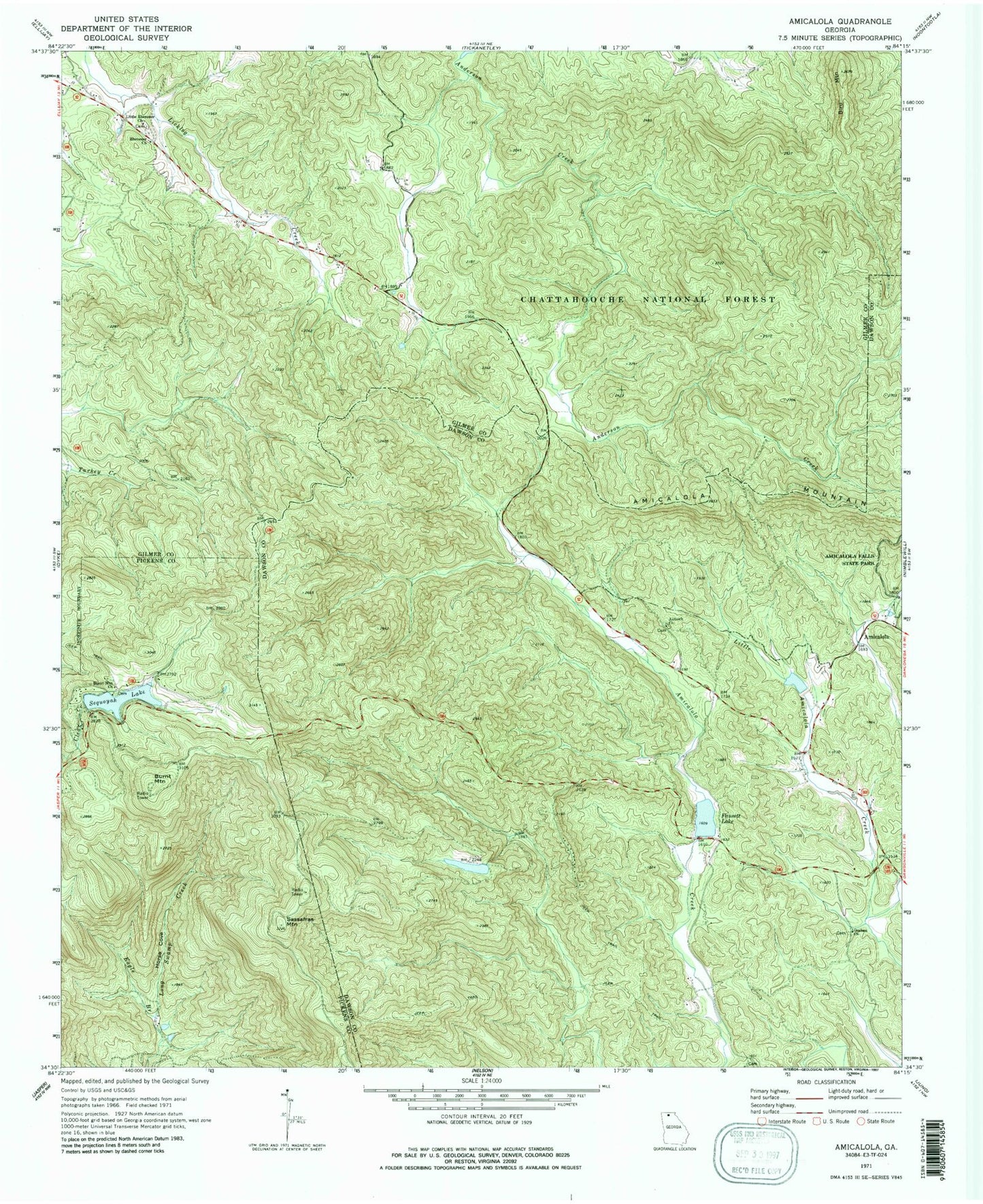
Historical USGS topographic quad map of Amicalola in the state of Georgia. Typical map scale is 1:24,000, but may vary for certain years, if available. Print size: 24" x 27"
This quadrangle is in the following counties: Dawson, Gilmer, Pickens.
The map contains contour lines, roads, rivers, towns, and lakes. Printed on high-quality waterproof paper with UV fade-resistant inks, and shipped rolled.
Contains the following named places: Antioch Church, Bird Mountain, Burnt Mountain Church, Eagle Branch, Goshen Church, Horse Cove, Little Ebenezer Church, Sassafras Mountain, Licklog, Fausett Lake Dam, Amicalola Creek Watershed Structure Number One Dam, Kincaid Lake, Sequoyah Lake Dam, Fall Creek, Huckleberry Branch, Ebenezer Baptist Church Cemetery, Amicalola, Burnt Mountain, Ebenezer Church, Fausett Lake, Sequoyah Lake, Burnt Mountain Estates, Johntown (historical), Licklog (historical), Snider (historical), Gilmer County Fire Department Station 2, Tate Mountain Estates