MyTopo
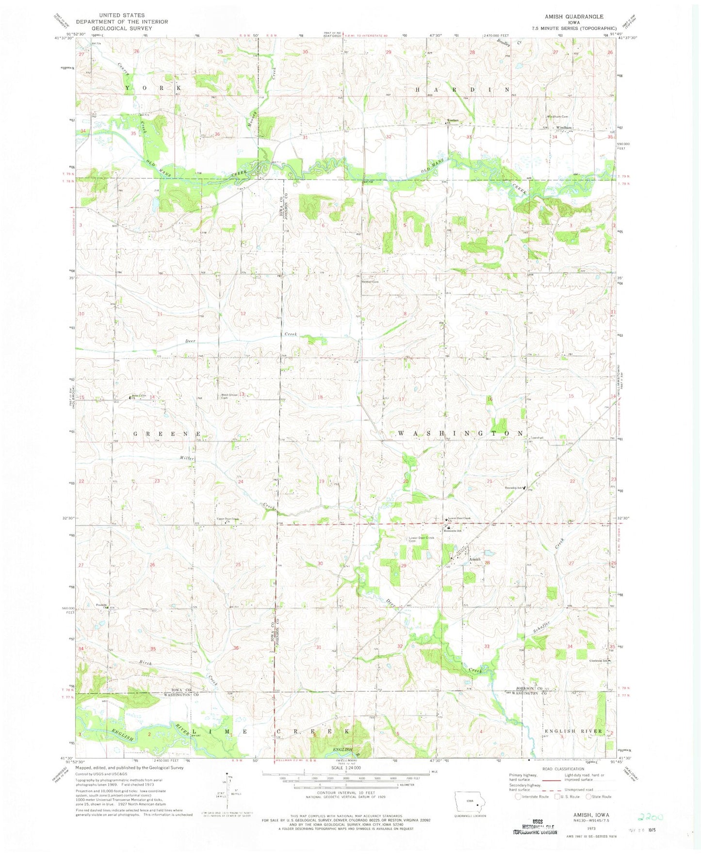
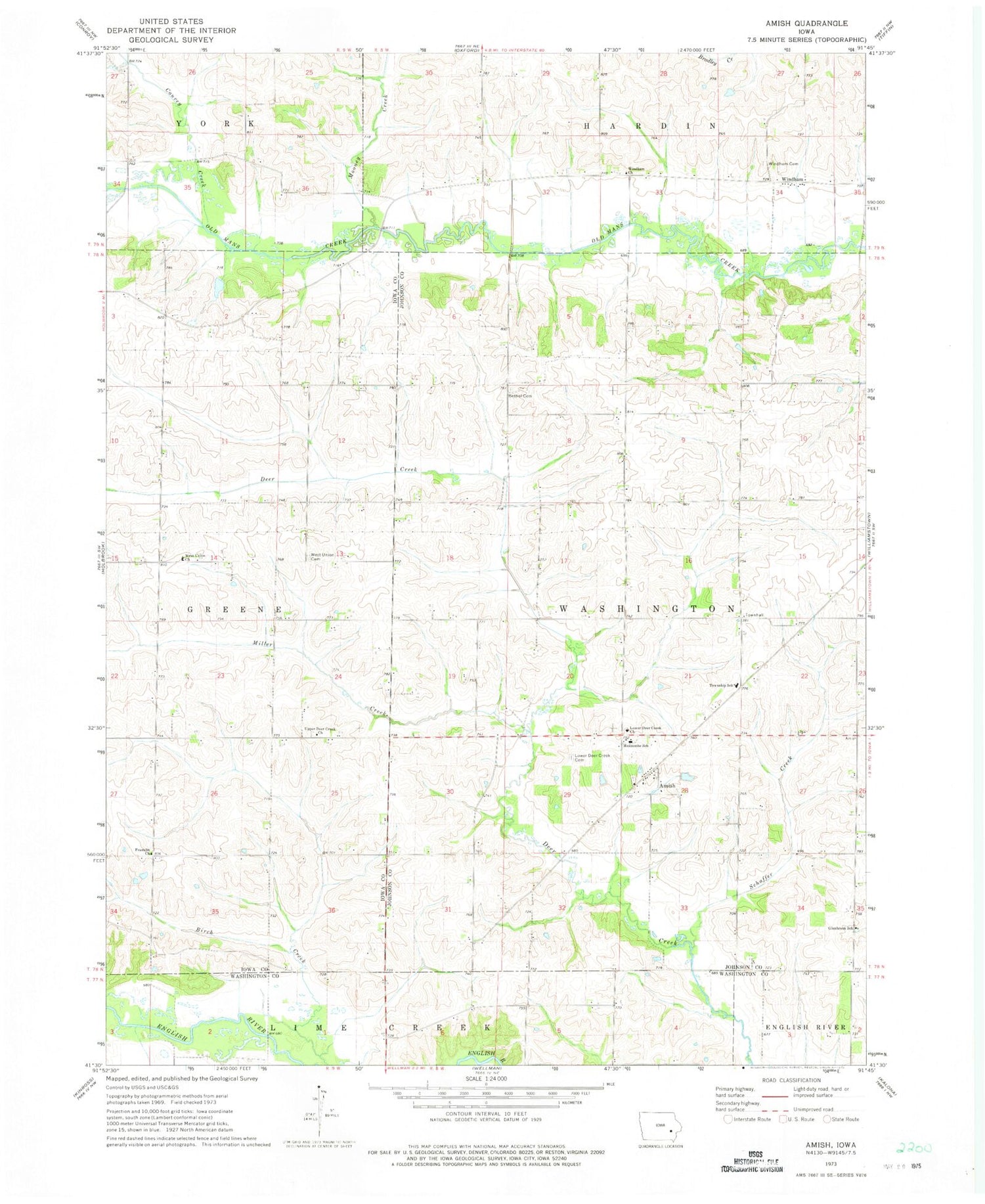
Classic USGS Amish Iowa 7.5'x7.5' Topo Map
Couldn't load pickup availability
Historical USGS topographic quad map of Amish in the state of Iowa. Map scale may vary for some years, but is generally around 1:24,000. Print size is approximately 24" x 27"
This quadrangle is in the following counties: Iowa, Johnson, Washington.
The map contains contour lines, roads, rivers, towns, and lakes. Printed on high-quality waterproof paper with UV fade-resistant inks, and shipped rolled.
Contains the following named places: Amish, Amish Post Office, Bethel Cemetery, Brenneman Cemetery, Convey Creek, Franklin Church, Frendale Post Office, Iowa Mennonite School, Lower Deer Creek Cemetery, Lower Deer Creek Church, Miller Creek, Mooney Creek, Pleasant Hill Cemetery, Schaffer Creek, Schottler Cemetery, Township of Washington, Upper Deer Creek Church, Washington Townhall, Washington Township Elementary School, Wertz Cemetery, West Union Church, West Union Mennonite Cemetery, Windham, Windham Cemetery, Windham Church, Windham Post Office