MyTopo
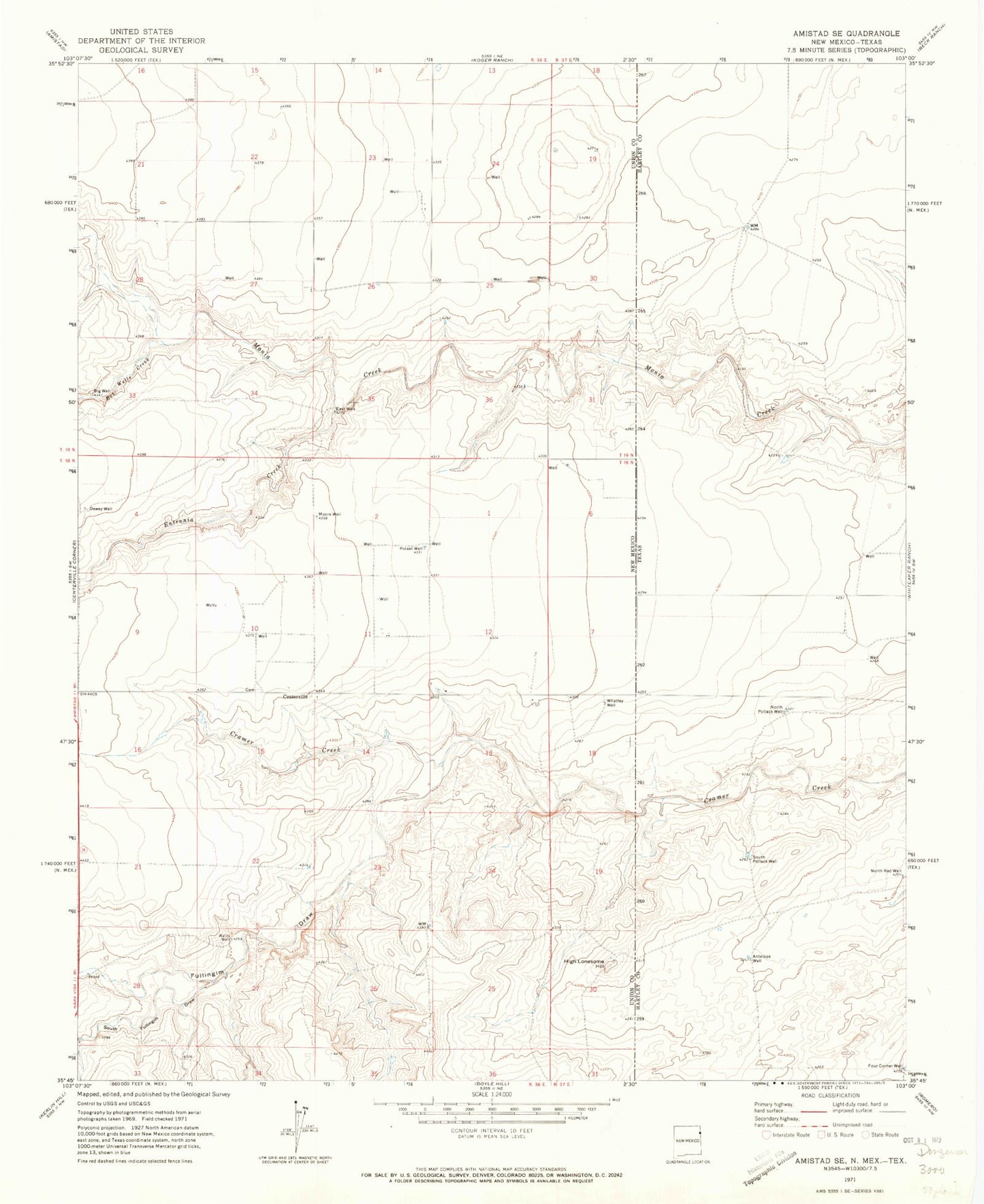
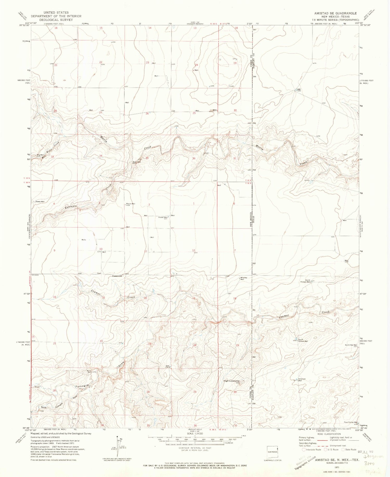
Classic USGS Amistad SE New Mexico 7.5'x7.5' Topo Map
Couldn't load pickup availability
Historical USGS topographic quad map of Amistad SE in the states of New Mexico, Texas. Map scale may vary for some years, but is generally around 1:24,000. Print size is approximately 24" x 27"
This quadrangle is in the following counties: Hartley, Union.
The map contains contour lines, roads, rivers, towns, and lakes. Printed on high-quality waterproof paper with UV fade-resistant inks, and shipped rolled.
Contains the following named places: Antelope Well, Big Well, Bob Wells Creek, Centerville, Centerville Cemetery, Centerville Post Office, Cramer Creek, Dewey Well, East Well, Entrania Creek, Four Corner Well, Fullingim Draw, High Lonesome Hill, Monia Creek, Moore Well, North Pollack Well, North Red Well, Poteet Well, South Fullingim Draw, South Pollack Well, Watts Well, Whatley Well