
MyTopo
Classic USGS Amity Missouri 7.5'x7.5' Topo Map
Couldn't load pickup availability
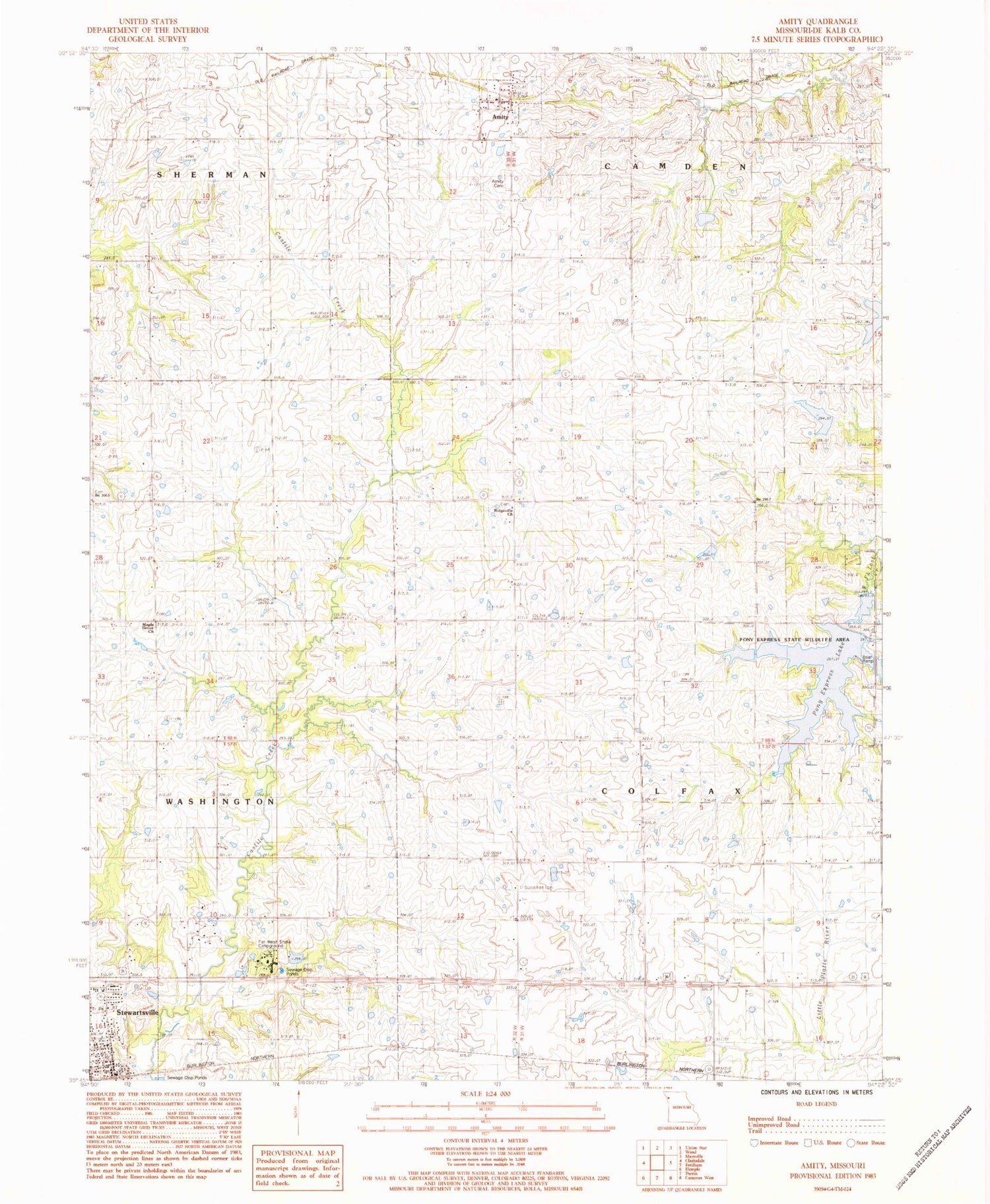
Historical USGS topographic quad map of Amity in the state of Missouri. Map scale may vary for some years, but is generally around 1:24,000. Print size is approximately 24" x 27"
This quadrangle is in the following counties: DeKalb.
The map contains contour lines, roads, rivers, towns, and lakes. Printed on high-quality waterproof paper with UV fade-resistant inks, and shipped rolled.
Contains the following named places: Amity, Amity Cemetery, B-20 Lake, B-21 Lake, B-22 Lake, Cayton Pony Express Airport, City of Stewartsville, Clover Hill School, Fairview School, Far West Stake Campground, Far West Stake RLDS Church Lake Dam, Frost School, Grindstone-Lost-Muddy Creek Watershed Dam B-20, Grindstone-Lost-Muddy Creek Watershed Dam B-21, Grindstone-Lost-Muddy Creek Watershed Dam B-22, Grindstone-Lost-Muddy Creek Watershed Dam B-4, Haan Lake Dam, Lone Oak School, Maple Grove Church, McCartney School, Oberg School, Pony Express Lake, Pony Express Lake Dam, Pony Express State Wildlife Area, Ridgeville Church, Smith School, Stewartsville, Stewartsville Post Office, Town of Amity, Township of Colfax, White Dove School, Willow Brook School, ZIP Code: 64474


