MyTopo
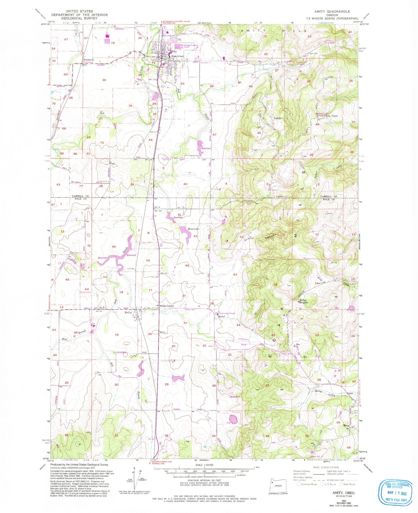
Classic USGS Amity Oregon 7.5'x7.5' Topo Map
Couldn't load pickup availability
Historical USGS topographic quad map of Amity in the state of Oregon. Typical map scale is 1:24,000, but may vary for certain years, if available. Print size: 24" x 27"
This quadrangle is in the following counties: Polk, Yamhill.
The map contains contour lines, roads, rivers, towns, and lakes. Printed on high-quality waterproof paper with UV fade-resistant inks, and shipped rolled.
Contains the following named places: Bethel Cemetery, Finns Corner, Amity Cemetery, Markee Reservoir, Martin Brothers Flashboard Reservoir, Bowles Reservoir, Solle Ponds, Rohde Dam, Marvin Fast Dam, Bethel, Bethel Heights, Yampo, Bethel Community Church, Athey Canyon, Feldman Reservoir, Rohde Reservoir, Robinson Reservoir, Larson Spring, Zimmerman Spring, Kraitz Reservoir, Four H Reservoir, Brydon Reservoir, Athey Creek, Anderson Reservoir, Amity, Ash Swale, Eola Crest, West Branch Ash Swale, Zena, Zena Cemetery, Mathew Spring, Stewart Reservoir, Crescent Hill, Wilson Reservoir, Maple Mound Reservoir, Vineyard Airport, Phil Olson Reservoir, Phil Olson Dam, Martin Brothers Flashboard Dam, Amity Post Office, Bethel Post Office (historical), Briedwell Post Office (historical), McCoy Post Office (historical), Zena Post Office (historical), Calvert (historical), Cottle (historical), Baxter (historical), Briedwell (historical), McCoy, Plum Valley, City of Amity, Amity Elementary School, Amity High School, Amity Middle School, Church of Christ, Amity Fire District, Red's Field, Amity Sewage Treatment Plant, Amity Water Treatment Plant, Amity City Hall, Amity City Public Library, Amity Municipal Courthouse, Amity Public Works, Amity Police Department