MyTopo
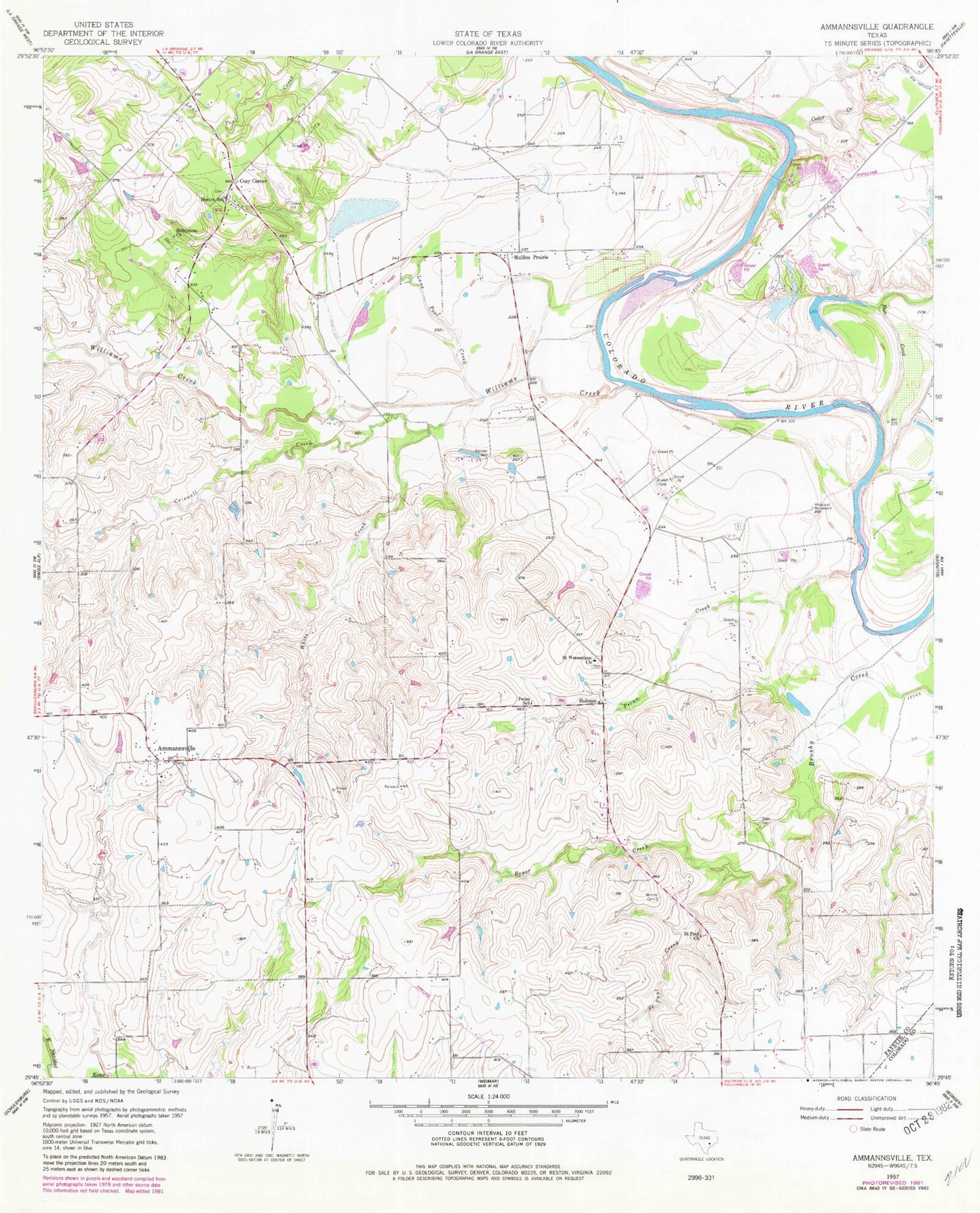
Classic USGS Ammannsville Texas 7.5'x7.5' Topo Map
Couldn't load pickup availability
Historical USGS topographic quad map of Ammannsville in the state of Texas. Map scale may vary for some years, but is generally around 1:24,000. Print size is approximately 24" x 27"
This quadrangle is in the following counties: Colorado, Fayette.
The map contains contour lines, roads, rivers, towns, and lakes. Printed on high-quality waterproof paper with UV fade-resistant inks, and shipped rolled.
Contains the following named places: Ammannsville, Baylor Creek, Bethlehem Church, Bittner Cemetery, Brandt Cemetery, Cedar Creek, Cozy Corner, Criswell Creek, Dallas West Branch Library, DeSoto Public Library, Farmers Branch Manske Public Library, Fretz Park Branch Library, Hampton - Illinois Branch Library, Highland Hills Branch Library, Highland Park Library, Holman, Hostyn School, Lakewood Branch Library, Lane Pool Creek, Mullins Prairie, Pecan Creek, Pecan School, Roper Creek, Ross Creek, Saint John the Baptist Catholic Church, Saint Paul Church, Saint Paul Creek, Saint Wenceslaus Church, Shaw Cemetery, White Creek, Williams Creek