MyTopo
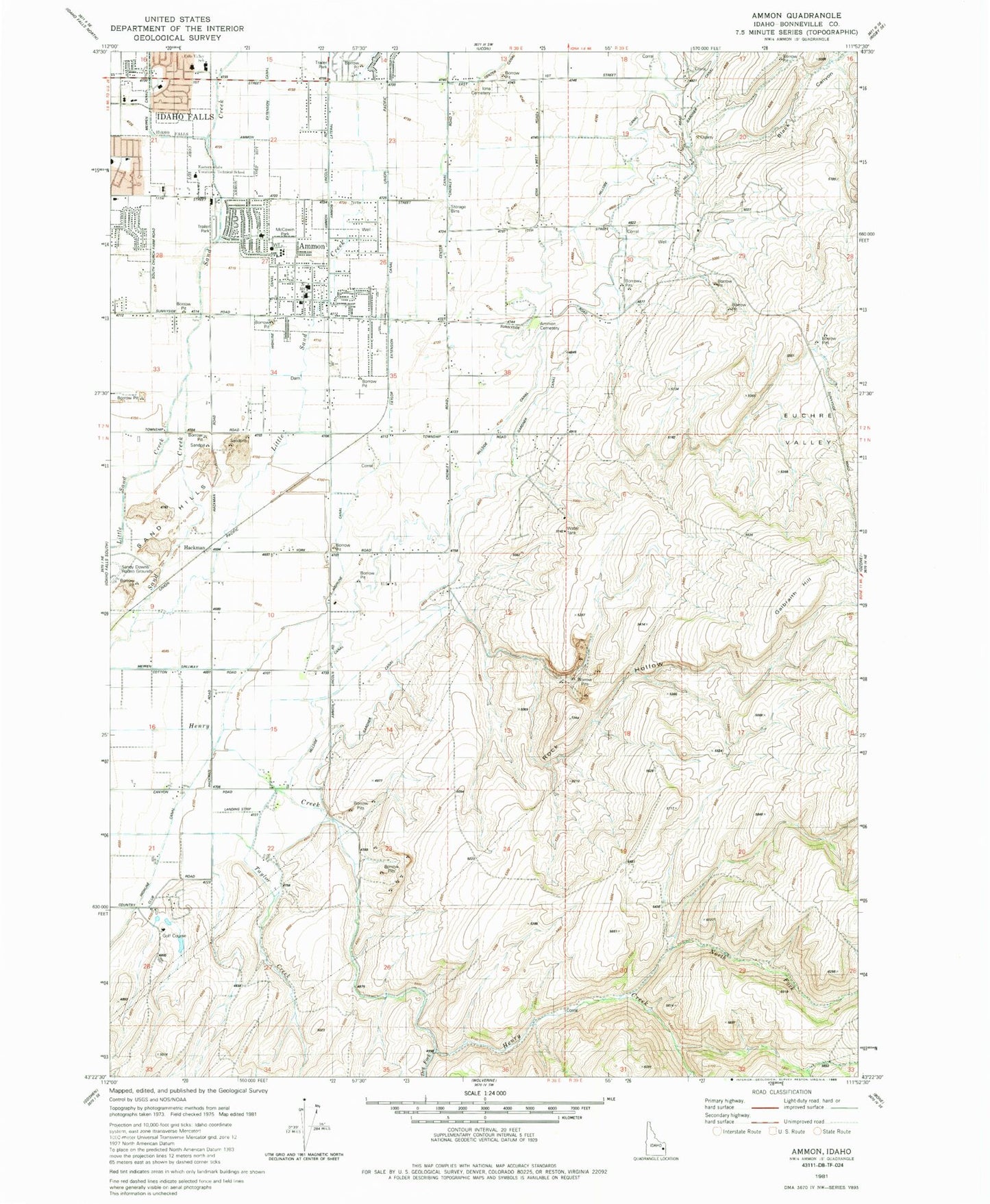
Classic USGS Ammon Idaho 7.5'x7.5' Topo Map
Couldn't load pickup availability
Historical USGS topographic quad map of Ammon in the state of Idaho. Map scale may vary for some years, but is generally around 1:24,000. Print size is approximately 24" x 27"
This quadrangle is in the following counties: Bonneville.
The map contains contour lines, roads, rivers, towns, and lakes. Printed on high-quality waterproof paper with UV fade-resistant inks, and shipped rolled.
Contains the following named places: Ammon, Ammon Cemetery, Ammon Extension Canal, Ammon Fire Department, Ammon Intermediate School, Black Canyon, Center Canal, City of Ammon, Dewey School, Dry Fork, E I Regional Medical Center Heliport, Eastern Idaho Regional Behavioral Health Center, Eastern Idaho Regional Medical Center, Eastern Idaho Vocational Technical School, Euchre Valley, Falls Valley Elementary School, Family Emergency Center, Galbraith Hill, Grand Teton Mall, Hackman, Henry Creek, Henry Creek School, Highline Canal, Hillcrest High School, Hillside Canal, Hillview Primary School, Hope Lutheran School, Idaho Falls Division, Iona Cemetery, McCowin Park, Meppen Spillway, Mountain View Hospital, North Fork Henry Creek, Pleasant View School, Rainbow Ranch Airport, Rock Hollow, Sandcreek Middle School, Snake River Plain, Taylor Creek, Taylor Extension Canal, Tiebreaker Elementary School, Western Rehabilitation Institute