MyTopo
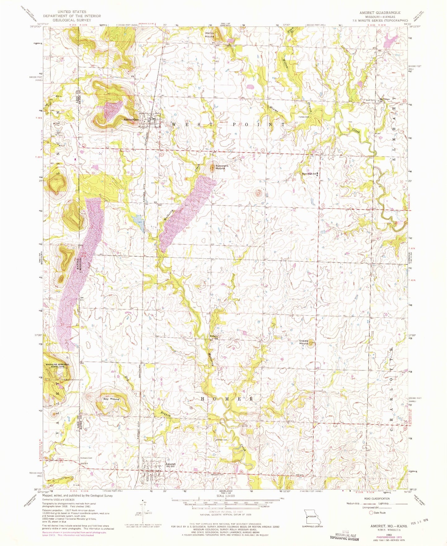
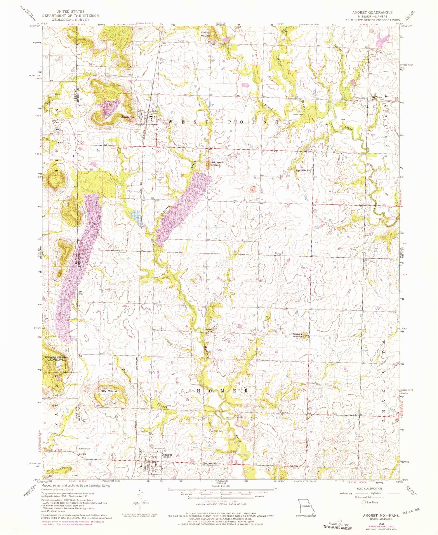
Classic USGS Amoret Missouri 7.5'x7.5' Topo Map
Couldn't load pickup availability
Historical USGS topographic quad map of Amoret in the states of Missouri, Kansas. Map scale may vary for some years, but is generally around 1:24,000. Print size is approximately 24" x 27"
This quadrangle is in the following counties: Bates, Linn.
The map contains contour lines, roads, rivers, towns, and lakes. Printed on high-quality waterproof paper with UV fade-resistant inks, and shipped rolled.
Contains the following named places: Amoret, Amoret Fire Department, Amoret Post Office, Amoret School, Amsterdam, Amsterdam Post Office, Amsterdam Volunteer Fire Department, Benjamin Cemetery, City of Amoret, City of Amsterdam, Forbes Cemetery, Forbes School, Graves Mound, Hog Branch, Hot Water School, Jackson Cemetery, KCS Bridge A-65 Dam, Marais des Cygnes Massacre State Historic Site, Massacre Memorial State Park, Miami Elementary School, Miami High School, Mount Vernon Church, Mulberry, Mulberry Church, Nelson Lake Dam, Plain View School, Plum Branch, Railroad Lake, Scott Cemetery, Spy Mound, State Line Cemetery, Summers Mound, Township of Homer, Township of West Point, Vinton, Walley Cemetery, Walley Mound, Ward Lake Section 7 Dam, Willow Branch, Willow Branch School, ZIP Codes: 64722, 64723