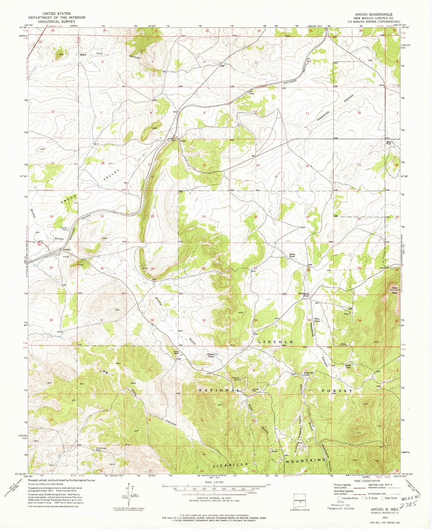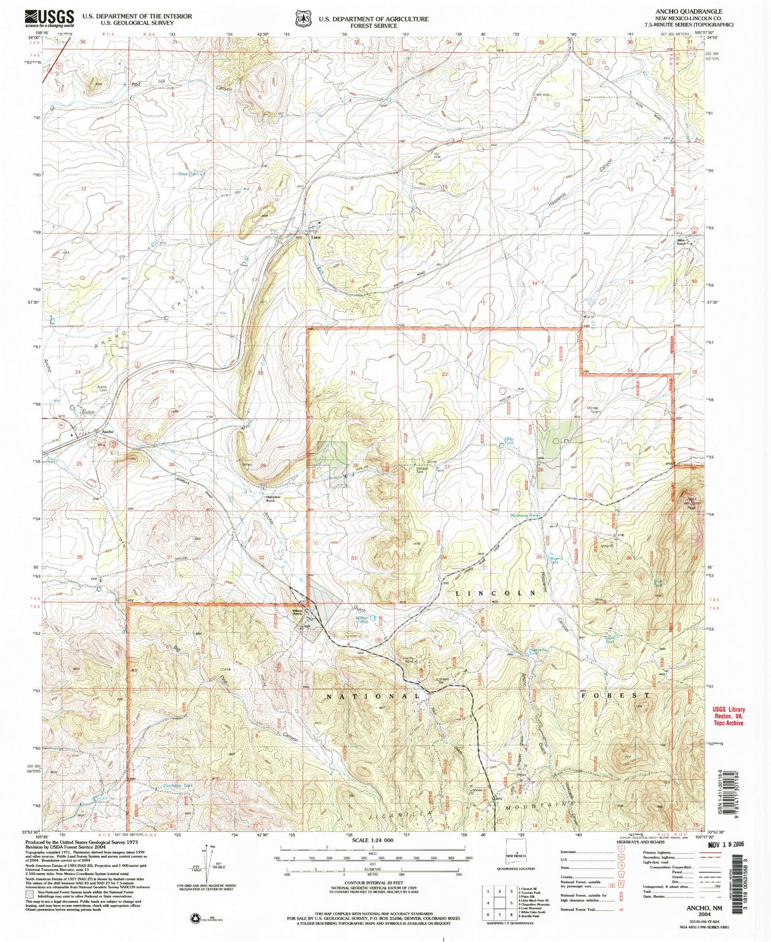
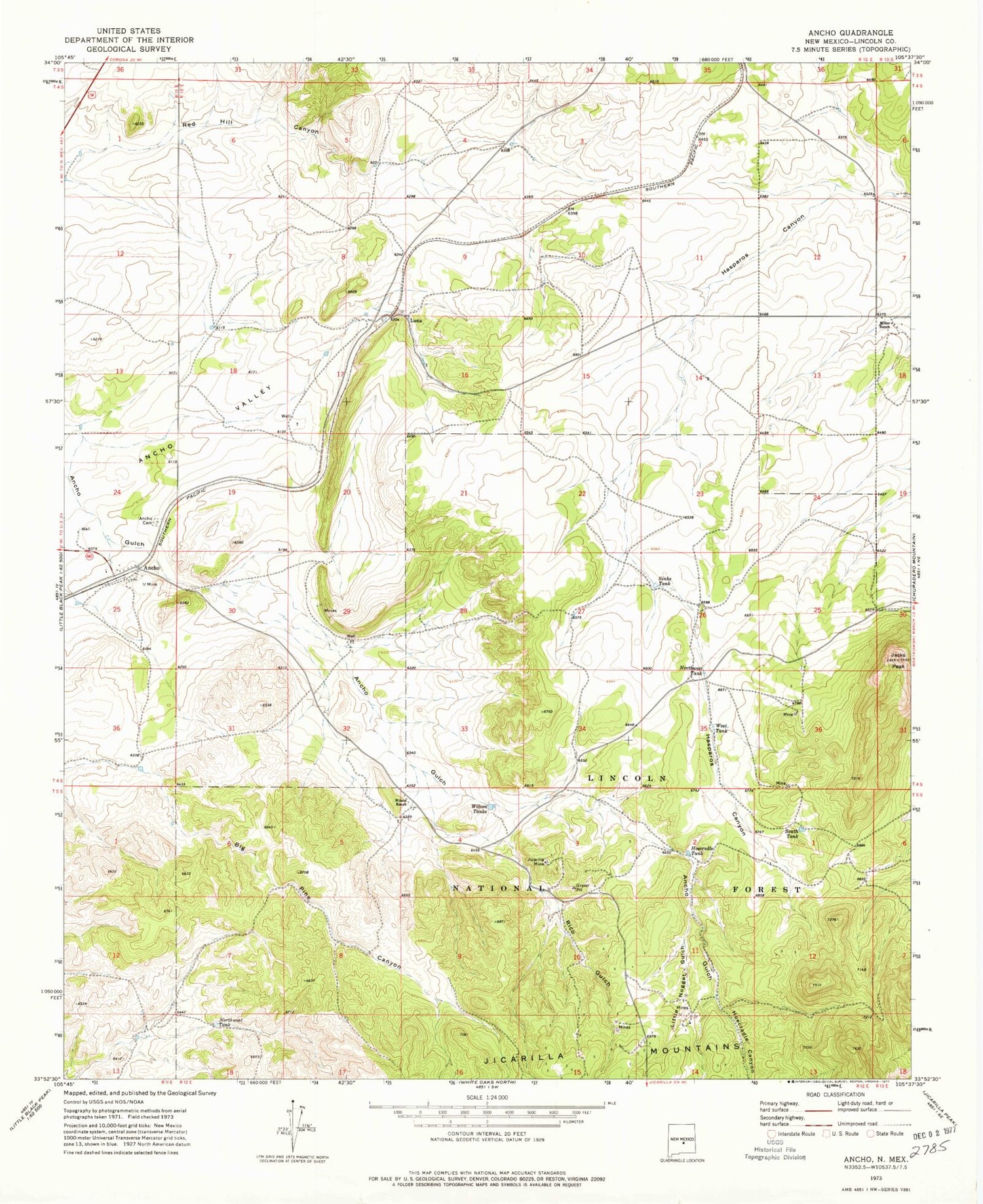
MyTopo
Classic USGS Ancho New Mexico 7.5'x7.5' Topo Map
Couldn't load pickup availability
Historical USGS topographic quad map of Ancho in the state of New Mexico. Typical map scale is 1:24,000, but may vary for certain years, if available. Print size: 24" x 27"
This quadrangle is in the following counties: Lincoln.
The map contains contour lines, roads, rivers, towns, and lakes. Printed on high-quality waterproof paper with UV fade-resistant inks, and shipped rolled.
Contains the following named places: Mountain Ministry Parish, Ancho, Ancho Cemetery, Hoecradle Canyon, Hoecradle Tank, Jacks Peak, Jicarilla Mine, Little Nugget Gulch, Luna, Miller Ranch, Northwest Tank, Northwest Tank, Rico Gulch, Sinks Tank, South Tank, West Tank, Wilson Ranch, Wilson Tanks, Lobner, Norma Grande, Jack Mine, Ancho Clay, Ancho Crusher Plant, Ancho Gypsum, Alpha Mine, Black Hat Group, Pittsburg Number One, Sierra Blanca Mill and Processing, Ancho Weather Station, Ancho Railroad Depot Historic Site, Ancho Post Office (historical), Alpha Mill Mine, Ancho Gulch, Hightower Ranch