MyTopo
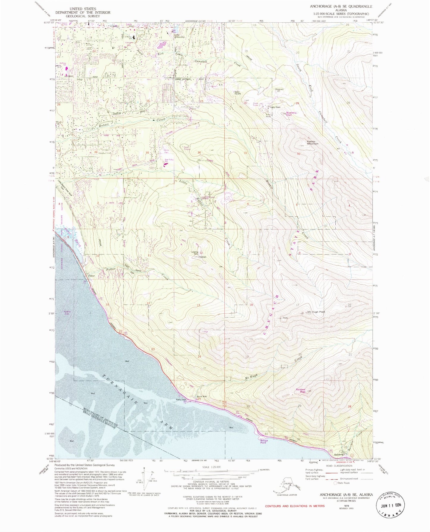
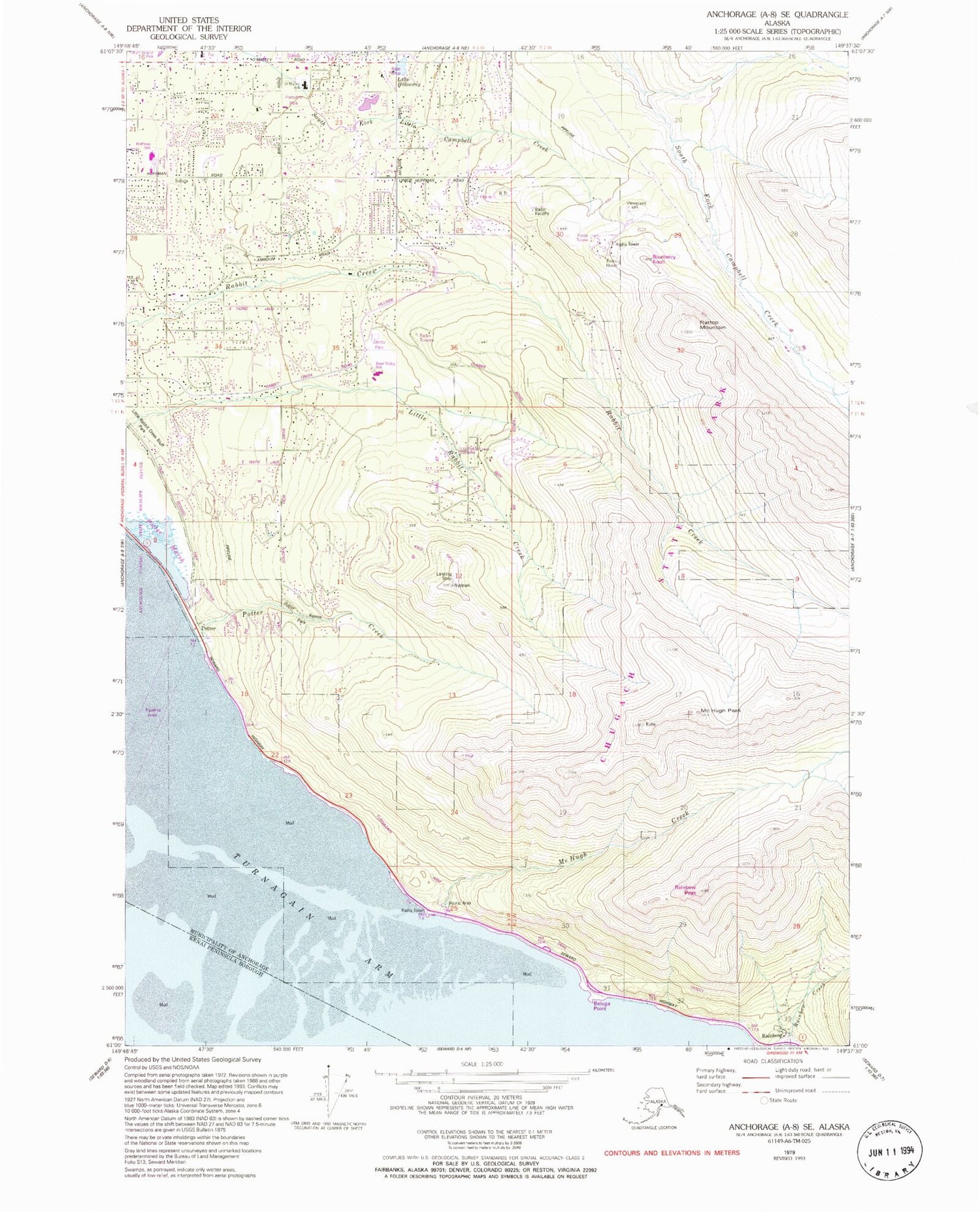
Classic USGS Anchorage A-8 SE Alaska 7.5'x7.5' Topo Map
Couldn't load pickup availability
Historical USGS topographic quad map of Anchorage A-8 SE in the state of Alaska. Typical map scale is 1:24,000, but may vary for certain years, if available. Print size: 24" x 27"
This quadrangle is in the following counties: Anchorage, Kenai Peninsula.
The map contains contour lines, roads, rivers, towns, and lakes. Printed on high-quality waterproof paper with UV fade-resistant inks, and shipped rolled.
Contains the following named places: Flattop Mountain, Lake Hideaway, McHugh Creek, McHugh Peak, Potter, Potter Creek, Rainbow, Potter Marsh, Little Survival Creek, Little Rabbit Creek Bluff Park, Potter Ravine Park, Lake 'O' the Hills Dam, Lake 'O' the Hills, KATB-FM (Anchorage), Patricks Beach (not official), Knik Heights, Forsythe Park, Storck Park, Little Rabbit Creek Greenbelt, Blueberry Knoll, Beluga Point, Rainbow Peak, Anchorage Fire Department Station 8, Anchorage Fire Department Station 10, Middle Fork Campbell Creek