
MyTopo
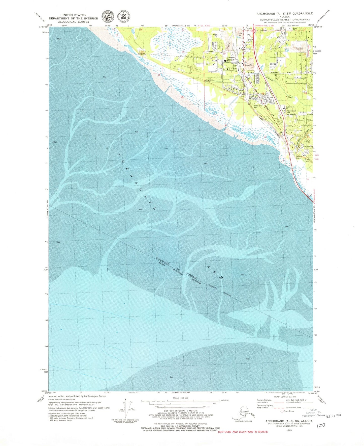
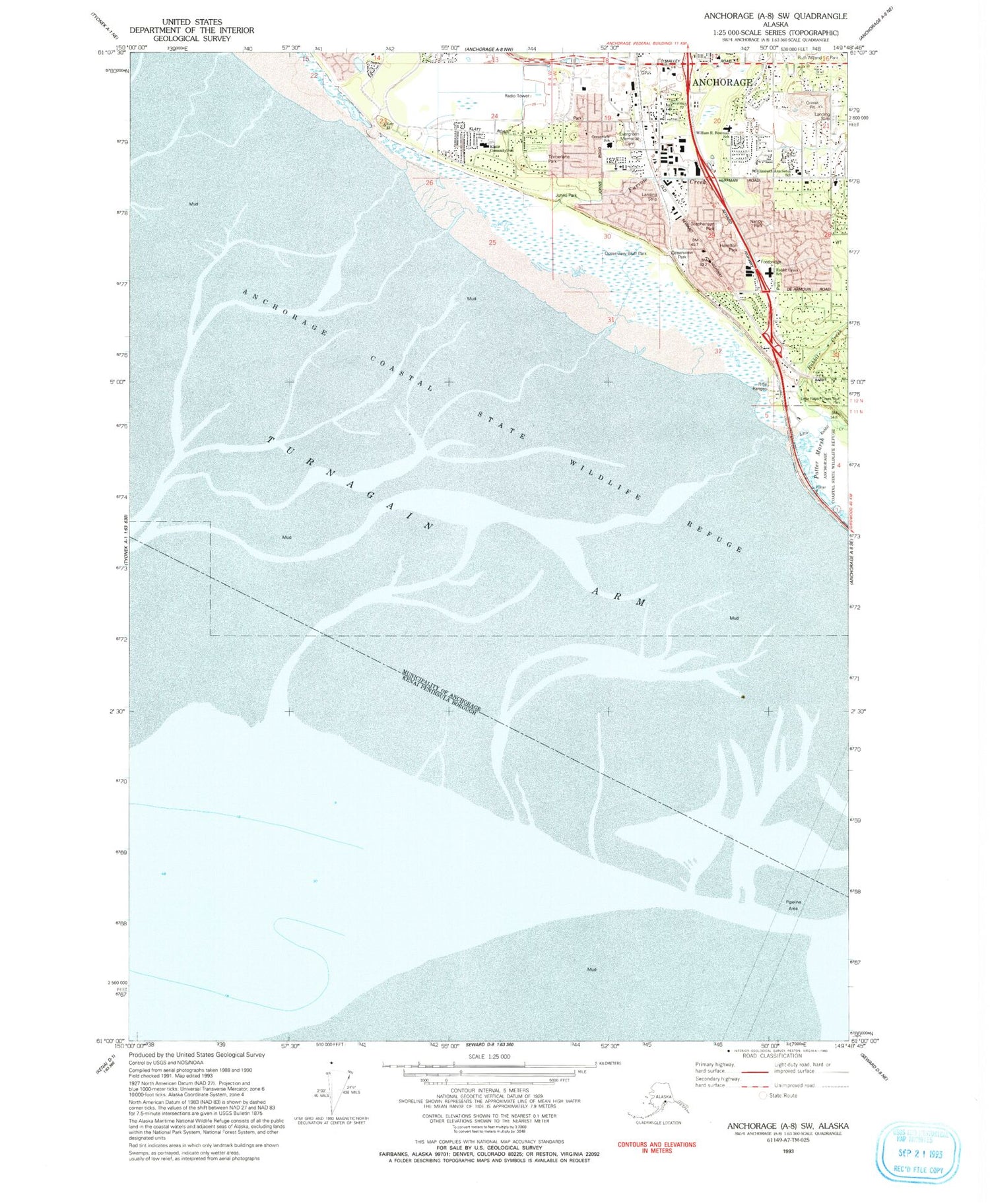
Classic USGS Anchorage A-8 SW Alaska 7.5'x7.5' Topo Map
Couldn't load pickup availability
Historical USGS topographic quad map of Anchorage A-8 SW in the state of Alaska. Map scale may vary for some years, but is generally around 1:24,000. Print size is approximately 24" x 27"
This quadrangle is in the following counties: Anchorage, Kenai Peninsula.
The map contains contour lines, roads, rivers, towns, and lakes. Printed on high-quality waterproof paper with UV fade-resistant inks, and shipped rolled.
Contains the following named places: Anchorage Coastal State Wildlife Refuge, Anchorage Fire Department Station 15, Anchorage Fire Department Station 9, Angelus Memorial Park, Evergreen Memorial Cemetery, First Care Medical Center Southside, Flying Crown Airport, Furrow Creek, Hamilton Park, Huffman Post Office, Johns Park, KFQD-AM (Anchorage), KKLV-FM (Anchorage), KKSD-AM (Anchorage), Little Rabbit Creek, Nancy Park, Ocean View Elementary School, Oceanview Bluff Park, Oceanview Park, Potter Hill, Rabbit Creek, Rabbit Creek Airport, Rabbit Creek Elementary School, Rabbit Creek Park, Sky Harbor Airport, Stephenson Park, Timberlane Park, Turnagain Childrens Home, ZIP Code: 99515