MyTopo
Classic USGS Anchorage B-7 SW Alaska 7.5'x7.5' Topo Map
Couldn't load pickup availability
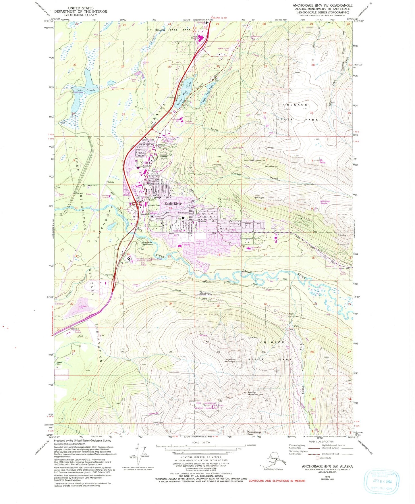
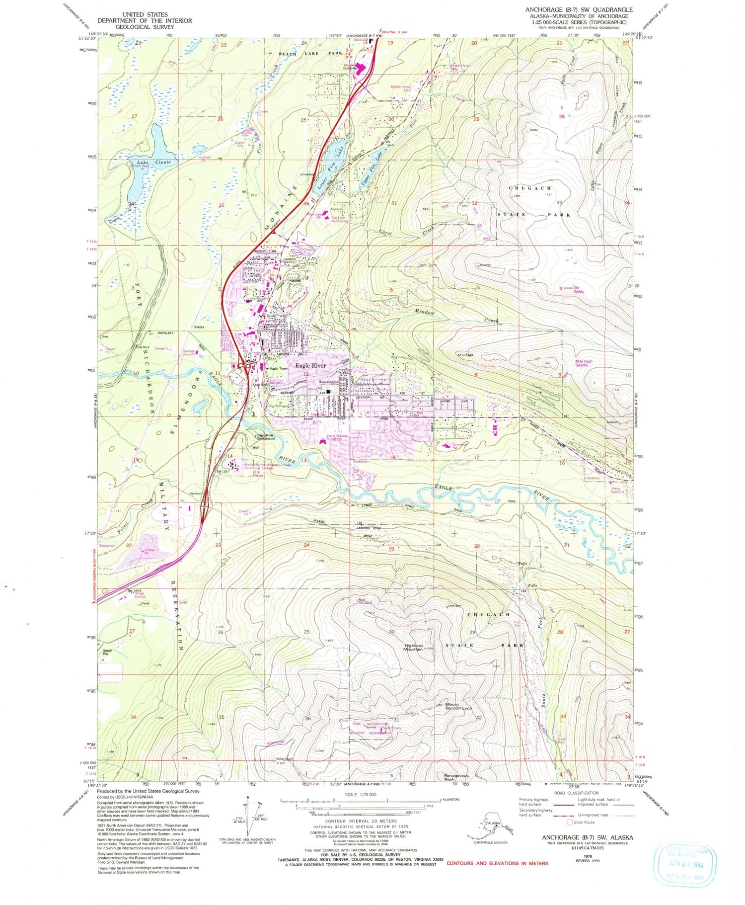
Historical USGS topographic quad map of Anchorage B-7 SW in the state of Alaska. Typical map scale is 1:24,000, but may vary for certain years, if available. Print size: 24" x 27"
This quadrangle is in the following counties: Anchorage.
The map contains contour lines, roads, rivers, towns, and lakes. Printed on high-quality waterproof paper with UV fade-resistant inks, and shipped rolled.
Contains the following named places: Lake Clunie, Eagle River, Highland Mountain, Lower Fire Lake, Meadow Creek, Rendezvous Peak, South Fork Eagle River, Upper Fire Lake, Ice Palace Raceway, Eagle River Campground, Homestead Elementary School, Carol Creek, Chugiak High School, Alaska Railroad Power Reserve, Beach Lake Park, KWHL-FM (Anchorage), KPXR-FM (Anchorage), KASH-FM (Anchorage), KGOT-FM (Anchorage), KYES-TV (Anchorage), Mount Gordon Lyon, D&C Fire Lake Flying Club Seaplane Base, Anchorage Fire Department Station 11, South Fork Volunteer Fire Department, South Fork Volunteer Fire Department, Chugiak Volunteer Fire and Rescue Company Station 31, Chugiak Volunteer Fire Department Station 35, Highland Airport, Providence Eagle River Medical Office, Eagle River Post Office, Anchorage Police Department Eagle River Subdivision, Hiland Mountain Correctional Center