MyTopo
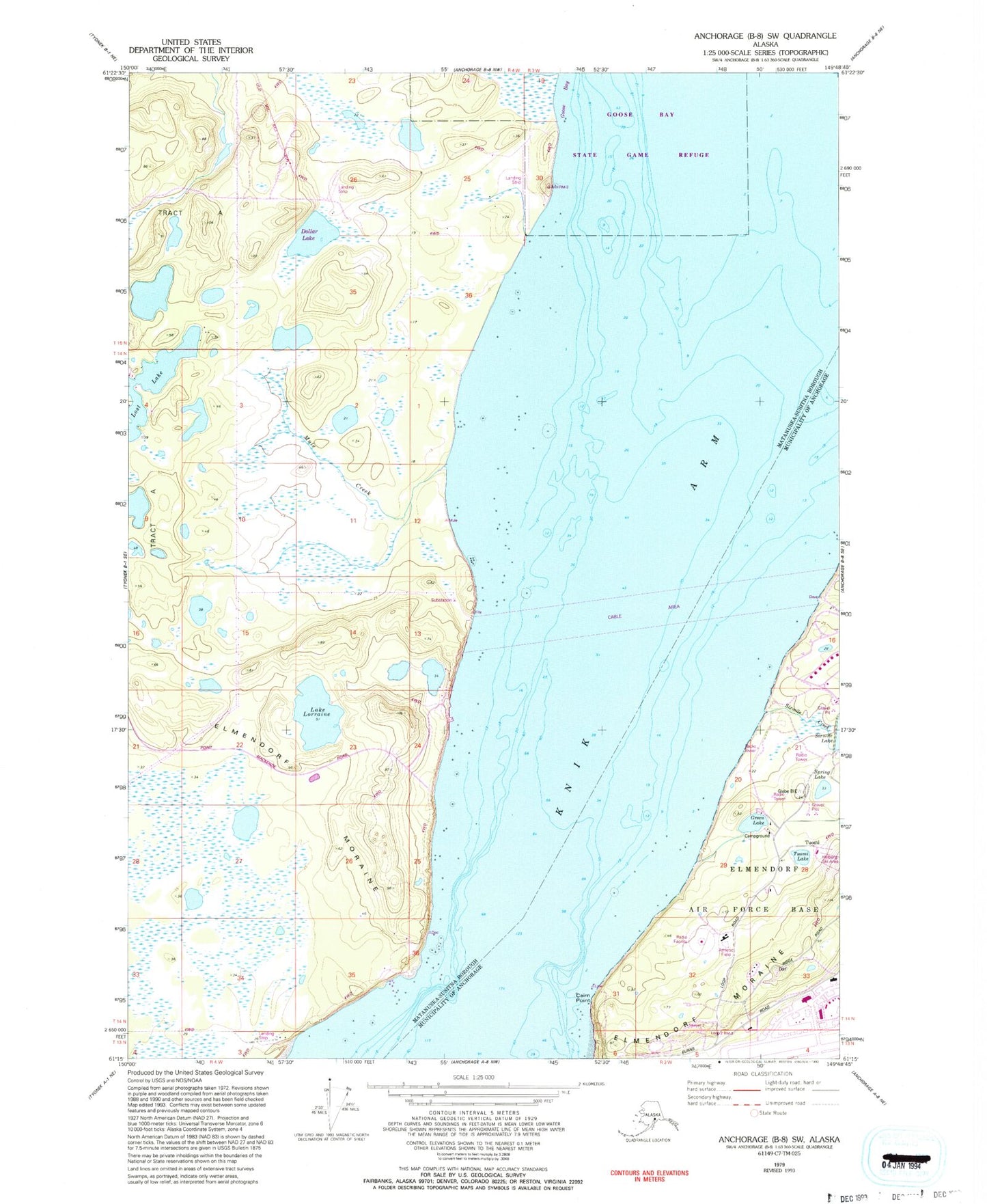
Classic USGS Anchorage B-8 SW Alaska 7.5'x7.5' Topo Map
Couldn't load pickup availability
Historical USGS topographic quad map of Anchorage B-8 SW in the state of Alaska. Map scale may vary for some years, but is generally around 1:24,000. Print size is approximately 24" x 27"
This quadrangle is in the following counties: Anchorage, Matanuska-Susitna.
The map contains contour lines, roads, rivers, towns, and lakes. Printed on high-quality waterproof paper with UV fade-resistant inks, and shipped rolled.
Contains the following named places: Cairn Point, Elmendorf Moraine, Green Lake, Gregory Lake Dam, Joint Base Elmendorf - Richardson Fire Station 6, Lake Lorraine, Lost Lake, MacKenzie Country Airpark, Mule Creek, Nitak, Point MacKenzie, Port MacKenzie, Sixmile Creek, Sleepers Strip, Spring Lake, Tuomi, Tuomi Lake