MyTopo
Classic USGS Anderson Butte Idaho 7.5'x7.5' Topo Map
Couldn't load pickup availability
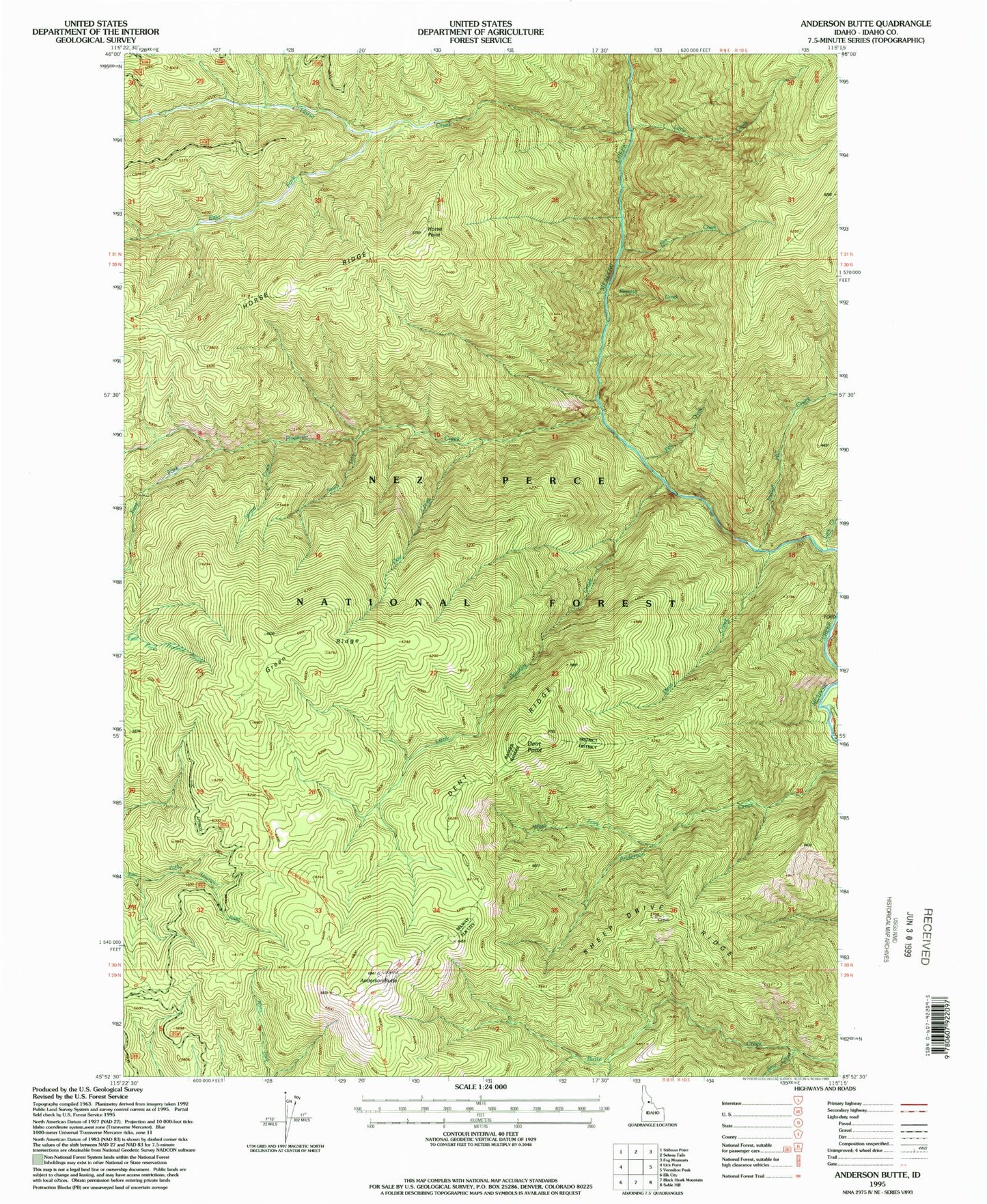
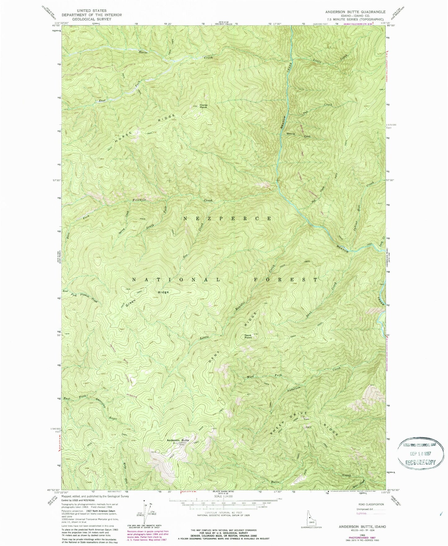
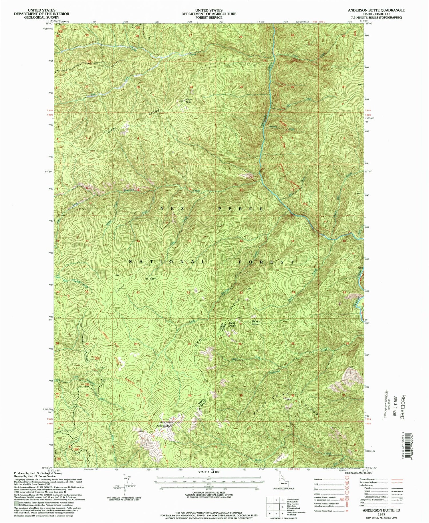
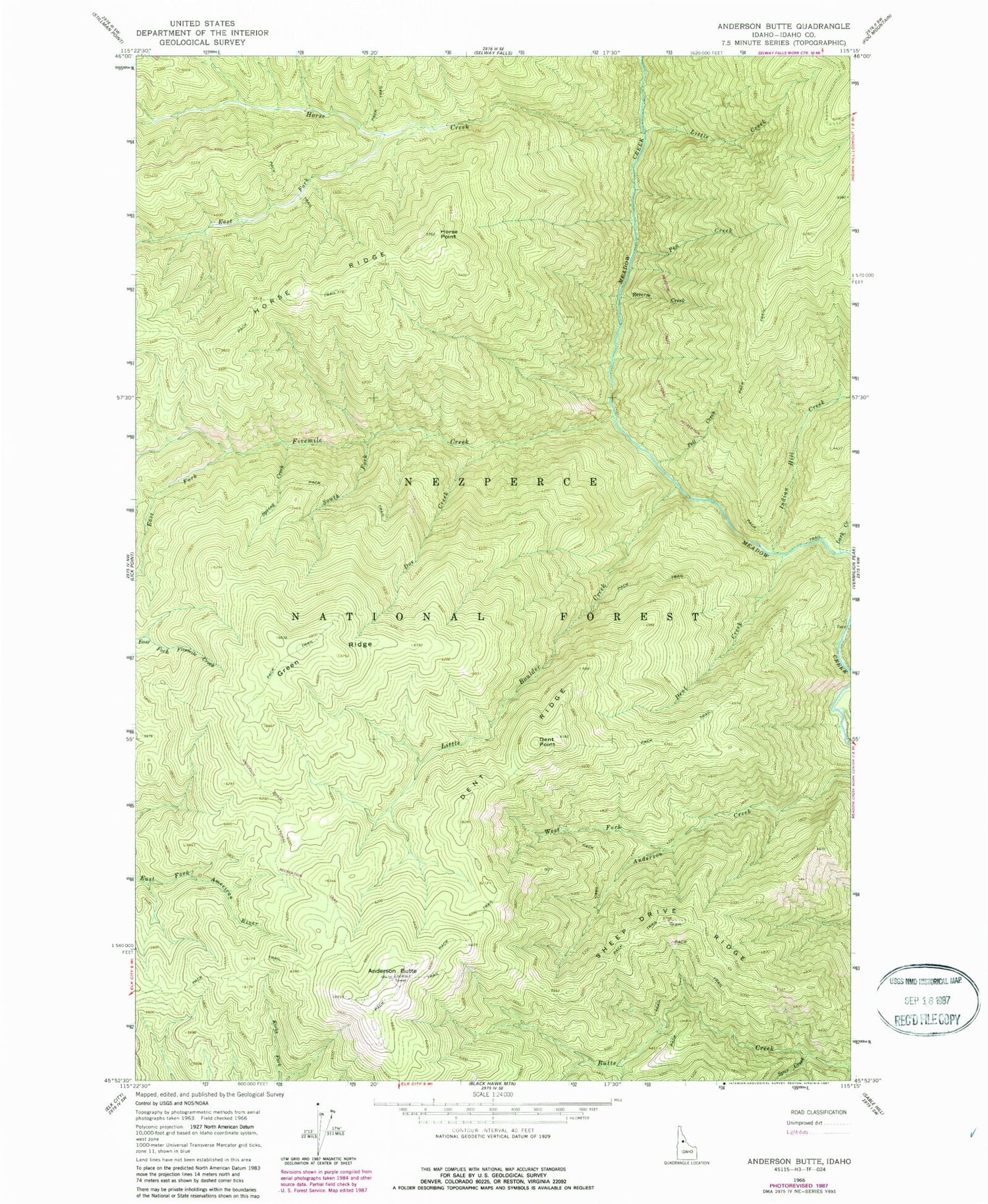
Historical USGS topographic quad map of Anderson Butte in the state of Idaho. Map scale may vary for some years, but is generally around 1:24,000. Print size is approximately 24" x 27"
This quadrangle is in the following counties: Idaho.
The map contains contour lines, roads, rivers, towns, and lakes. Printed on high-quality waterproof paper with UV fade-resistant inks, and shipped rolled.
Contains the following named places: Anderson Butte, Anderson Butte National Recreation Trail, Buck Lake Creek, Dent Creek, Dent Point, Dent Ridge, Doe Creek, East Fork Fivemile Creek, East Fork Horse Creek, Fivemile Creek, Green Ridge, Horse Creek, Horse Point, Indian Hill Creek, Lark Creek, Little Boulder Creek, Little Creek, Meadow Creek National Recreation Trail, Pea Creek, Pell Creek, Reverse Creek, Sheep Drive Ridge, South Fork Fivemile Creek, Spring Creek, Spur Creek, West Fork Anderson Creek