
MyTopo
Classic USGS Anderson Canyon Arizona 7.5'x7.5' Topo Map
Regular price
$16.95
Regular price
Sale price
$16.95
Unit price
per
Couldn't load pickup availability
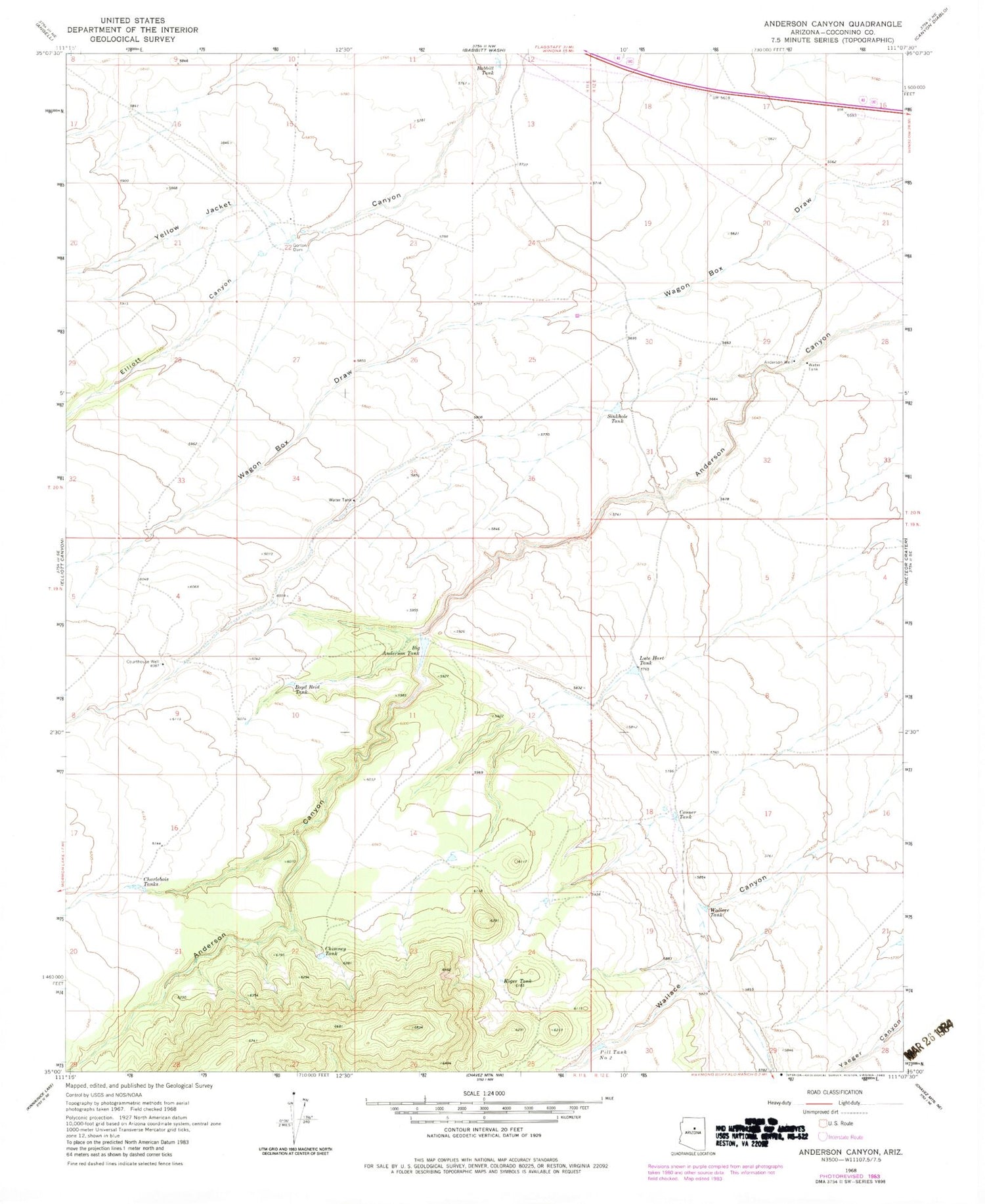
Historical USGS topographic quad map of Anderson Canyon in the state of Arizona. Map scale may vary for some years, but is generally around 1:24,000. Print size is approximately 24" x 27"
This quadrangle is in the following counties: Coconino.
The map contains contour lines, roads, rivers, towns, and lakes. Printed on high-quality waterproof paper with UV fade-resistant inks, and shipped rolled.
Contains the following named places: Anderson Well, Babbit Tank, Big Anderson Tank, Boyd Reid Tank, Casner Tank, Charlebois Tanks, Chimney Tank, Courthouse Well, Elliott Canyon, Golden Dam Tank, Gorton Dam, Koger Tank, KTDX-FM (Winslow), Lute Hart Tank, Pill Two Tank, Sinkhole Tank, Wallace Tank


