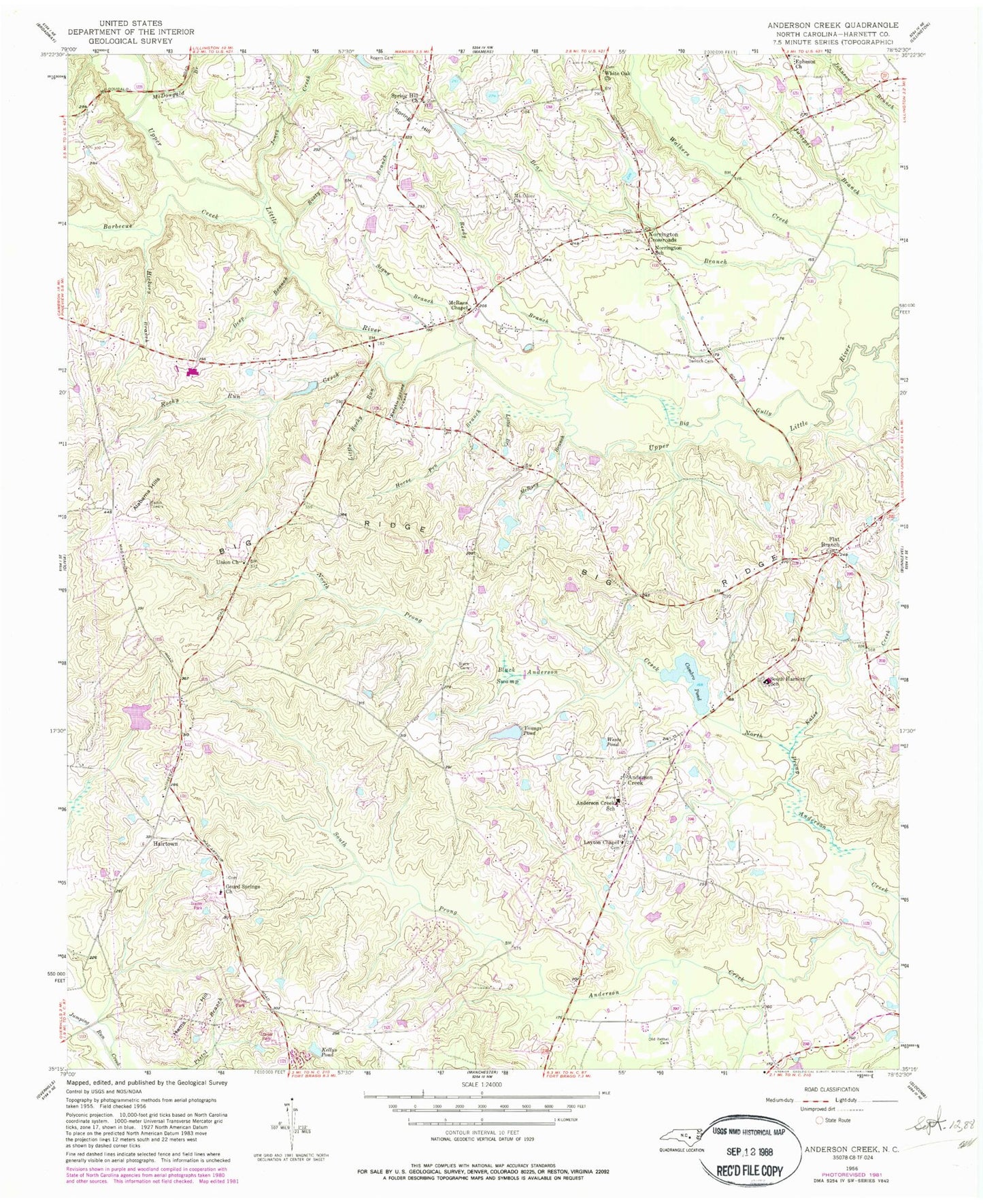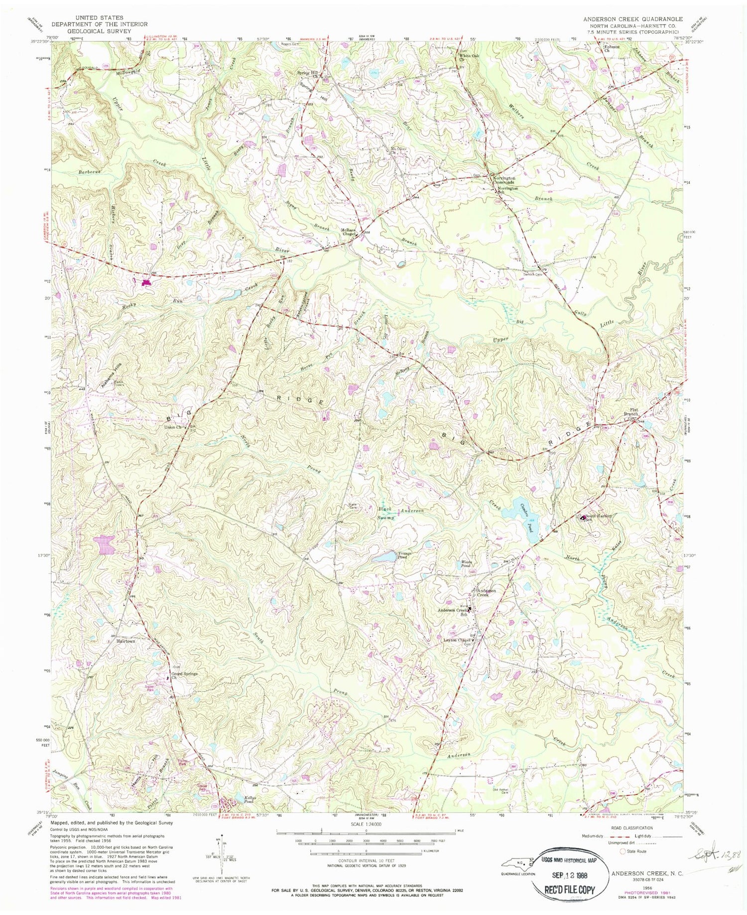
MyTopo
Classic USGS Anderson Creek North Carolina 7.5'x7.5' Topo Map
Couldn't load pickup availability
Historical USGS topographic quad map of Anderson Creek in the state of North Carolina. Typical map scale is 1:24,000, but may vary for certain years, if available. Print size: 24" x 27"
This quadrangle is in the following counties: Harnett.
The map contains contour lines, roads, rivers, towns, and lakes. Printed on high-quality waterproof paper with UV fade-resistant inks, and shipped rolled.
Contains the following named places: Anderson Creek School, Barbecue Creek, Bear Branch, Big Gully, Big Ridge, Black Cemetery, Black Swamp, Cambro Pond, Darroch Cemetery, Deep Branch, Flat Branch, Gourd Springs Church, Hairtown, Hickory Branch, Horse Pen Branch, Jones Creek, Kellys Pond, Knights Spring Branch, Layton Chapel, Little Branch, Little Rocky Run, McDougald Branch, McRaes Chapel, McRany Branch, Mount Olive Church, Norrington Crossroads, Norrington School, North Prong Anderson Creek, Old Bethel Cemetery, Reedy Branch, Rice Patch Branch, Rocky Run Creek, Rooty Branch, South Harnett School, South Prong Anderson Creek, South Prong McLeod Creek, Spring Hill Church, Stony Branch, Union Church, Walkers Creek, Wests Pond, White Oak Church, Youngs Pond, Bakers Pond, Smith Lake Dam, Cambro Pond Dam, Western Harnett High School, Alabama Hills, Anderson Creek, Hams Hill, Spring Hill, Township of Anderson Creek, Flat Branch Volunteer Fire Department, Anderson Creek Emergency Services, Harnett County Emergency Medical Service Quick Response Vehicle - Flatbranch Station, Anderson Creek Census Designated Place