MyTopo
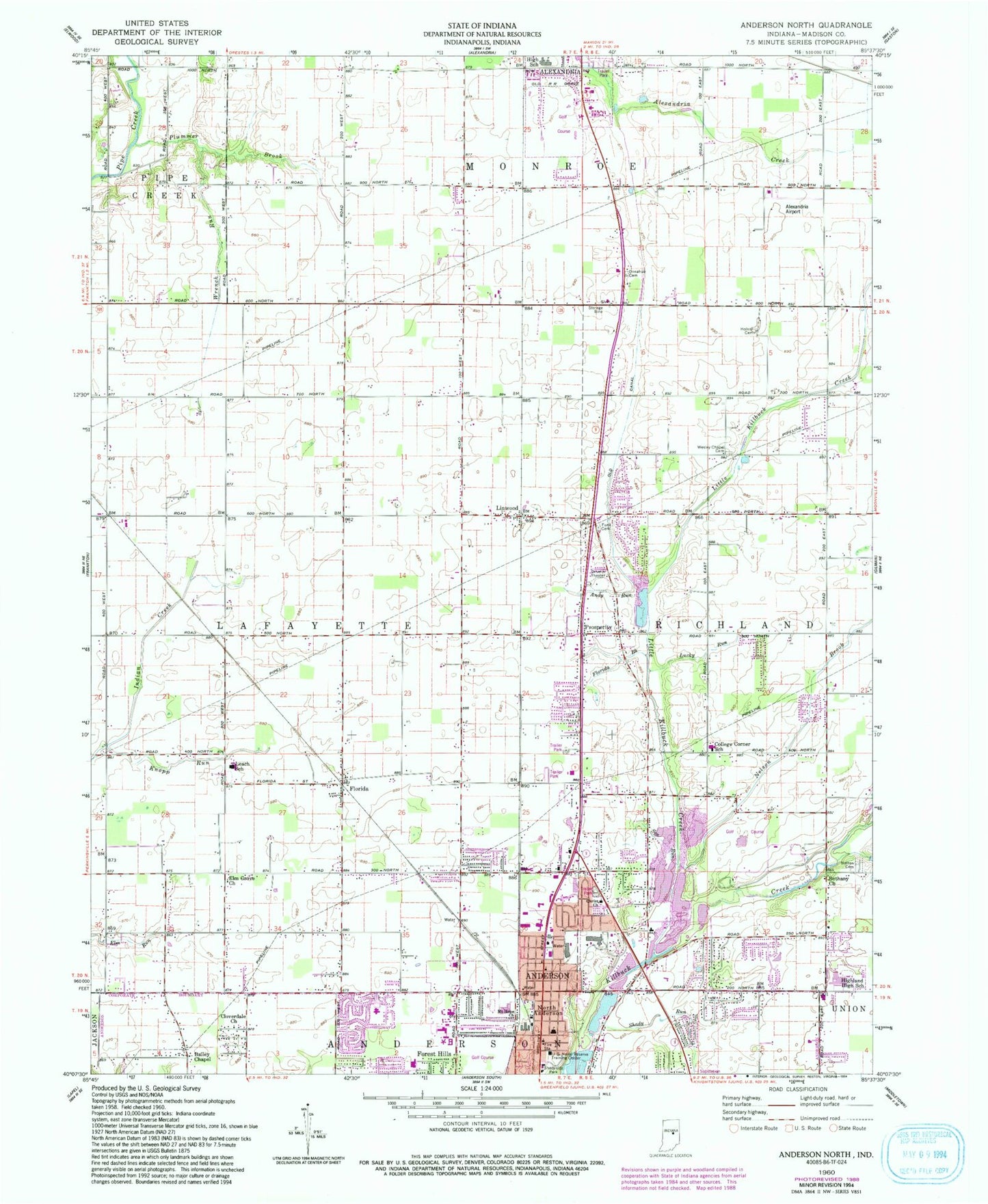
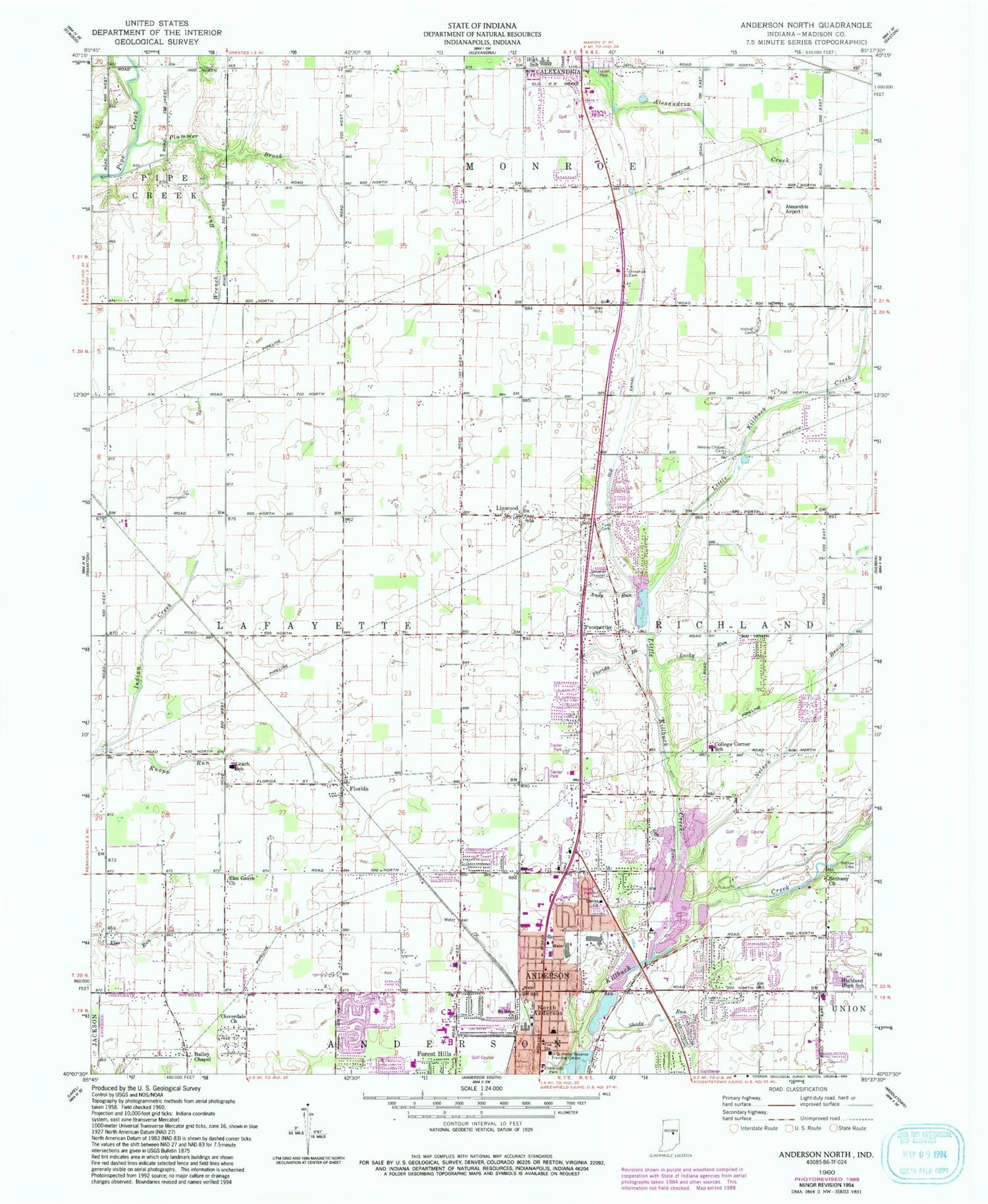
Classic USGS Anderson North Indiana 7.5'x7.5' Topo Map
Couldn't load pickup availability
Historical USGS topographic quad map of Anderson North in the state of Indiana. Map scale may vary for some years, but is generally around 1:24,000. Print size is approximately 24" x 27"
This quadrangle is in the following counties: Madison.
The map contains contour lines, roads, rivers, towns, and lakes. Printed on high-quality waterproof paper with UV fade-resistant inks, and shipped rolled.
Contains the following named places: Alexandria Airport, Alexandria-Monroe High School, Anderson Fire Department Station 4, Andy Run, Bailey Chapel, Bethany Church, Christ Church, Cloverdale Church, College Corner Elementary School, Community Hospital Airport, Community Hospital Anderson, Donahoo Cemetery, Elm Grove Church, Florida, Florida Brook, Frankton Volunteer Fire Department Station 2, H and R Skylane Airport, Hiawatha School, Highland High School, Holson Cemetery, Indian Creek, Knopp Run, Leach Elementary and Junior High School, Linwood, Little Killbuck Creek, Lucky Run, Madison County, Mount Hope Church, Nelson Brook, Nelson Cemetery, North Anderson, North Anderson Elementary School, Old Canal, Plummer Brook, Prosperity, Richland Township Volunteer Fire Department, Shady Run, Shadyside Park, Shuter Sunset Farms, Smith Cemetery, Township of Lafayette, WAXT-FM (Alexandria), Wesley Chapel Cemetery, Wrench Run