
MyTopo
Classic USGS Anderson Ridge Wyoming 7.5'x7.5' Topo Map
Regular price
$16.95
Regular price
Sale price
$16.95
Unit price
per
Couldn't load pickup availability
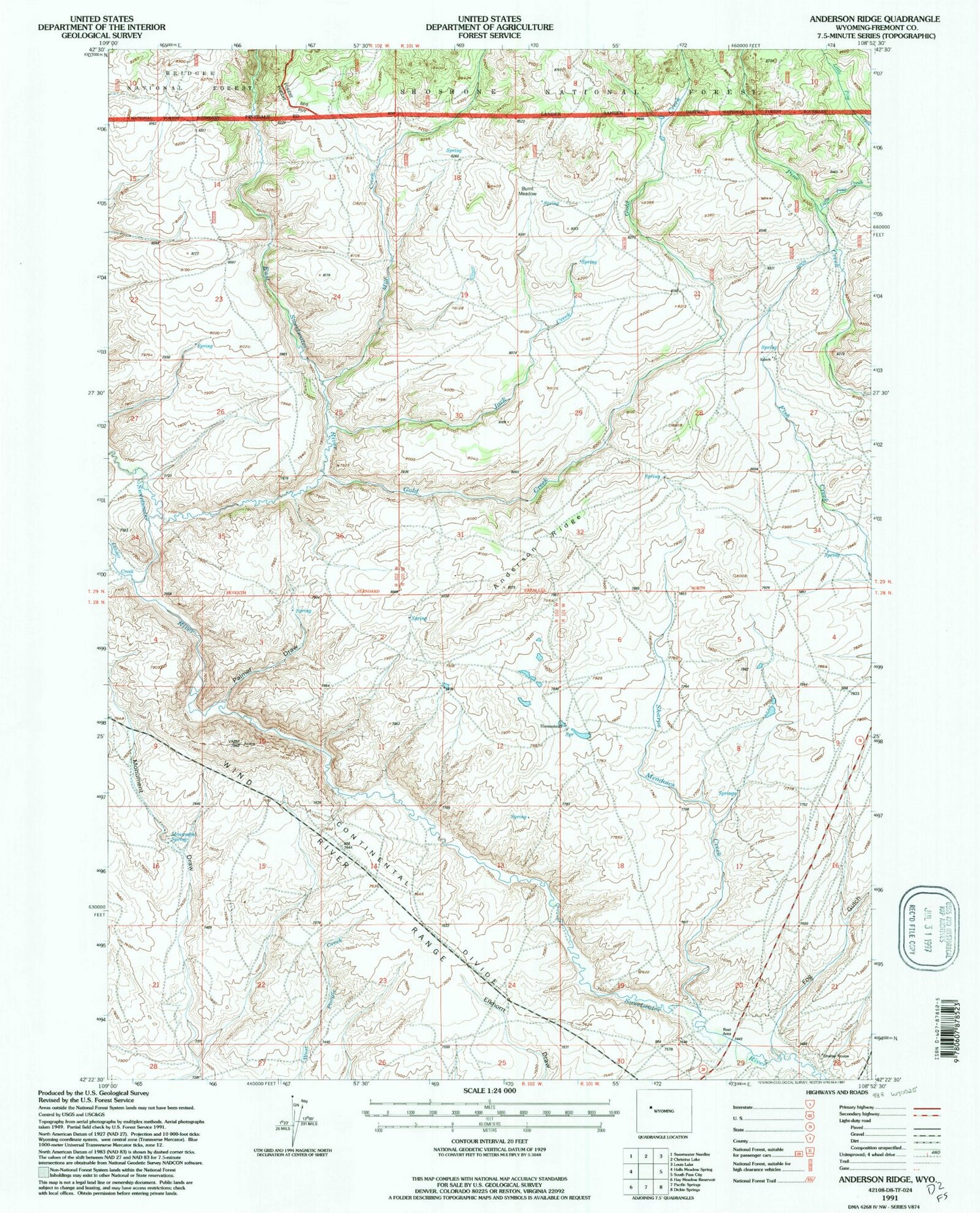
Historical USGS topographic quad map of Anderson Ridge in the state of Wyoming. Map scale may vary for some years, but is generally around 1:24,000. Print size is approximately 24" x 27"
This quadrangle is in the following counties: Fremont.
The map contains contour lines, roads, rivers, towns, and lakes. Printed on high-quality waterproof paper with UV fade-resistant inks, and shipped rolled.
Contains the following named places: Anderson Homestead, Anderson Ridge, Burnt Meadow, East Sweetwater River, Fog Gulch, Gold Creek, Jack Creek, Jack Ranch, Lander Creek, Little Pine Creek, Mill Creek, Monument Spring, Palmer Draw, Rinker Ditch, Sharps Meadows Creek, Shelter House


