
MyTopo
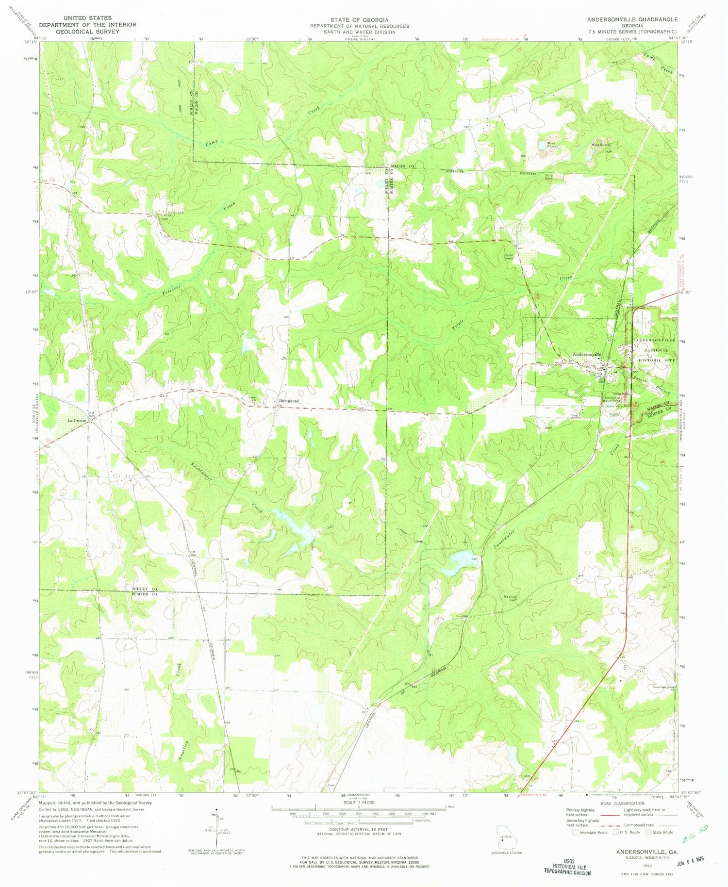
Classic USGS Andersonville Georgia 7.5'x7.5' Topo Map
Couldn't load pickup availability
Historical USGS topographic quad map of Andersonville in the state of Georgia. Map scale may vary for some years, but is generally around 1:24,000. Print size is approximately 24" x 27"
This quadrangle is in the following counties: Macon, Schley, Sumter.
The map contains contour lines, roads, rivers, towns, and lakes. Printed on high-quality waterproof paper with UV fade-resistant inks, and shipped rolled.
Contains the following named places: Andersonville, Andersonville Cemetery, Andersonville National Cemetery, Andersonville National Historic Site, Andersonville Post Office, Bumphead, Charles Reeves Lake, Charles Reeves Lake Dam, City of Andersonville, County Line Church, Esperanza Farms Lake Dam, Esperanza Lake, Grace Church, Hodges Mill, John James Lake, John James Lake Dam, La Crosse, Mount Olive Cemetery, Sumter County Fire Department Station 2, Sweetwater Mineral Springs, Tharpe Lake, Toteover Creek, Ttharpe Lake Dam, Union Oak Grove Church, Wohlwender Lake, Wohlwender Lake Dam, ZIP Code: 31711


