MyTopo
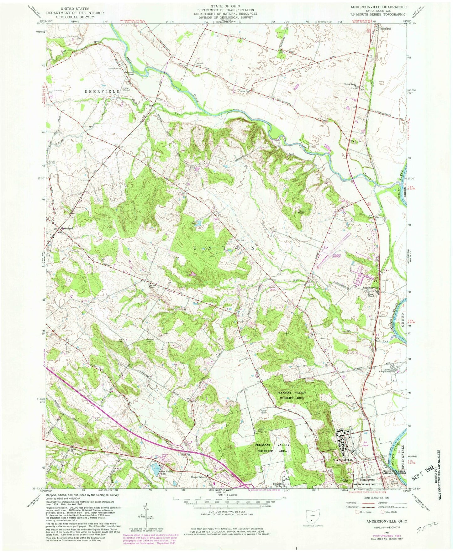
Classic USGS Andersonville Ohio 7.5'x7.5' Topo Map
Couldn't load pickup availability
Historical USGS topographic quad map of Andersonville in the state of Ohio. Map scale may vary for some years, but is generally around 1:24,000. Print size is approximately 24" x 27"
This quadrangle is in the following counties: Ross.
The map contains contour lines, roads, rivers, towns, and lakes. Printed on high-quality waterproof paper with UV fade-resistant inks, and shipped rolled.
Contains the following named places: Albright School, Andersonville, Andersonville Census Designated Place, Andersonville Post Office, Bowdle Cemetery, Bowill School, Briggs School, Browns Chapel, Browns Chapel Cemetery, Brownstown, Carey, Chillicothe Veterans Affairs Medical Center, Deer Creek, Draper Cemetery, Dry Run, Dry Run Chapel, Dry Run School, Dunlap School, Forest Hill School, Greenland, Greenland Post Office, Hay Run, Mad Run, Metzger School, Minear Cemetery, Mona School, Noble Cemetery, Pleasant Valley Church, Pleasant Valley School, Pleasant Valley Wildlife Area, Ross County Airport, Rouse School, Rustic Acres Lake, Rustic Acres Lake Dam, Shiloh Church, Shiloh School, Spring Bank Church, Springbank Cemetery, Springbank School, Stall Run, Sun Valley Lake, Sun Valley Lake Dam, Tootle School, Township of Union, Triplett Farm, Union Cemetery, Union Chapel, Union Chapel Cemetery, Union Township Fire Department Station 2, Union Township Fire Department Station 3, View, View Post Office, Waugh Run