
MyTopo
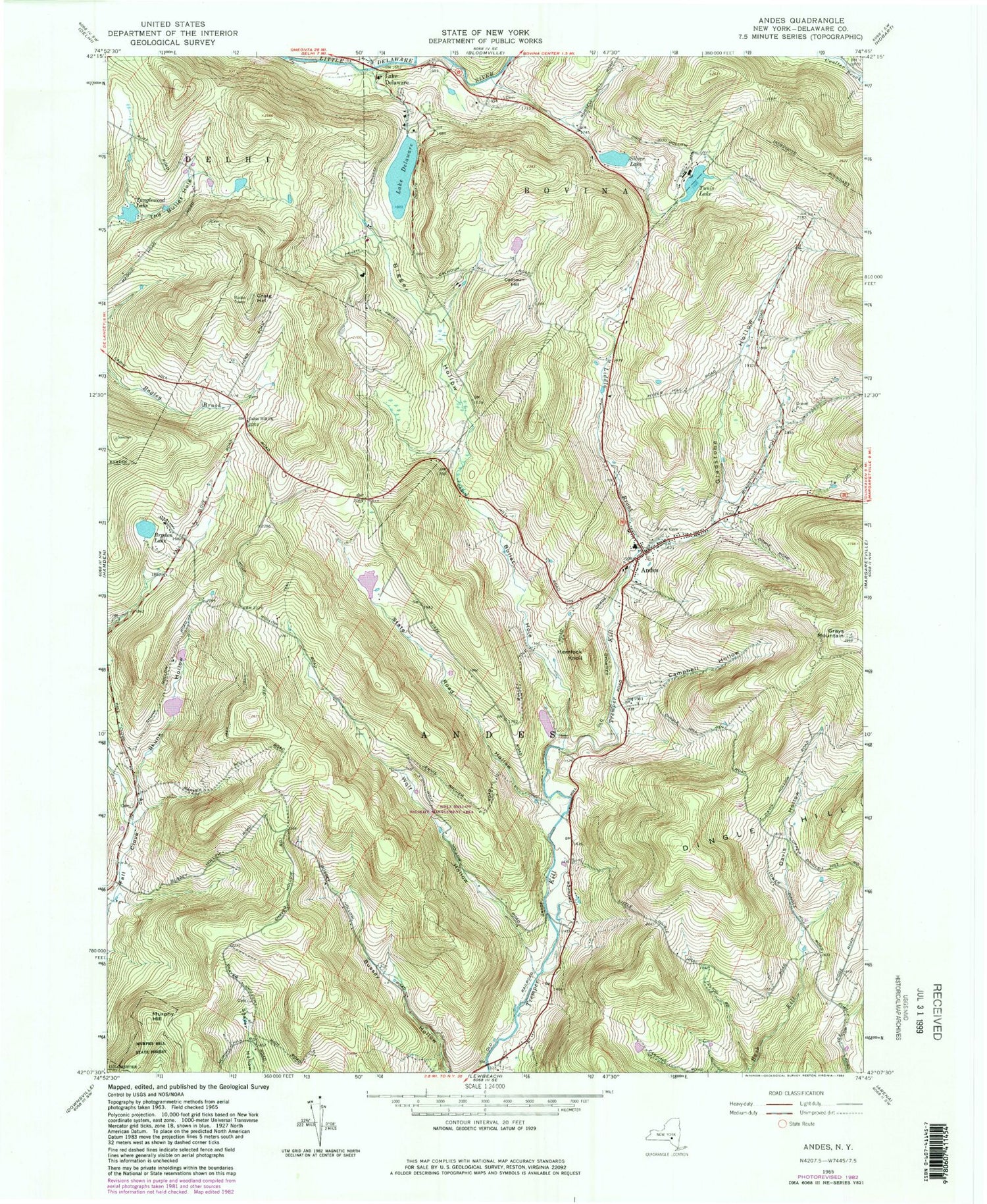
Classic USGS Andes New York 7.5'x7.5' Topo Map
Couldn't load pickup availability
Historical USGS topographic quad map of Andes in the state of New York. Map scale may vary for some years, but is generally around 1:24,000. Print size is approximately 24" x 27"
This quadrangle is in the following counties: Delaware.
The map contains contour lines, roads, rivers, towns, and lakes. Printed on high-quality waterproof paper with UV fade-resistant inks, and shipped rolled.
Contains the following named places: Andes, Andes Census Designated Place, Andes Central School, Andes Gap Filler Annex, Andes Post Office, Andes Presbyterian Church, Andes Rural Cemetery, Andes United Methodist Church, Andes Village Cemetery, Andes Volunteer Fire Department, Arena Reservoir, Bigger Hollow, Brydon Lake, Bullet Hole, Bush Creek Farm, Cabin Hill Church, Calhoun Hill, Campbell Hollow, Craig Hill, Davis Hollow, Fall Clove Cemetery, Gladstone Hollow, Grays Mountain, Hemlock Knoll, Hemlock Springs Farm, Herr Cemetery, Lake Delaware, Liddle Brook, Murphy Hill, Shaver Hollow Road Cemetery, Silver Lake, Skink Hollow, Skunk Hollow, State Road Hollow, Tanglewood Lake, Town of Andes, Tunis Lake, Tuttle Farm, Waterbury Cemetery, Wolf Hollow, ZIP Code: 13731


