MyTopo
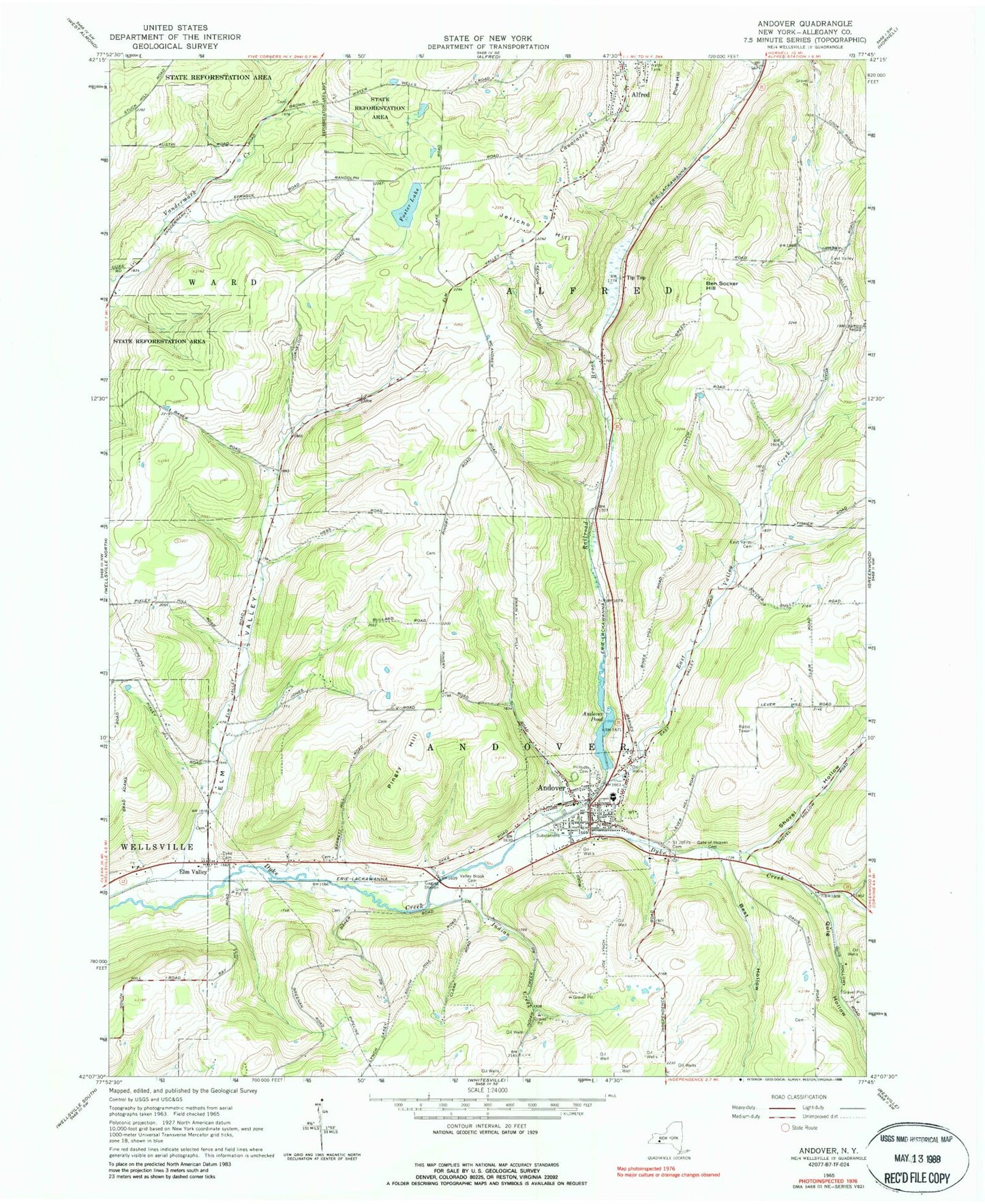
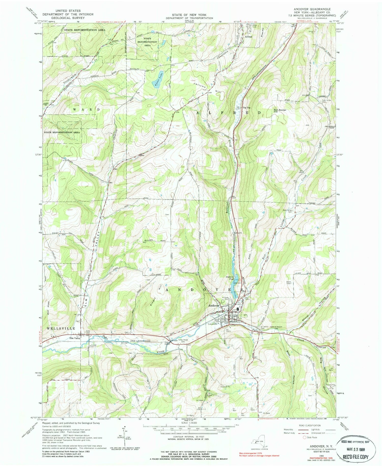
Classic USGS Andover New York 7.5'x7.5' Topo Map
Couldn't load pickup availability
Historical USGS topographic quad map of Andover in the state of New York. Map scale may vary for some years, but is generally around 1:24,000. Print size is approximately 24" x 27"
This quadrangle is in the following counties: Allegany.
The map contains contour lines, roads, rivers, towns, and lakes. Printed on high-quality waterproof paper with UV fade-resistant inks, and shipped rolled.
Contains the following named places: Andover, Andover First Baptist Church, Andover Free Library, Andover Pond, Andover Post Office, Andover School, Andover United Methodist Church, Andover Volunteer Fire Department and Ambulance, Ben Socker Hill, Best Hollow, Blessed Sacrament Catholic Church, Cole Dike Cemetery, East Valley Cemetery, East Valley Creek, Elm Valley, Foster Lake, Gate of Heaven Cemetery, Hillside Cemetery, Indian Creek, Jericho Hill, Kent Farms, Pingry Hill, Quig Hollow, Railroad Brook, Saint Johns Cemetery, School Number 1, School Number 2, School Number 3, School Number 4, School Number 5, School Number 7, School Number 8, School Number 9, Shovel Hollow, Sunny Cove Farm, Tip Top, Town of Alfred, Town of Andover, Valley Brook Cemetery, Village of Andover, ZIP Code: 14806