MyTopo
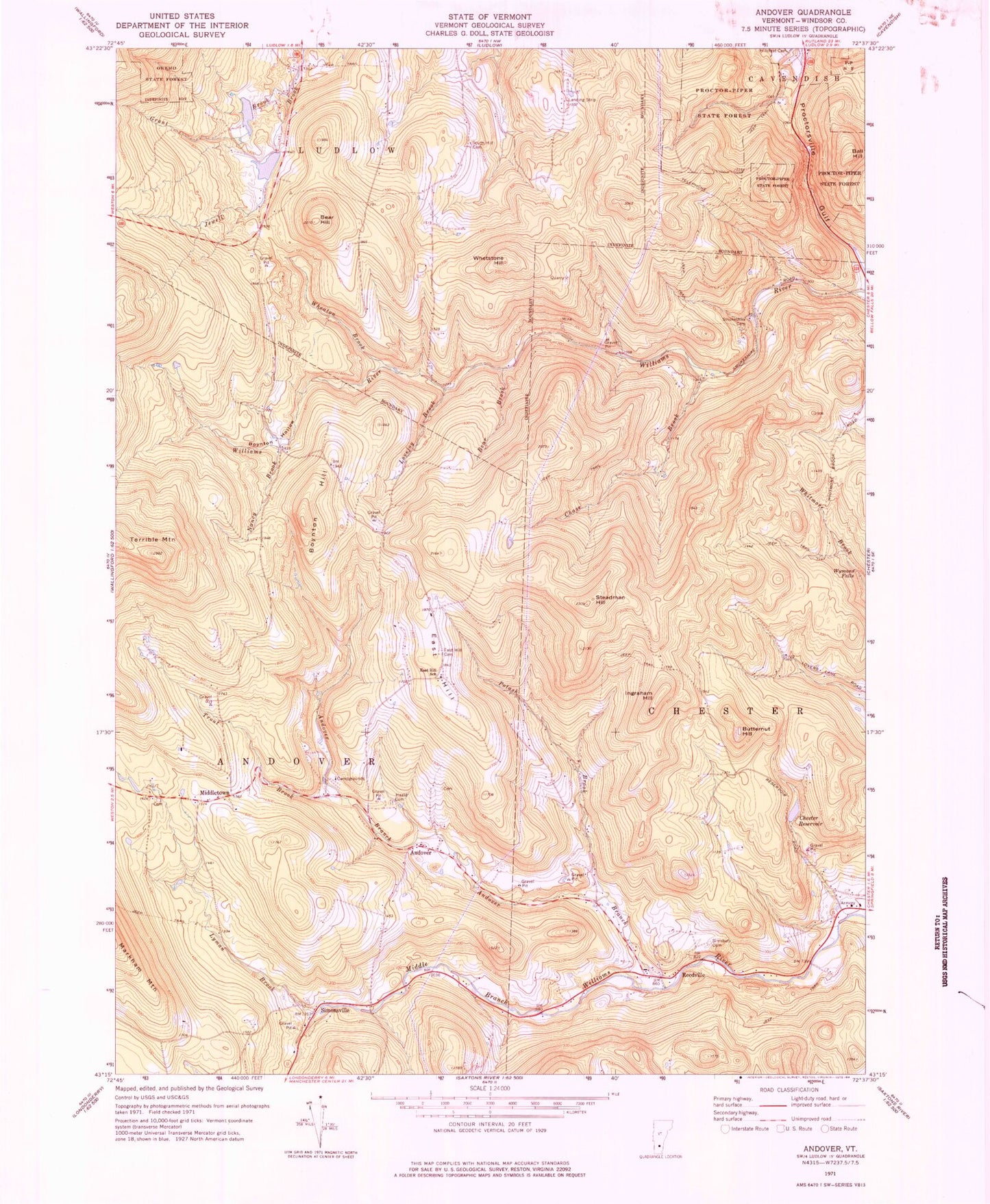
Classic USGS Andover Vermont 7.5'x7.5' Topo Map
Couldn't load pickup availability
Historical USGS topographic quad map of Andover in the state of Vermont. Typical map scale is 1:24,000, but may vary for certain years, if available. Print size: 24" x 27"
This quadrangle is in the following counties: Windsor.
The map contains contour lines, roads, rivers, towns, and lakes. Printed on high-quality waterproof paper with UV fade-resistant inks, and shipped rolled.
Contains the following named places: Andover, Andover Branch, Ball Hill, Bear Brook, Bear Hill, Boynton Hill, Boynton Hollow, Butternut Hill, Chase Brook, Chester Reservoir, East Hill, East Hill Cemetery, East Hill School, Grant Brook, Heald Cemetery, Ingraham Hill, Lovejoy Brook, Middletown, Nancy Brook, Potash Brook, Proctor-Piper State Forest, Reedville, Simonsville, Simsbury Cemetery, Smokeshire Cemetery, South Hill Cemetery, Steadman Hill, Trout Brook, Wheaton Brook, Whetstone Hill, Wymans Falls, Lyman Brook, Terrible Mountain, Holloway Airport, Smith Airport, Town of Andover, Jewell Brook Site Number 1 Dam, Jewell Brook Site Number 1 Reservoir, Jewell Brook Site Number 2 Dam, Jewell Brook Site Number 2 Reservoir, Andover Community Church, Barton School (historical), Boynton Hills School (historical), Chester Town Forest, Horseshoe Acres, Middletown Cemetery, Pettengill Cemetery, Simonsville Cemetery, Simsbury School (historical), Smokeshire School (historical), Wadleigh School (historical), Williams River State Forest