MyTopo
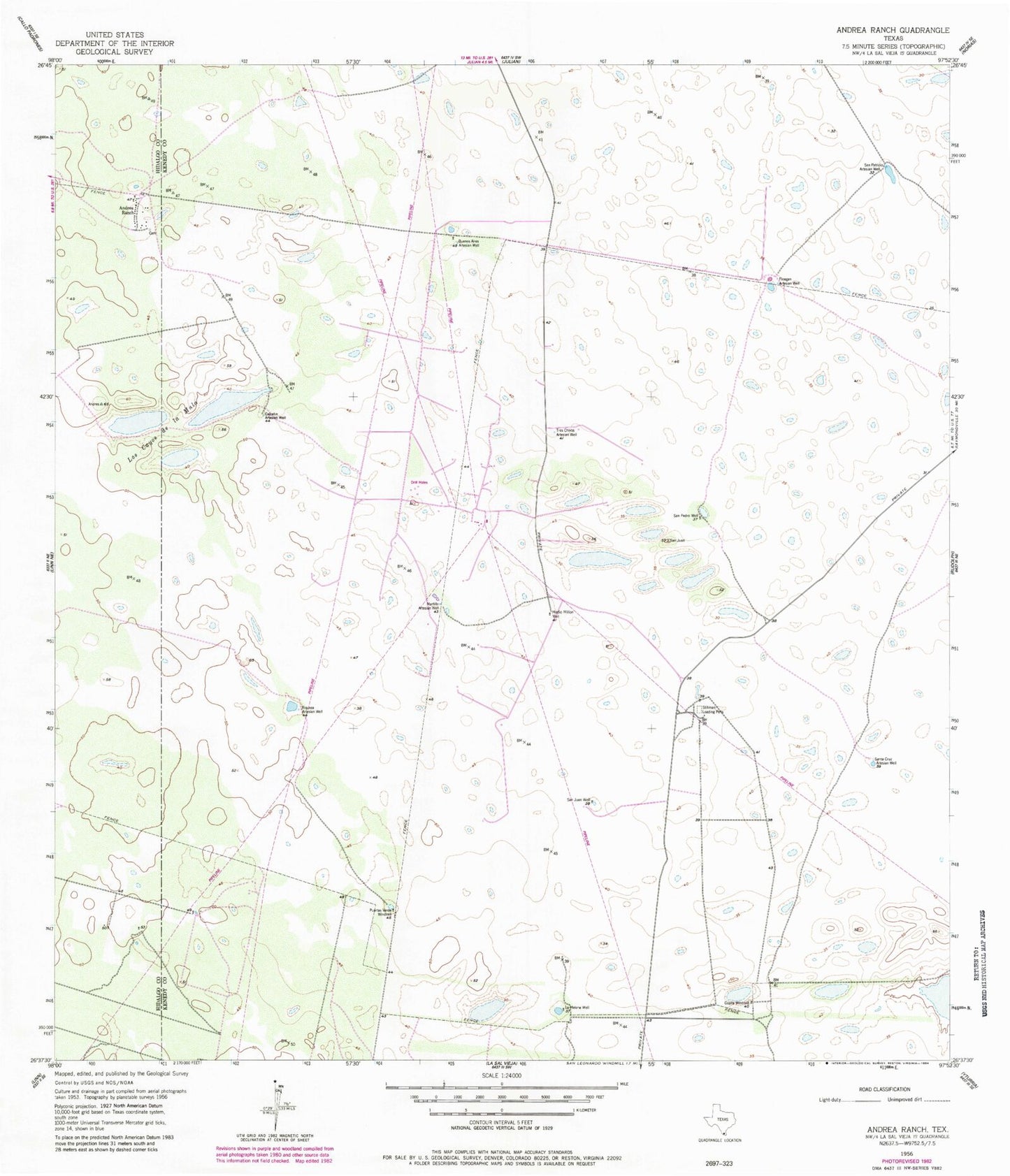
Classic USGS Andrea Ranch Texas 7.5'x7.5' Topo Map
Couldn't load pickup availability
Historical USGS topographic quad map of Andrea Ranch in the state of Texas. Map scale may vary for some years, but is generally around 1:24,000. Print size is approximately 24" x 27"
This quadrangle is in the following counties: Hidalgo, Kenedy.
The map contains contour lines, roads, rivers, towns, and lakes. Printed on high-quality waterproof paper with UV fade-resistant inks, and shipped rolled.
Contains the following named places: Andrea Ranch, Buenos Aires Artesian Well, Calcetin Artesian Well, Copita Windmill, Finegan Artesian Well, La Melona Windmill, Los Cayos de la Mula, Martillo Artesian Well, Medio Millon Well, Puertas Verde Windmill, Riqueza Artesian Well, San Juan Well, San Patricio Artesian Well, San Pedro Well, Santa Cruz Artesian Well, Stillman Loading Pens, Tres Chivos Artesian Well